Property Record
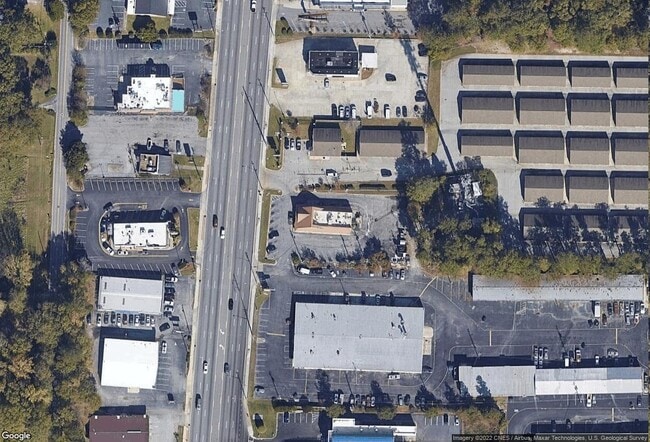
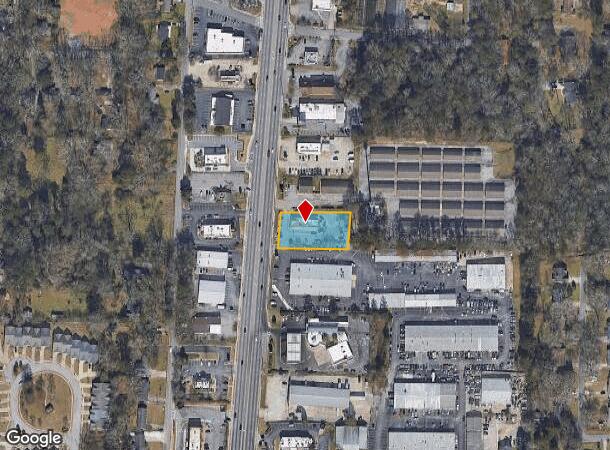
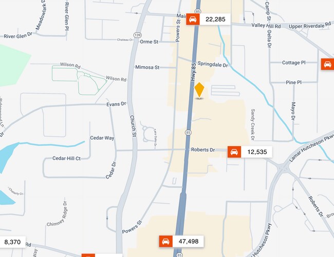
6814 Highway 85, Riverdale, GA 30274
NEARBY LISTINGS FOR SALE OR LEASE
Property Detail
6814 Highway 85
13-0151D-00A-015
Clayton
Restaurantdrivein
Georgia
X
151
13063C0058F
0.61 AC
2025
Riverdale/Jonesboro
2025
Atlanta
040523
Atlanta-Sandy Springs-Roswell, GA
2,744 SF
DEMOGRAPHICS near 6814 Highway 85
1 Mile
3 Mile
5 Mile
2024 Total Population
10,237
87,542
191,838
2029 Population
10,169
87,159
192,833
Pop Growth 2024-2029
(0.66%)
(0.44%)
+ 0.52%
Average Age
37
35
36
2024 Total Households
3,892
32,997
70,458
HH Growth 2024-2029
(0.62%)
(0.48%)
+ 0.55%
Median Household Inc
$46,418
$45,601
$47,888
Avg Household Size
2.60
2.60
2.70
2024 Avg HH Vehicles
1.00
2.00
2.00
Median Home Value
$138,046
$155,508
$161,244
Median Year Built
1981
1984
1983
Nearby Places
Map Layers
Map Styles
 Street
 Aerial
- Restaurants
- Banks
- Shops
- Fitness
- Groceries
PUBLIC TRANSPORTATION
AIRPORT
Hartsfield - Jackson Atlanta International
DRIVE
WALK
Distance
Hartsfield - Jackson Atlanta International
14 min
6.7 mi
SALE & LEASE HISTORY
LISTING DATE
SALE/LEASE

Mar 31, 2025
For Sale
Nearby Properties
Address
Land Use
TOTAL SIZE
Lot Size
Zoning
Address
Land Use
TOTAL SIZE
Lot Size
Zoning
518,648 SF
31.03 AC
MCD
Address
Land Use
TOTAL SIZE
Lot Size
Zoning
40,472 SF
116.70 AC
HI
Address
Land Use
TOTAL SIZE
Lot Size
Zoning
596 SF
57.40 AC
RM
Address
Land Use
TOTAL SIZE
Lot Size
Zoning
324 SF
49.49 AC
RM
Address
Land Use
TOTAL SIZE
Lot Size
Zoning
123,000 SF
48 AC
RS110
Address
Land Use
TOTAL SIZE
Lot Size
Zoning
424 SF
54.79 AC
RM
Address
Land Use
TOTAL SIZE
Lot Size
Zoning
270 SF
28.02 AC
RM
Address
Land Use
TOTAL SIZE
Lot Size
Zoning
370 SF
36.20 AC
RM
Address
Land Use
TOTAL SIZE
Lot Size
Zoning
278 SF
18.53 AC
PUD
Address
Land Use
TOTAL SIZE
Lot Size
Zoning
264 SF
24.92 AC
RM
Address
Land Use
TOTAL SIZE
Lot Size
Zoning
316 SF
34.30 AC
RG75
Address
Land Use
TOTAL SIZE
Lot Size
Zoning
212,048 SF
110.06 AC
HI
Address
Land Use
TOTAL SIZE
Lot Size
Zoning
224 SF
25 AC
C
Address
Land Use
TOTAL SIZE
Lot Size
Zoning
387 SF
32.53 AC
RM
Address
Land Use
TOTAL SIZE
Lot Size
Zoning
252 SF
27.14 AC
RM
Address
Land Use
TOTAL SIZE
Lot Size
Zoning
216 SF
24.45 AC
RM
Address
Land Use
TOTAL SIZE
Lot Size
Zoning
200 SF
20.71 AC
RM
Address
Land Use
TOTAL SIZE
Lot Size
Zoning
190 SF
21.66 AC
RM
Address
Land Use
TOTAL SIZE
Lot Size
Zoning
410 SF
35 AC
RM
Address
Land Use
TOTAL SIZE
Lot Size
Zoning
167,008 SF
36.21 AC
HI
Address
Land Use
TOTAL SIZE
Lot Size
Zoning
240 SF
28.43 AC
RM
Address
Land Use
TOTAL SIZE
Lot Size
Zoning
57.05 AC
GB
Address
Land Use
TOTAL SIZE
Lot Size
Zoning
296 SF
27.93 AC
RM
Address
Land Use
TOTAL SIZE
Lot Size
Zoning
198 SF
32.10 AC
RM
Address
Land Use
TOTAL SIZE
Lot Size
Zoning
208 SF
19.26 AC
RM
Address
Land Use
TOTAL SIZE
Lot Size
Zoning
203,067 SF
18 AC
C
Address
Land Use
TOTAL SIZE
Lot Size
Zoning
180,300 SF
12.77 AC
WH
Address
Land Use
TOTAL SIZE
Lot Size
Zoning
176 SF
17.67 AC
RM
Address
Land Use
TOTAL SIZE
Lot Size
Zoning
108,738 SF
28.31 AC
C
Address
Land Use
TOTAL SIZE
Lot Size
Zoning
230 SF
21.20 AC
RM
The World's #1 Commercial Real Estate Marketplace
Connect with us
© 2025 CoStar Group
The information above has been obtained from sources believed reliable. While we do not doubt its accuracy we have not verified it and make no guarantee, warranty or representation about it. It is your responsibility to independently confirm its accuracy and completeness. Any projections, opinions, assumptions, or estimates used are for example only and do not represent the current or future performance of the property. The value of this transaction to you depends on tax and other factors which should be evaluated by your tax, financial, and legal advisors. You and your advisors should conduct a careful, independent investigation of the property to determine to your satisfaction the suitability of the property for your needs.