Property Record
6815 State Road 70 E, Bradenton, FL 34203


Property Detail
6815 State Road 70 E
17305-0055-8
LOT 10 CAMPBELL COMMERCIAL SUB PI#17305.0055/8
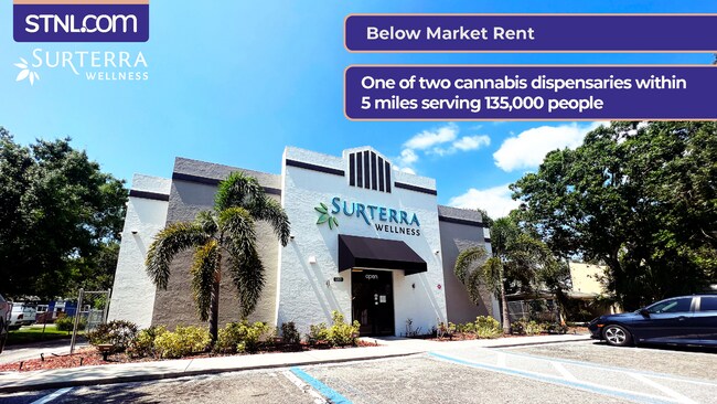
Storemultistory
Manatee
GC GENERA
Florida
B and X Area of moderate flood hazard, usually the area between the limits of the 100-year and 500-year floods.
10
2024
0.76 AC
2025
Manatee
002012
Tampa/St Petersburg
3,424 SF
North Port-Bradenton-Sarasota, FL
NEARBY LISTINGS FOR SALE OR LEASE
DEMOGRAPHICS near 6815 State Road 70 E
1 mile
3 mile
5 mile
2025 Total Population
6,427
44,285
143,019
2030 Population
7,245
49,679
159,686
Pop Growth 2025-2030
+ 12.73%
+ 12.18%
+ 11.65%
Average Age
52
51
47
2025 Total Households
3,014
19,974
61,662
HH Growth 2025-2030
+ 13.14%
+ 12.39%
+ 11.81%
Median Household Inc
$85,687
$101,015
$95,614
Avg Household Size
2.10
2.20
2.30
2025 Avg HH Vehicles
2.00
2.00
2.00
Median Home Value
$430,804
$480,621
$477,480
Median Year Built
1996
2002
2003
Nearby Places
Map Layers
Map Styles
 Street
 Aerial
Transit
 Traffic
 Biking
Places
Listings with unknown addresses are not visible on the map
- Restaurants
- Banks
- Shops
- Fitness
- Groceries
PUBLIC TRANSPORTATION
AIRPORT
Sarasota/Bradenton International
Drive
Walk
Distance
Sarasota/Bradenton International
18 min
10.3 mi
Freight Ports
Port Manatee
Drive
Walk
Distance
Port Manatee
28 min
18.5 mi
SALE & LEASE HISTORY
LISTING DATE
SALE/LEASE

May 09, 2017
For Sale
Mar 04, 2025
For Lease
Jul 07, 2023
For Sale
Nearby Properties
Address
Land Use
TOTAL SIZE
Lot Size
Zoning
Address
Land Use
TOTAL SIZE
Lot Size
Zoning
512,380 SF
11.24 AC
PD-MU
Address
Land Use
TOTAL SIZE
Lot Size
Zoning
385,610 SF
32.65 AC
RMF-6 MULT
Address
Land Use
TOTAL SIZE
Lot Size
Zoning
483,594 SF
23.32 AC
PD-MU
Address
Land Use
TOTAL SIZE
Lot Size
Zoning
335,712 SF
27.91 AC
PD-MU
Address
Land Use
TOTAL SIZE
Lot Size
Zoning
349,151 SF
16.70 AC
PD-MU
Address
Land Use
TOTAL SIZE
Lot Size
Zoning
384,346 SF
56.41 AC
PD-PI
Address
Land Use
TOTAL SIZE
Lot Size
Zoning
405,307 SF
23.79 AC
PD-MU
Address
Land Use
TOTAL SIZE
Lot Size
Zoning
211,519 SF
82.32 AC
PD-MU
Address
Land Use
TOTAL SIZE
Lot Size
Zoning
303,515 SF
36.98 AC
PD-MU
Address
Land Use
TOTAL SIZE
Lot Size
Zoning
241,504 SF
27.72 AC
A GENERAL
Address
Land Use
TOTAL SIZE
Lot Size
Zoning
125,972 SF
24.18 AC
PD-PI
Address
Land Use
TOTAL SIZE
Lot Size
Zoning
175,410 SF
39.05 AC
PD-MU
Address
Land Use
TOTAL SIZE
Lot Size
Zoning
343,415 SF
31.02 AC
PD-C
Address
Land Use
TOTAL SIZE
Lot Size
Zoning
345,812 SF
37 AC
PD-R
Address
Land Use
TOTAL SIZE
Lot Size
Zoning
89,137 SF
11.61 AC
Address
Land Use
TOTAL SIZE
Lot Size
Zoning
227,842 SF
12.97 AC
PD-C
Address
Land Use
TOTAL SIZE
Lot Size
Zoning
29,566 SF
1.17 AC
PD-PI
Address
Land Use
TOTAL SIZE
Lot Size
Zoning
109,010 SF
7 AC
PD-MU
Address
Land Use
TOTAL SIZE
Lot Size
Zoning
125,678 SF
48.86 AC
Address
Land Use
TOTAL SIZE
Lot Size
Zoning
10,389 SF
57.58 AC
PD-RV
Address
Land Use
TOTAL SIZE
Lot Size
Zoning
124,129 SF
23.29 AC
PDC
Address
Land Use
TOTAL SIZE
Lot Size
Zoning
94,206 SF
10.62 AC
PD-C
Address
Land Use
TOTAL SIZE
Lot Size
Zoning
121,771 SF
28.17 AC
A-1 SUBURB
Address
Land Use
TOTAL SIZE
Lot Size
Zoning
310,215 SF
134.06 AC
A GENERAL
Address
Land Use
TOTAL SIZE
Lot Size
Zoning
180,648 SF
21.97 AC
PD-MU
Address
Land Use
TOTAL SIZE
Lot Size
Zoning
10,094 SF
51.90 AC
PD-RV
Address
Land Use
TOTAL SIZE
Lot Size
Zoning
92,466 SF
18.80 AC
A-1 SUBURB
Address
Land Use
TOTAL SIZE
Lot Size
Zoning
88,713 SF
8.70 AC
PD-C
Address
Land Use
TOTAL SIZE
Lot Size
Zoning
160,767 SF
15.63 AC
PD-C
Address
Land Use
TOTAL SIZE
Lot Size
Zoning
53,884 SF
2.33 AC
PD-C
The World's #1 Commercial Real Estate Marketplace
Connect with us
© 2026 CoStar Group
The information above has been obtained from sources believed reliable. While we do not doubt its accuracy we have not verified it and make no guarantee, warranty or representation about it. It is your responsibility to independently confirm its accuracy and completeness. Any projections, opinions, assumptions, or estimates used are for example only and do not represent the current or future performance of the property. The value of this transaction to you depends on tax and other factors which should be evaluated by your tax, financial, and legal advisors. You and your advisors should conduct a careful, independent investigation of the property to determine to your satisfaction the suitability of the property for your needs.