Property Record
6818 Fm 2855 Rd, Katy, TX 77493
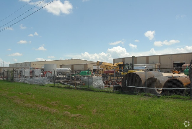
Property Detail
6818 Fm 2855 Rd
178321
ABS A337400 A-374 FRED EULE TRACT 1-1 ACRES 8.603 P/O A 11.804 AC TR
Industrialgeneral
WALLER
B and X Area of moderate flood hazard, usually the area between the limits of the 100-year and 500-year floods.
Texas
2025
8.60 AC
2025
Northwest Outliers
680100
Houston
88,860 SF
Houston-Pasadena-The Woodlands, TX
NEARBY LISTINGS FOR SALE OR LEASE
-
-
View all Katy listings for lease on LoopNet.com
DEMOGRAPHICS near 6818 Fm 2855 Rd
1 mile
3 mile
5 mile
2025 Total Population
913
5,232
18,099
2030 Population
1,120
6,302
21,142
Pop Growth 2025-2030
+ 22.67%
+ 20.45%
+ 16.81%
Average Age
37
36
35
2025 Total Households
299
1,689
5,596
HH Growth 2025-2030
+ 23.08%
+ 20.72%
+ 17.16%
Median Household Inc
$112,980
$111,819
$120,312
Avg Household Size
3.10
3.10
3.20
2025 Avg HH Vehicles
3.00
3.00
3.00
Median Home Value
$525,943
$477,351
$406,090
Median Year Built
2011
2011
2011
Nearby Places
Map Layers
Map Styles
 Street
 Aerial
Layers
 Traffic
 Biking
Places
Listings with unknown addresses are not visible on the map
- Restaurants
- Banks
- Shops
- Fitness
- Groceries
SALE & LEASE HISTORY
LISTING DATE
SALE/LEASE

Apr 18, 2018
For Lease
Apr 18, 2018
For Sale
Nearby Properties
Address
Land Use
TOTAL SIZE
Lot Size
Zoning
Address
Land Use
TOTAL SIZE
Lot Size
Zoning
117,884 SF
58.56 AC
Address
Land Use
TOTAL SIZE
Lot Size
Zoning
90,000 SF
9.80 AC
Address
Land Use
TOTAL SIZE
Lot Size
Zoning
111,361 SF
15 AC
Address
Land Use
TOTAL SIZE
Lot Size
Zoning
78,032 SF
10.21 AC
Address
Land Use
TOTAL SIZE
Lot Size
Zoning
19,200 SF
101.15 AC
Address
Land Use
TOTAL SIZE
Lot Size
Zoning
54,000 SF
4.49 AC
Address
Land Use
TOTAL SIZE
Lot Size
Zoning
274.70 AC
Address
Land Use
TOTAL SIZE
Lot Size
Zoning
32,307 SF
39.23 AC
Address
Land Use
TOTAL SIZE
Lot Size
Zoning
262.42 AC
Address
Land Use
TOTAL SIZE
Lot Size
Zoning
83,300 SF
10.06 AC
Address
Land Use
TOTAL SIZE
Lot Size
Zoning
147.42 AC
Address
Land Use
TOTAL SIZE
Lot Size
Zoning
9,000 SF
35 AC
Address
Land Use
TOTAL SIZE
Lot Size
Zoning
47,281 SF
11.66 AC
Address
Land Use
TOTAL SIZE
Lot Size
Zoning
36,000 SF
2.50 AC
Address
Land Use
TOTAL SIZE
Lot Size
Zoning
32,229 SF
5.66 AC
Address
Land Use
TOTAL SIZE
Lot Size
Zoning
15,476 SF
16.84 AC
Address
Land Use
TOTAL SIZE
Lot Size
Zoning
1,364 SF
19 AC
Address
Land Use
TOTAL SIZE
Lot Size
Zoning
24,756 SF
28.14 AC
Address
Land Use
TOTAL SIZE
Lot Size
Zoning
28.67 AC
Address
Land Use
TOTAL SIZE
Lot Size
Zoning
28.18 AC
Address
Land Use
TOTAL SIZE
Lot Size
Zoning
28.15 AC
Address
Land Use
TOTAL SIZE
Lot Size
Zoning
3 SF
160 AC
Address
Land Use
TOTAL SIZE
Lot Size
Zoning
15,000 SF
2.05 AC
Address
Land Use
TOTAL SIZE
Lot Size
Zoning
2,245 SF
15 AC
Address
Land Use
TOTAL SIZE
Lot Size
Zoning
96.29 AC
Address
Land Use
TOTAL SIZE
Lot Size
Zoning
7,004 SF
10 AC
Address
Land Use
TOTAL SIZE
Lot Size
Zoning
17.87 AC
Address
Land Use
TOTAL SIZE
Lot Size
Zoning
48,636 SF
10 AC
Address
Land Use
TOTAL SIZE
Lot Size
Zoning
4,400 SF
20.89 AC
The World's #1 Commercial Real Estate Marketplace
Connect with us
© 2026 CoStar Group
The information above has been obtained from sources believed reliable. While we do not doubt its accuracy we have not verified it and make no guarantee, warranty or representation about it. It is your responsibility to independently confirm its accuracy and completeness. Any projections, opinions, assumptions, or estimates used are for example only and do not represent the current or future performance of the property. The value of this transaction to you depends on tax and other factors which should be evaluated by your tax, financial, and legal advisors. You and your advisors should conduct a careful, independent investigation of the property to determine to your satisfaction the suitability of the property for your needs.