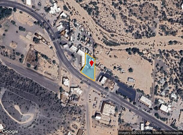
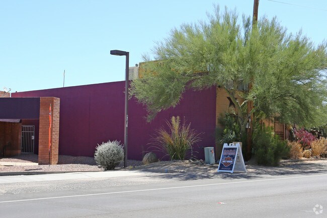
Property Record
6820 E Cave Creek Rd, Cave Creek, AZ 85331

NEARBY LISTINGS FOR SALE OR LEASE
Property Detail
6820 E Cave Creek Rd
216-07-002B
PT SE4 SEC 27 DAF COM AT S4 COR SD SEC 27 TH N 1206F TH S 58D 28M E 222.12F TH N 31D 31M E 32.27F TO PT ON N R/W CAVE CREEK RD PER BK 17 RD MAP PG 27 & TPOB TH CONT N 31D 31M E 97.73F TH N 123.45F TH S 58D 28M E 116.96F TH S 241.77F TO PT SD N R/W TH
Commercialnec
Maricopa
X
Arizona
04013C0883L
0.63 AC
2025
Carefree
2025
Phoenix
613000
Phoenix-Mesa-Scottsdale, AZ
7,807 SF
DEMOGRAPHICS near 6820 E Cave Creek Rd
1 Mile
3 Mile
5 Mile
2024 Total Population
1,779
12,758
35,018
2029 Population
1,949
14,138
38,777
Pop Growth 2024-2029
+ 9.56%
+ 10.82%
+ 10.73%
Average Age
57
58
55
2024 Total Households
868
6,018
15,527
HH Growth 2024-2029
+ 9.56%
+ 10.92%
+ 11.00%
Median Household Inc
$102,544
$123,562
$140,680
Avg Household Size
2.00
2.10
2.20
2024 Avg HH Vehicles
2.00
2.00
2.00
Median Home Value
$846,409
$832,522
$818,402
Median Year Built
1991
1995
2000
Nearby Places
Map Layers
Map Styles
 Street
 Aerial
- Restaurants
- Banks
- Shops
- Fitness
- Groceries
PUBLIC TRANSPORTATION
AIRPORT
Phoenix Sky Harbor International
DRIVE
WALK
Distance
Phoenix Sky Harbor International
53 min
34.8 mi
Freight Ports
Port of San Diego
DRIVE
WALK
Distance
Port of San Diego
435 min
383.2 mi
SALE & LEASE HISTORY
LISTING DATE
SALE/LEASE

Jun 08, 2018
For Sale
Jul 10, 2017
For Sale
Nearby Properties
Address
Land Use
TOTAL SIZE
Lot Size
Zoning
Address
Land Use
TOTAL SIZE
Lot Size
Zoning
140,303 SF
29.18 AC
R-4R
Address
Land Use
TOTAL SIZE
Lot Size
Zoning
123,518 SF
14.92 AC
C-C
Address
Land Use
TOTAL SIZE
Lot Size
Zoning
126,785 SF
17.94 AC
C-G
Address
Land Use
TOTAL SIZE
Lot Size
Zoning
223,188 SF
13.68 AC
RT
Address
Land Use
TOTAL SIZE
Lot Size
Zoning
82,175 SF
8.65 AC
C-C
Address
Land Use
TOTAL SIZE
Lot Size
Zoning
47,830 SF
5.22 AC
R-43
Address
Land Use
TOTAL SIZE
Lot Size
Zoning
84,248 SF
6.68 AC
C-C
Address
Land Use
TOTAL SIZE
Lot Size
Zoning
35,734 SF
10.13 AC
R-43
Address
Land Use
TOTAL SIZE
Lot Size
Zoning
32,944 SF
6.89 AC
R-70
Address
Land Use
TOTAL SIZE
Lot Size
Zoning
65,744 SF
2.05 AC
Address
Land Use
TOTAL SIZE
Lot Size
Zoning
21,828 SF
58.46 AC
R-43
Address
Land Use
TOTAL SIZE
Lot Size
Zoning
15,261 SF
13.02 AC
R135
Address
Land Use
TOTAL SIZE
Lot Size
Zoning
31,318 SF
5.37 AC
C-C
Address
Land Use
TOTAL SIZE
Lot Size
Zoning
27,058 SF
8.21 AC
O-S
Address
Land Use
TOTAL SIZE
Lot Size
Zoning
64,796 SF
2.86 AC
C-C
Address
Land Use
TOTAL SIZE
Lot Size
Zoning
29,900 SF
3.18 AC
GC
Address
Land Use
TOTAL SIZE
Lot Size
Zoning
12.46 AC
C-C
Address
Land Use
TOTAL SIZE
Lot Size
Zoning
35,680 SF
5.91 AC
RT
Address
Land Use
TOTAL SIZE
Lot Size
Zoning
9.27 AC
RT
Address
Land Use
TOTAL SIZE
Lot Size
Zoning
29,792 SF
3.42 AC
C-T
Address
Land Use
TOTAL SIZE
Lot Size
Zoning
14,188 SF
2.80 AC
C-C
Address
Land Use
TOTAL SIZE
Lot Size
Zoning
1.10 AC
R35
Address
Land Use
TOTAL SIZE
Lot Size
Zoning
7.65 AC
RT
Address
Land Use
TOTAL SIZE
Lot Size
Zoning
29,535 SF
2.07 AC
C-C
Address
Land Use
TOTAL SIZE
Lot Size
Zoning
8,277 SF
4.26 AC
R-35
Address
Land Use
TOTAL SIZE
Lot Size
Zoning
31,283 SF
3 AC
C-T
Address
Land Use
TOTAL SIZE
Lot Size
Zoning
3,043 SF
9.09 AC
R-89
Address
Land Use
TOTAL SIZE
Lot Size
Zoning
44,849 SF
1.70 AC
M-L
Address
Land Use
TOTAL SIZE
Lot Size
Zoning
15,064 SF
1.47 AC
C-T
The World's #1 Commercial Real Estate Marketplace
Connect with us
© 2026 CoStar Group
The information above has been obtained from sources believed reliable. While we do not doubt its accuracy we have not verified it and make no guarantee, warranty or representation about it. It is your responsibility to independently confirm its accuracy and completeness. Any projections, opinions, assumptions, or estimates used are for example only and do not represent the current or future performance of the property. The value of this transaction to you depends on tax and other factors which should be evaluated by your tax, financial, and legal advisors. You and your advisors should conduct a careful, independent investigation of the property to determine to your satisfaction the suitability of the property for your needs.