Property Record
6821 Mayer Ave, Bakersfield, CA 93314

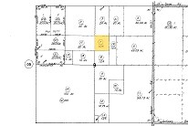
Property Detail
6821 Mayer Ave
104-060-07-00-6
SECTION 9 , TOWNSHIP 29 , RANGE 25 , QUARTER
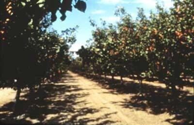
Orchard
KERN
A
California
B and X Area of moderate flood hazard, usually the area between the limits of the 100-year and 500-year floods.
10 AC
2024
NW Outlying Kern County
2025
Bakersfield
006600
Bakersfield-Delano, CA
NEARBY LISTINGS FOR SALE OR LEASE
-
-
View all Bakersfield listings for sale on LoopNet.com
DEMOGRAPHICS near 6821 Mayer Ave
1 mile
3 mile
5 mile
2025 Total Population
80
2,018
7,922
2030 Population
81
2,081
8,018
Pop Growth 2025-2030
+ 1.25%
+ 3.12%
+ 1.21%
Average Age
35
34
34
2025 Total Households
22
521
1,880
HH Growth 2025-2030
0.00%
+ 3.07%
+ 1.97%
Median Household Inc
$79,167
$93,749
$75,284
Avg Household Size
3.60
3.70
3.80
2025 Avg HH Vehicles
3.00
3.00
3.00
Median Home Value
$399,999
$381,182
$339,935
Median Year Built
1986
2002
1993
Nearby Places
Map Layers
Map Styles
 Street
 Aerial
Layers
 Traffic
 Biking
Places
Listings with unknown addresses are not visible on the map
- Restaurants
- Banks
- Shops
- Fitness
- Groceries
PUBLIC TRANSPORTATION
AIRPORT
Meadows Field
Drive
Walk
Distance
Meadows Field
32 min
15.9 mi
Freight Ports
The Port of Hueneme
Drive
Walk
Distance
The Port of Hueneme
174 min
133.5 mi
Nearby Properties
Address
Land Use
TOTAL SIZE
Lot Size
Zoning
Address
Land Use
TOTAL SIZE
Lot Size
Zoning
19.09 AC
Address
Land Use
TOTAL SIZE
Lot Size
Zoning
327,692 SF
634 AC
A
Address
Land Use
TOTAL SIZE
Lot Size
Zoning
165,960 SF
77.22 AC
A
Address
Land Use
TOTAL SIZE
Lot Size
Zoning
4,263 SF
49.09 AC
A
Address
Land Use
TOTAL SIZE
Lot Size
Zoning
41.47 AC
M-3
Address
Land Use
TOTAL SIZE
Lot Size
Zoning
263.80 AC
A
Address
Land Use
TOTAL SIZE
Lot Size
Zoning
1,440 SF
312.47 AC
A
Address
Land Use
TOTAL SIZE
Lot Size
Zoning
116.97 AC
A
Address
Land Use
TOTAL SIZE
Lot Size
Zoning
7,200 SF
15.17 AC
M3
Address
Land Use
TOTAL SIZE
Lot Size
Zoning
589.37 AC
A
Address
Land Use
TOTAL SIZE
Lot Size
Zoning
Address
Land Use
TOTAL SIZE
Lot Size
Zoning
5,250 SF
38.18 AC
A
Address
Land Use
TOTAL SIZE
Lot Size
Zoning
4.62 AC
M3
Address
Land Use
TOTAL SIZE
Lot Size
Zoning
6,080 SF
39.83 AC
A
Address
Land Use
TOTAL SIZE
Lot Size
Zoning
5,701 SF
39.27 AC
A
Address
Land Use
TOTAL SIZE
Lot Size
Zoning
154.54 AC
A
Address
Land Use
TOTAL SIZE
Lot Size
Zoning
8.51 AC
Address
Land Use
TOTAL SIZE
Lot Size
Zoning
6,626 SF
24.40 AC
M-2 PD
Address
Land Use
TOTAL SIZE
Lot Size
Zoning
4,800 SF
5.01 AC
NR
Address
Land Use
TOTAL SIZE
Lot Size
Zoning
178.18 AC
A
Address
Land Use
TOTAL SIZE
Lot Size
Zoning
5,721 SF
2.14 AC
M2
Address
Land Use
TOTAL SIZE
Lot Size
Zoning
3,877 SF
14.80 AC
A
Address
Land Use
TOTAL SIZE
Lot Size
Zoning
22.08 AC
NR(20) M-2
Address
Land Use
TOTAL SIZE
Lot Size
Zoning
21.99 AC
NR(20)
Address
Land Use
TOTAL SIZE
Lot Size
Zoning
21.85 AC
NR(20)
Address
Land Use
TOTAL SIZE
Lot Size
Zoning
24,000 SF
4.79 AC
NR
Address
Land Use
TOTAL SIZE
Lot Size
Zoning
21.20 AC
A
Address
Land Use
TOTAL SIZE
Lot Size
Zoning
1,340 SF
237.33 AC
A
Address
Land Use
TOTAL SIZE
Lot Size
Zoning
1,140 SF
4.30 AC
M2
The World's #1 Commercial Real Estate Marketplace
Connect with us
© 2026 CoStar Group
The information above has been obtained from sources believed reliable. While we do not doubt its accuracy we have not verified it and make no guarantee, warranty or representation about it. It is your responsibility to independently confirm its accuracy and completeness. Any projections, opinions, assumptions, or estimates used are for example only and do not represent the current or future performance of the property. The value of this transaction to you depends on tax and other factors which should be evaluated by your tax, financial, and legal advisors. You and your advisors should conduct a careful, independent investigation of the property to determine to your satisfaction the suitability of the property for your needs.