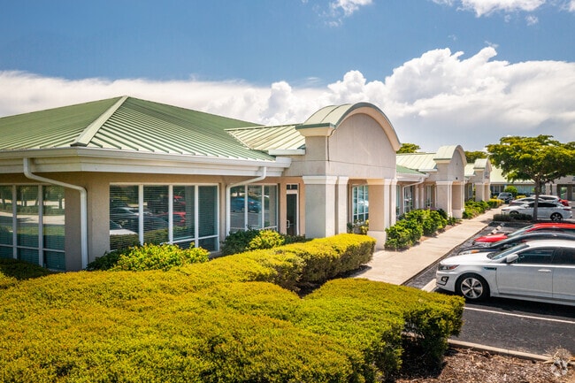
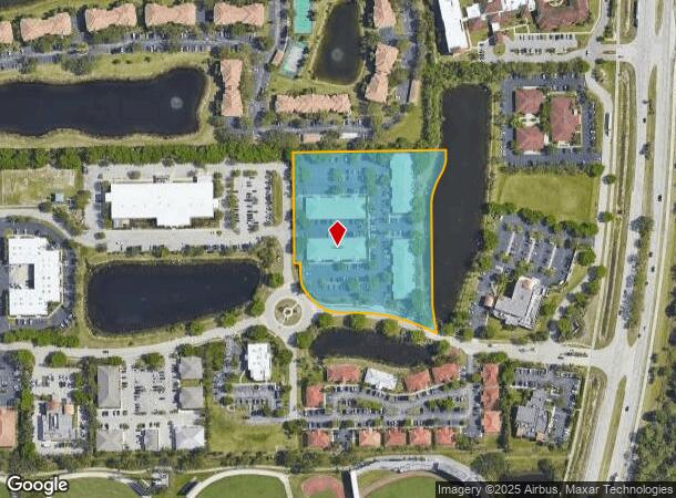
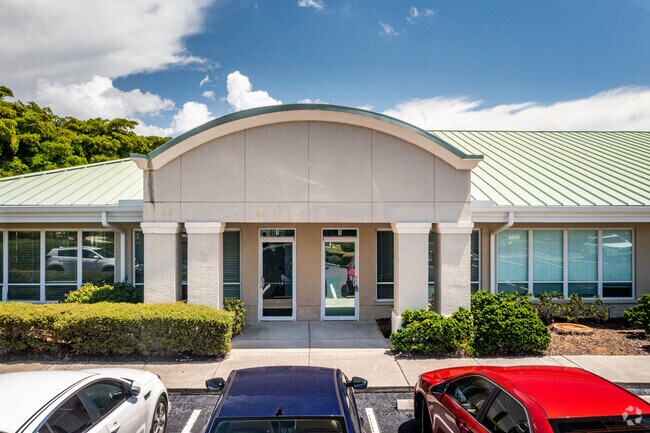
Property Record
6801 Palisades Park Ct, Fort Myers, FL 33912
Current Lease Availabilities
NEARBY LISTINGS FOR SALE OR LEASE
Property Detail
6801 Palisades Park Ct
19-45-25-18-0000E.0000
Metro Parkway Corridor
Officebuilding
INTERNATIONAL CENTER DESC IN PB 70 PGS 72-74 TRACT E
AH
Lee
12071C0437H
Florida
2024
5.17 AC
2025
S Ft Myers/San Carlos
001206
Southwest Florida
45,504 SF
Cape Coral-Fort Myers, FL
DEMOGRAPHICS near 6801 Palisades Park Ct
1 Mile
3 Mile
5 Mile
2024 Total Population
5,004
45,485
146,325
2029 Population
5,867
53,857
173,789
Pop Growth 2024-2029
+ 17.25%
+ 18.41%
+ 18.77%
Average Age
45
51
47
2024 Total Households
2,421
21,486
66,991
HH Growth 2024-2029
+ 16.81%
+ 18.08%
+ 18.43%
Median Household Inc
$69,469
$68,437
$65,870
Avg Household Size
2.00
2.00
2.10
2024 Avg HH Vehicles
2.00
2.00
2.00
Median Home Value
$301,247
$274,143
$282,127
Median Year Built
1992
1990
1994
Nearby Places
- Restaurants
- Banks
- Shops
- Fitness
- Groceries
PUBLIC TRANSPORTATION
AIRPORT
Southwest Florida International
DRIVE
WALK
Distance
Southwest Florida International
14 min
6.8 mi
Punta Gorda
DRIVE
WALK
Distance
Punta Gorda
43 min
33.0 mi
Nearby Properties
Address
Land Use
TOTAL SIZE
Lot Size
Zoning
Address
Land Use
TOTAL SIZE
Lot Size
Zoning
741,488 SF
23.22 AC
CPD
Address
Land Use
TOTAL SIZE
Lot Size
Zoning
541,926 SF
54.06 AC
RM2
Address
Land Use
TOTAL SIZE
Lot Size
Zoning
576,858 SF
77.73 AC
CF-2
Address
Land Use
TOTAL SIZE
Lot Size
Zoning
562,104 SF
18.98 AC
RPD
Address
Land Use
TOTAL SIZE
Lot Size
Zoning
15.08 AC
Address
Land Use
TOTAL SIZE
Lot Size
Zoning
331,738 SF
39.51 AC
RM-10
Address
Land Use
TOTAL SIZE
Lot Size
Zoning
445,073 SF
44.82 AC
C-1
Address
Land Use
TOTAL SIZE
Lot Size
Zoning
346,817 SF
26.28 AC
MPD
Address
Land Use
TOTAL SIZE
Lot Size
Zoning
25.16 AC
RPD
Address
Land Use
TOTAL SIZE
Lot Size
Zoning
441,655 SF
33.09 AC
RM-2
Address
Land Use
TOTAL SIZE
Lot Size
Zoning
24,552 SF
71.20 AC
IPD
Address
Land Use
TOTAL SIZE
Lot Size
Zoning
347,746 SF
29.74 AC
RM-10
Address
Land Use
TOTAL SIZE
Lot Size
Zoning
444,774 SF
36.07 AC
MPD
Address
Land Use
TOTAL SIZE
Lot Size
Zoning
313,327 SF
29.72 AC
C-1
Address
Land Use
TOTAL SIZE
Lot Size
Zoning
59,832 SF
4.23 AC
CPD
Address
Land Use
TOTAL SIZE
Lot Size
Zoning
170,495 SF
7.80 AC
CPD
Address
Land Use
TOTAL SIZE
Lot Size
Zoning
263,160 SF
19.96 AC
IPD
Address
Land Use
TOTAL SIZE
Lot Size
Zoning
127,625 SF
11.45 AC
CPD
Address
Land Use
TOTAL SIZE
Lot Size
Zoning
116,776 SF
9.06 AC
CPD
Address
Land Use
TOTAL SIZE
Lot Size
Zoning
137,556 SF
4.73 AC
C-1
Address
Land Use
TOTAL SIZE
Lot Size
Zoning
316,597 SF
19.19 AC
IPD
Address
Land Use
TOTAL SIZE
Lot Size
Zoning
7.06 AC
MPD
Address
Land Use
TOTAL SIZE
Lot Size
Zoning
206,923 SF
21.44 AC
IL
Address
Land Use
TOTAL SIZE
Lot Size
Zoning
406,192 SF
2.75 AC
CPD
Address
Land Use
TOTAL SIZE
Lot Size
Zoning
112,487 SF
4.75 AC
C-1
Address
Land Use
TOTAL SIZE
Lot Size
Zoning
2.54 AC
MPD
Address
Land Use
TOTAL SIZE
Lot Size
Zoning
74,747 SF
2.76 AC
CPD
Address
Land Use
TOTAL SIZE
Lot Size
Zoning
89,650 SF
6.72 AC
C-1A
Address
Land Use
TOTAL SIZE
Lot Size
Zoning
180,386 SF
10.11 AC
IPD
Address
Land Use
TOTAL SIZE
Lot Size
Zoning
101,990 SF
12.07 AC
CPD
The World's #1 Commercial Real Estate Marketplace
Connect with us
© 2025 CoStar Group
The information above has been obtained from sources believed reliable. While we do not doubt its accuracy we have not verified it and make no guarantee, warranty or representation about it. It is your responsibility to independently confirm its accuracy and completeness. Any projections, opinions, assumptions, or estimates used are for example only and do not represent the current or future performance of the property. The value of this transaction to you depends on tax and other factors which should be evaluated by your tax, financial, and legal advisors. You and your advisors should conduct a careful, independent investigation of the property to determine to your satisfaction the suitability of the property for your needs.