Property Record
6822 Forest Ave, Ridgewood, NY 11385
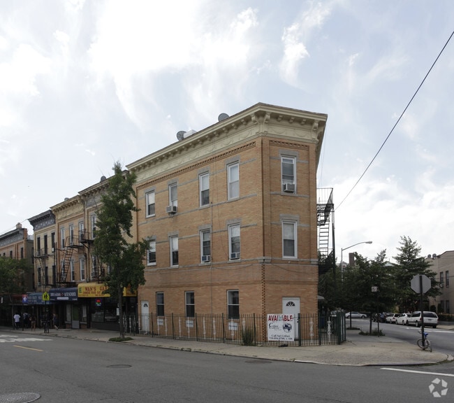


Property Detail
6822 Forest Ave
03484-0001
Queens
Commercialofficeresidentialmixeduse
New York
R6B
1
B and X Area of moderate flood hazard, usually the area between the limits of the 100-year and 500-year floods.
0.08 AC
2024
Ridgewood
2025
Long Island (New York)
058500
New York-Jersey City-White Plains, NY-NJ
6,105 SF
NEARBY LISTINGS FOR SALE OR LEASE
DEMOGRAPHICS near 6822 Forest Ave
1 mile
3 mile
5 mile
2025 Total Population
117,601
1,032,065
2,957,092
2030 Population
113,361
1,014,626
2,946,733
Pop Growth 2025-2030
(3.61%)
(1.69%)
(0.35%)
Average Age
38
39
40
2025 Total Households
41,191
366,146
1,131,455
HH Growth 2025-2030
(4.19%)
(2.09%)
(0.21%)
Median Household Inc
$81,873
$72,614
$84,785
Avg Household Size
2.80
2.70
2.50
2025 Avg HH Vehicles
1.00
1.00
1.00
Median Home Value
$885,600
$802,824
$786,425
Median Year Built
1946
1949
1950
Nearby Places
Map Layers
Map Styles
 Street
 Aerial
Layers
 Traffic
 Biking
Places
Listings with unknown addresses are not visible on the map
- Restaurants
- Banks
- Shops
- Fitness
- Groceries
PUBLIC TRANSPORTATION
TRANSIT/SUBWAY
Forest Avenue (M - New York MTA Subway (The Subway))
Drive
Walk
Distance
Forest Avenue (M - New York MTA Subway (The Subway))
1 min
3 min
0.2 mi
Fresh Pond Road (M - New York MTA Subway (The Subway))
Drive
Walk
Distance
Fresh Pond Road (M - New York MTA Subway (The Subway))
2 min
9 min
0.4 mi
Seneca Avenue (M - New York MTA Subway (The Subway))
Drive
Walk
Distance
Seneca Avenue (M - New York MTA Subway (The Subway))
2 min
9 min
0.4 mi
Halsey Street (L Line) (L - New York MTA Subway (The Subway))
Drive
Walk
Distance
Halsey Street (L Line) (L - New York MTA Subway (The Subway))
3 min
12 min
0.6 mi
Myrtle-Wyckoff Avenues (L - New York MTA Subway (The Subway), M - New York MTA Subway (The Subway))
Drive
Walk
Distance
Myrtle-Wyckoff Avenues (L - New York MTA Subway (The Subway), M - New York MTA Subway (The Subway))
2 min
13 min
0.7 mi
COMMUTER RAIL
East New York Station (Far Rockaway Branch - Long Island Rail Road, Long Beach Branch - Long Island Rail Road, West Hempstead Branch - Long Island Rail Road)
Drive
Walk
Distance
East New York Station (Far Rockaway Branch - Long Island Rail Road, Long Beach Branch - Long Island Rail Road, West Hempstead Branch - Long Island Rail Road)
8 min
2.7 mi
Woodside Station (Babylon Branch - Long Island Rail Road, Far Rockaway Branch - Long Island Rail Road, Hempstead Branch - Long Island Rail Road, Long Beach Branch - Long Island Rail Road, Montauk Branch - Long Island Rail Road, Port Jefferson Branch - Long Island Rail Road, Port Washington Branch - Long Island Rail Road, Ronkonkoma Branch - Long Island Rail Road)
Drive
Walk
Distance
Woodside Station (Babylon Branch - Long Island Rail Road, Far Rockaway Branch - Long Island Rail Road, Hempstead Branch - Long Island Rail Road, Long Beach Branch - Long Island Rail Road, Montauk Branch - Long Island Rail Road, Port Jefferson Branch - Long Island Rail Road, Port Washington Branch - Long Island Rail Road, Ronkonkoma Branch - Long Island Rail Road)
10 min
3.8 mi
AIRPORT
LaGuardia
Drive
Walk
Distance
LaGuardia
16 min
6.5 mi
John F Kennedy International
Drive
Walk
Distance
John F Kennedy International
17 min
10.3 mi
Newark Liberty International
Drive
Walk
Distance
Newark Liberty International
34 min
18.1 mi
Freight Ports
NY - Red Hook Container Terminal
Drive
Walk
Distance
NY - Red Hook Container Terminal
17 min
7.8 mi
SALE & LEASE HISTORY
LISTING DATE
SALE/LEASE

Nov 08, 2022
For Lease
Nearby Properties
Address
Land Use
TOTAL SIZE
Lot Size
Zoning
Address
Land Use
TOTAL SIZE
Lot Size
Zoning
2,812,739 SF
2.10 AC
C5-3
Address
Land Use
TOTAL SIZE
Lot Size
Zoning
772,163 SF
5.24 AC
C4-5X
Address
Land Use
TOTAL SIZE
Lot Size
Zoning
54,170 SF
229.57 AC
PARK
Address
Land Use
TOTAL SIZE
Lot Size
Zoning
1,292,074 SF
C4-2F
Address
Land Use
TOTAL SIZE
Lot Size
Zoning
835,231 SF
11.32 AC
R6
Address
Land Use
TOTAL SIZE
Lot Size
Zoning
234,891 SF
3.17 AC
C4-5X
Address
Land Use
TOTAL SIZE
Lot Size
Zoning
126.85 AC
PARK
Address
Land Use
TOTAL SIZE
Lot Size
Zoning
264,691 SF
5.17 AC
M1-2
Address
Land Use
TOTAL SIZE
Lot Size
Zoning
1,000 SF
210.07 AC
R3-2
Address
Land Use
TOTAL SIZE
Lot Size
Zoning
1,572,198 SF
22.06 AC
M1-2
Address
Land Use
TOTAL SIZE
Lot Size
Zoning
344,116 SF
0.92 AC
R7-1
Address
Land Use
TOTAL SIZE
Lot Size
Zoning
826,915 SF
8.83 AC
M3-1
Address
Land Use
TOTAL SIZE
Lot Size
Zoning
446,763 SF
12.52 AC
R6
Address
Land Use
TOTAL SIZE
Lot Size
Zoning
1,150,500 SF
15.17 AC
R6
Address
Land Use
TOTAL SIZE
Lot Size
Zoning
360,000 SF
5.88 AC
C4-2
Address
Land Use
TOTAL SIZE
Lot Size
Zoning
307,038 SF
7.84 AC
M1-1
Address
Land Use
TOTAL SIZE
Lot Size
Zoning
474,715 SF
1.72 AC
M14R8A
Address
Land Use
TOTAL SIZE
Lot Size
Zoning
458,778 SF
2.09 AC
R6
Address
Land Use
TOTAL SIZE
Lot Size
Zoning
490,600 SF
12.01 AC
M1-1
Address
Land Use
TOTAL SIZE
Lot Size
Zoning
248,200 SF
1.25 AC
R6
Address
Land Use
TOTAL SIZE
Lot Size
Zoning
257,660 SF
1.94 AC
R7A
Address
Land Use
TOTAL SIZE
Lot Size
Zoning
1,136,208 SF
30.25 AC
R5
Address
Land Use
TOTAL SIZE
Lot Size
Zoning
353,333 SF
1.99 AC
R6A
Address
Land Use
TOTAL SIZE
Lot Size
Zoning
780,000 SF
11.15 AC
R6
Address
Land Use
TOTAL SIZE
Lot Size
Zoning
88,700 SF
4.59 AC
M3-1
Address
Land Use
TOTAL SIZE
Lot Size
Zoning
821,016 SF
8.92 AC
R6
Address
Land Use
TOTAL SIZE
Lot Size
Zoning
220,627 SF
0.79 AC
C4-4
Address
Land Use
TOTAL SIZE
Lot Size
Zoning
388,023 SF
1.58 AC
R7A
Address
Land Use
TOTAL SIZE
Lot Size
Zoning
266,195 SF
4.59 AC
C4-2
Address
Land Use
TOTAL SIZE
Lot Size
Zoning
272,081 SF
4.59 AC
C4-2
The World's #1 Commercial Real Estate Marketplace
Connect with us
© 2026 CoStar Group
The information above has been obtained from sources believed reliable. While we do not doubt its accuracy we have not verified it and make no guarantee, warranty or representation about it. It is your responsibility to independently confirm its accuracy and completeness. Any projections, opinions, assumptions, or estimates used are for example only and do not represent the current or future performance of the property. The value of this transaction to you depends on tax and other factors which should be evaluated by your tax, financial, and legal advisors. You and your advisors should conduct a careful, independent investigation of the property to determine to your satisfaction the suitability of the property for your needs.