Property Record
6822 Spindle Top Rd, San Angelo, TX 76901
NEARBY LISTINGS FOR SALE OR LEASE
Property Detail
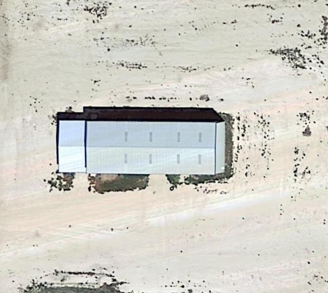
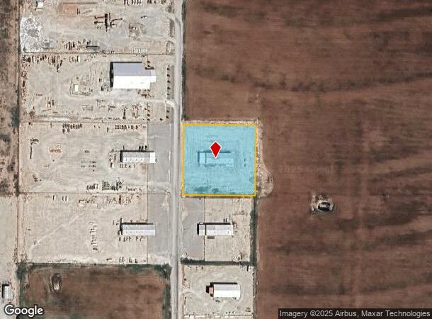
6822 Spindle Top Rd
35-02740-0000-010-00
Northwood Estates
Officebuilding
ACRES: 2.584 SUBD: NORTHWOOD ESTATES TRACT: 10 SEC 2-A
X
Tom Green
48451C0340E
Texas
2025
2.58 AC
2025
Texas West Area
001709
Other Market Areas
1,250 SF
San Angelo, TX
DEMOGRAPHICS near 6822 Spindle Top Rd
1 Mile
3 Mile
5 Mile
2024 Total Population
754
9,113
33,519
2029 Population
755
9,111
33,464
Pop Growth 2024-2029
+ 0.13%
(0.02%)
(0.16%)
Average Age
41
39
38
2024 Total Households
284
3,419
12,487
HH Growth 2024-2029
+ 0.35%
0.00%
(0.11%)
Median Household Inc
$70,961
$55,145
$48,711
Avg Household Size
2.60
2.60
2.50
2024 Avg HH Vehicles
2.00
2.00
2.00
Median Home Value
$170,481
$132,181
$112,708
Median Year Built
1982
1973
1967
Nearby Places
Map Layers
Map Styles
 Street
 Aerial
- Restaurants
- Banks
- Shops
- Fitness
- Groceries
PUBLIC TRANSPORTATION
AIRPORT
San Angelo Regional/Mathis Field
DRIVE
WALK
Distance
San Angelo Regional/Mathis Field
29 min
17.4 mi
Nearby Properties
Address
Land Use
TOTAL SIZE
Lot Size
Zoning
Address
Land Use
TOTAL SIZE
Lot Size
Zoning
204,347 SF
25.94 AC
Address
Land Use
TOTAL SIZE
Lot Size
Zoning
69,776 SF
3.59 AC
Address
Land Use
TOTAL SIZE
Lot Size
Zoning
1,250 SF
117.01 AC
Address
Land Use
TOTAL SIZE
Lot Size
Zoning
73,100 SF
6.13 AC
Address
Land Use
TOTAL SIZE
Lot Size
Zoning
16,125 SF
4.71 AC
Address
Land Use
TOTAL SIZE
Lot Size
Zoning
2,000 SF
9 AC
Address
Land Use
TOTAL SIZE
Lot Size
Zoning
3,216 SF
7.18 AC
Address
Land Use
TOTAL SIZE
Lot Size
Zoning
5,490 SF
3.06 AC
Address
Land Use
TOTAL SIZE
Lot Size
Zoning
13,680 SF
2.48 AC
Address
Land Use
TOTAL SIZE
Lot Size
Zoning
9,000 SF
2.87 AC
Address
Land Use
TOTAL SIZE
Lot Size
Zoning
24,510 SF
3 AC
Address
Land Use
TOTAL SIZE
Lot Size
Zoning
1,400 SF
18.81 AC
Address
Land Use
TOTAL SIZE
Lot Size
Zoning
23,040 SF
0.78 AC
Address
Land Use
TOTAL SIZE
Lot Size
Zoning
26,158 SF
1.67 AC
Address
Land Use
TOTAL SIZE
Lot Size
Zoning
3,116 SF
3.50 AC
Address
Land Use
TOTAL SIZE
Lot Size
Zoning
27,500 SF
5 AC
Address
Land Use
TOTAL SIZE
Lot Size
Zoning
11,800 SF
5.47 AC
Address
Land Use
TOTAL SIZE
Lot Size
Zoning
12,800 SF
3.09 AC
Address
Land Use
TOTAL SIZE
Lot Size
Zoning
5,000 SF
5.44 AC
Address
Land Use
TOTAL SIZE
Lot Size
Zoning
19,368 SF
1.12 AC
Address
Land Use
TOTAL SIZE
Lot Size
Zoning
3,216 SF
1.38 AC
Address
Land Use
TOTAL SIZE
Lot Size
Zoning
25,000 SF
5.01 AC
Address
Land Use
TOTAL SIZE
Lot Size
Zoning
7,380 SF
3 AC
Address
Land Use
TOTAL SIZE
Lot Size
Zoning
2,400 SF
38 AC
Address
Land Use
TOTAL SIZE
Lot Size
Zoning
1,875 SF
3.33 AC
Address
Land Use
TOTAL SIZE
Lot Size
Zoning
840 SF
6.36 AC
Address
Land Use
TOTAL SIZE
Lot Size
Zoning
1,500 SF
1.84 AC
Address
Land Use
TOTAL SIZE
Lot Size
Zoning
600 SF
6 AC
Address
Land Use
TOTAL SIZE
Lot Size
Zoning
276 SF
2.48 AC
Address
Land Use
TOTAL SIZE
Lot Size
Zoning
198.38 AC
The World's #1 Commercial Real Estate Marketplace
Connect with us
© 2025 CoStar Group
The information above has been obtained from sources believed reliable. While we do not doubt its accuracy we have not verified it and make no guarantee, warranty or representation about it. It is your responsibility to independently confirm its accuracy and completeness. Any projections, opinions, assumptions, or estimates used are for example only and do not represent the current or future performance of the property. The value of this transaction to you depends on tax and other factors which should be evaluated by your tax, financial, and legal advisors. You and your advisors should conduct a careful, independent investigation of the property to determine to your satisfaction the suitability of the property for your needs.