Property Record
6825 Highway 161, Walls, MS 38680
NEARBY LISTINGS FOR SALE OR LEASE
-
-
View all Walls listings for sale on LoopNet.com
Property Detail
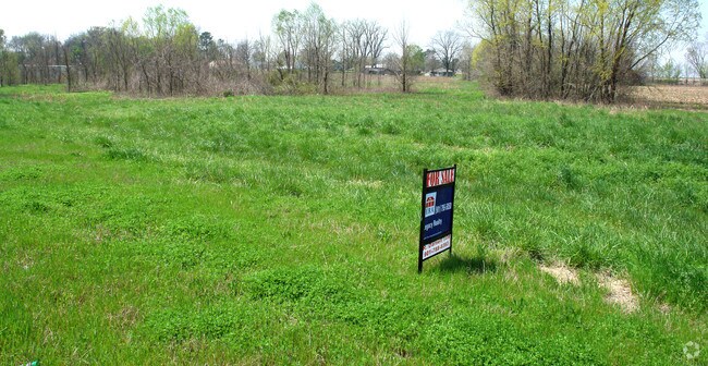
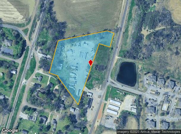
6825 Highway 161
Memphis, TN-MS-AR
33-1-9 LOT IN NE 1/4
1098330100000100
DeSoto
Vacantlandnec
Mississippi
AE
1
28033C0034H
5.50 AC
2025
DeSoto County
2025
Memphis
070102
DEMOGRAPHICS near 6825 Highway 161
1 Mile
3 Mile
5 Mile
2024 Total Population
1,391
6,338
17,717
2029 Population
1,529
6,923
18,961
Pop Growth 2024-2029
+ 9.92%
+ 9.23%
+ 7.02%
Average Age
33
37
38
2024 Total Households
558
2,344
6,416
HH Growth 2024-2029
+ 10.04%
+ 9.34%
+ 7.01%
Median Household Inc
$31,674
$58,778
$62,467
Avg Household Size
2.50
2.70
2.70
2024 Avg HH Vehicles
1.00
2.00
2.00
Median Home Value
$120,000
$171,590
$172,048
Median Year Built
1994
1994
1991
Nearby Places
Map Layers
Map Styles
 Street
 Aerial
- Restaurants
- Banks
- Shops
- Fitness
- Groceries
PUBLIC TRANSPORTATION
AIRPORT
Memphis International
DRIVE
WALK
Distance
Memphis International
22 min
13.8 mi
Freight Ports
Port of Shreveport
DRIVE
WALK
Distance
Port of Shreveport
418 min
381.5 mi
Nearby Properties
Address
Land Use
TOTAL SIZE
Lot Size
Zoning
Address
Land Use
TOTAL SIZE
Lot Size
Zoning
10,092 SF
21.02 AC
PUD
Address
Land Use
TOTAL SIZE
Lot Size
Zoning
371,726 SF
44 AC
M-1
Address
Land Use
TOTAL SIZE
Lot Size
Zoning
9,636 SF
16 AC
PUD
Address
Land Use
TOTAL SIZE
Lot Size
Zoning
1,352 SF
213 AC
A
Address
Land Use
TOTAL SIZE
Lot Size
Zoning
15,038 SF
2,504.46 AC
CA
Address
Land Use
TOTAL SIZE
Lot Size
Zoning
9,531 SF
15 AC
RM-6
Address
Land Use
TOTAL SIZE
Lot Size
Zoning
80,144 SF
22.98 AC
M-1
Address
Land Use
TOTAL SIZE
Lot Size
Zoning
9,913 SF
2.57 AC
C-4
Address
Land Use
TOTAL SIZE
Lot Size
Zoning
6,840 SF
4 AC
PUD
Address
Land Use
TOTAL SIZE
Lot Size
Zoning
19,650 SF
2.40 AC
M-1
Address
Land Use
TOTAL SIZE
Lot Size
Zoning
2,280 SF
99 AC
A
Address
Land Use
TOTAL SIZE
Lot Size
Zoning
9,242 SF
1.12 AC
C-1
Address
Land Use
TOTAL SIZE
Lot Size
Zoning
17,364 SF
1.69 AC
C-4
Address
Land Use
TOTAL SIZE
Lot Size
Zoning
4,450 SF
2 AC
PUD
Address
Land Use
TOTAL SIZE
Lot Size
Zoning
9,090 SF
4.40 AC
C-4
Address
Land Use
TOTAL SIZE
Lot Size
Zoning
2,839 SF
0.70 AC
C-1
Address
Land Use
TOTAL SIZE
Lot Size
Zoning
11,212 SF
2 AC
A-R
Address
Land Use
TOTAL SIZE
Lot Size
Zoning
447 AC
A
Address
Land Use
TOTAL SIZE
Lot Size
Zoning
11,837 SF
1.23 AC
PUD
Address
Land Use
TOTAL SIZE
Lot Size
Zoning
3,600 SF
1.83 AC
RM-6
Address
Land Use
TOTAL SIZE
Lot Size
Zoning
3,690 SF
318 AC
A
Address
Land Use
TOTAL SIZE
Lot Size
Zoning
53.28 AC
IH
Address
Land Use
TOTAL SIZE
Lot Size
Zoning
12,000 SF
15 AC
IH
Address
Land Use
TOTAL SIZE
Lot Size
Zoning
5,003 SF
2.31 AC
M-1
Address
Land Use
TOTAL SIZE
Lot Size
Zoning
1,762 SF
9.49 AC
M-1
Address
Land Use
TOTAL SIZE
Lot Size
Zoning
3,146 SF
13 AC
A-R
Address
Land Use
TOTAL SIZE
Lot Size
Zoning
3,813 SF
1 AC
PUD
Address
Land Use
TOTAL SIZE
Lot Size
Zoning
2,691 SF
2 AC
C-2
The World's #1 Commercial Real Estate Marketplace
Connect with us
© 2025 CoStar Group
The information above has been obtained from sources believed reliable. While we do not doubt its accuracy we have not verified it and make no guarantee, warranty or representation about it. It is your responsibility to independently confirm its accuracy and completeness. Any projections, opinions, assumptions, or estimates used are for example only and do not represent the current or future performance of the property. The value of this transaction to you depends on tax and other factors which should be evaluated by your tax, financial, and legal advisors. You and your advisors should conduct a careful, independent investigation of the property to determine to your satisfaction the suitability of the property for your needs.