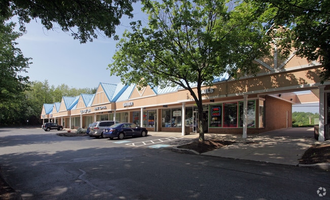
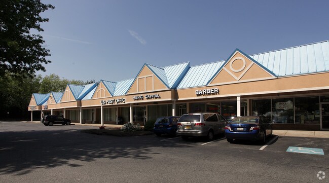
Property Record
6830 Olney Laytonsville Rd, Laytonsville, MD 20882

Property Detail
6830 Olney Laytonsville Rd
01-00001642
RES ON LAND OF GOSHE N
Storebuilding
MONTGOMERY
C1
Maryland
B and X Area of moderate flood hazard, usually the area between the limits of the 100-year and 500-year floods.
3.83 AC
2025
Outlying Montgmery Cnty E
2025
Washington, DC
700103
Washington-Arlington-Alexandria, DC-VA-MD-WV
25,704 SF
NEARBY LISTINGS FOR SALE OR LEASE
DEMOGRAPHICS near 6830 Olney Laytonsville Rd
1 mile
3 mile
5 mile
2025 Total Population
1,712
22,118
120,672
2030 Population
1,756
22,588
123,787
Pop Growth 2025-2030
+ 2.57%
+ 2.12%
+ 2.58%
Average Age
45
41
40
2025 Total Households
567
7,202
40,025
HH Growth 2025-2030
+ 2.47%
+ 2.03%
+ 2.56%
Median Household Inc
$168,617
$147,666
$121,271
Avg Household Size
3.00
3.00
2.90
2025 Avg HH Vehicles
3.00
2.00
2.00
Median Home Value
$789,017
$589,680
$527,201
Median Year Built
1981
1985
1982
Nearby Places
Map Layers
Map Styles
 Street
 Aerial
Layers
 Traffic
 Biking
Places
Listings with unknown addresses are not visible on the map
- Restaurants
- Banks
- Shops
- Fitness
- Groceries
PUBLIC TRANSPORTATION
COMMUTER RAIL
Washington Grove Marc Eb (BRUNSWICK - WASHINGTON - Maryland Transit Administration)
Drive
Walk
Distance
Washington Grove Marc Eb (BRUNSWICK - WASHINGTON - Maryland Transit Administration)
14 min
6.5 mi
Gaithersburg Marc Wb (BRUNSWICK - WASHINGTON - Maryland Transit Administration)
Drive
Walk
Distance
Gaithersburg Marc Wb (BRUNSWICK - WASHINGTON - Maryland Transit Administration)
15 min
7.2 mi
AIRPORT
Ronald Reagan Washington Ntl
Drive
Walk
Distance
Ronald Reagan Washington Ntl
54 min
29.3 mi
Baltimore/Washington International Thurgood Marshall
Drive
Walk
Distance
Baltimore/Washington International Thurgood Marshall
52 min
32.7 mi
Washington Dulles International
Drive
Walk
Distance
Washington Dulles International
62 min
37.9 mi
Freight Ports
Port of Baltimore
Drive
Walk
Distance
Port of Baltimore
57 min
35.6 mi
SALE & LEASE HISTORY
LISTING DATE
SALE/LEASE

Sep 25, 2016
For Lease
Jul 11, 2019
For Lease
Nearby Properties
Address
Land Use
TOTAL SIZE
Lot Size
Zoning
Address
Land Use
TOTAL SIZE
Lot Size
Zoning
185,040 SF
49.79 AC
IL1.0
Address
Land Use
TOTAL SIZE
Lot Size
Zoning
407,972 SF
44.95 AC
IL1.0
Address
Land Use
TOTAL SIZE
Lot Size
Zoning
161.53 AC
AR
Address
Land Use
TOTAL SIZE
Lot Size
Zoning
76,179 SF
10.47 AC
RE2
Address
Land Use
TOTAL SIZE
Lot Size
Zoning
79,786 SF
9.91 AC
NR0.2
Address
Land Use
TOTAL SIZE
Lot Size
Zoning
119,346 SF
95.41 AC
R200
Address
Land Use
TOTAL SIZE
Lot Size
Zoning
78,997 SF
6.16 AC
I4
Address
Land Use
TOTAL SIZE
Lot Size
Zoning
78,997 SF
4.90 AC
I4
Address
Land Use
TOTAL SIZE
Lot Size
Zoning
118,980 SF
9.06 AC
IL1.0
Address
Land Use
TOTAL SIZE
Lot Size
Zoning
99,190 SF
5.42 AC
IL0.5
Address
Land Use
TOTAL SIZE
Lot Size
Zoning
87,812 SF
3.90 AC
IL1.0
Address
Land Use
TOTAL SIZE
Lot Size
Zoning
35,885 SF
19.21 AC
RE1
Address
Land Use
TOTAL SIZE
Lot Size
Zoning
55,200 SF
1.33 AC
IL1.0
Address
Land Use
TOTAL SIZE
Lot Size
Zoning
78,547 SF
29.77 AC
R90
Address
Land Use
TOTAL SIZE
Lot Size
Zoning
156,500 SF
11.51 AC
IL1.0
Address
Land Use
TOTAL SIZE
Lot Size
Zoning
2,816 SF
219.76 AC
R200
Address
Land Use
TOTAL SIZE
Lot Size
Zoning
84,948 SF
4.14 AC
IL1.0
Address
Land Use
TOTAL SIZE
Lot Size
Zoning
63,098 SF
8.25 AC
NR0.2
Address
Land Use
TOTAL SIZE
Lot Size
Zoning
40,000 SF
2.69 AC
IL1.0
Address
Land Use
TOTAL SIZE
Lot Size
Zoning
64,160 SF
1.39 AC
RE2
Address
Land Use
TOTAL SIZE
Lot Size
Zoning
42,000 SF
4.02 AC
NR0.2
Address
Land Use
TOTAL SIZE
Lot Size
Zoning
57,216 SF
4.30 AC
IL1.0
Address
Land Use
TOTAL SIZE
Lot Size
Zoning
22.72 AC
RE1
Address
Land Use
TOTAL SIZE
Lot Size
Zoning
89,400 SF
12.90 AC
RE1
Address
Land Use
TOTAL SIZE
Lot Size
Zoning
50,150 SF
4.20 AC
I1
Address
Land Use
TOTAL SIZE
Lot Size
Zoning
70,000 SF
3.52 AC
IL1.0
Address
Land Use
TOTAL SIZE
Lot Size
Zoning
50,506 SF
1.65 AC
IL1.0
Address
Land Use
TOTAL SIZE
Lot Size
Zoning
18.62 AC
R200
Address
Land Use
TOTAL SIZE
Lot Size
Zoning
35.14 AC
AR
Address
Land Use
TOTAL SIZE
Lot Size
Zoning
45,840 SF
3.29 AC
IL1.0
The World's #1 Commercial Real Estate Marketplace
Connect with us
© 2026 CoStar Group
The information above has been obtained from sources believed reliable. While we do not doubt its accuracy we have not verified it and make no guarantee, warranty or representation about it. It is your responsibility to independently confirm its accuracy and completeness. Any projections, opinions, assumptions, or estimates used are for example only and do not represent the current or future performance of the property. The value of this transaction to you depends on tax and other factors which should be evaluated by your tax, financial, and legal advisors. You and your advisors should conduct a careful, independent investigation of the property to determine to your satisfaction the suitability of the property for your needs.