Property Record
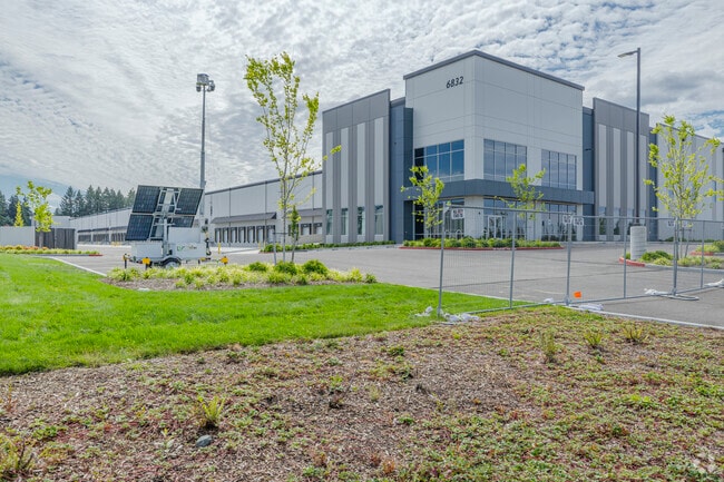
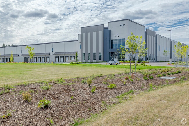
6832 192Nd St E, , WA

Property Detail
6832 192Nd St E
Seattle-Tacoma-Bellevue, WA
SECTION 06 TOWNSHIP 18 RANGE 04 QUARTER 12 PARCEL G OF ROS 2023-06-27-5008 DESC AS POR OF PARCEL B OF BLA 2021-02-17-5001 DESC AS FOLL COM AT SE COR OF SD PARCEL B TH S 88 DEG 44 MIN 38 SEC W ALG S LI OF SD PARCEL B 1791.29 FT TO TRUE POB TH CONT S 8
041806-1018
PIERCE
Warehouse
Washington
2024
30.76 AC
2025
Parkland/Spanaway
611,206 SF
Seattle/Puget Sound
NEARBY LISTINGS FOR SALE OR LEASE
DEMOGRAPHICS near 6832 192Nd St E
1 mile
3 mile
5 mile
2025 Total Population
6,688
76,434
167,297
2030 Population
6,674
76,943
169,371
Pop Growth 2025-2030
(0.21%)
+ 0.67%
+ 1.24%
Average Age
36
36
37
2025 Total Households
2,057
24,406
55,388
HH Growth 2025-2030
(0.24%)
+ 0.70%
+ 1.27%
Median Household Inc
$115,961
$113,416
$109,361
Avg Household Size
3.20
3.00
2.90
2025 Avg HH Vehicles
2.00
2.00
2.00
Median Home Value
$473,577
$487,879
$488,921
Median Year Built
1996
2000
1996
Nearby Places
Map Layers
Map Styles
 Street
 Aerial
Transit
 Traffic
 Biking
Places
Listings with unknown addresses are not visible on the map
- Restaurants
- Banks
- Shops
- Fitness
- Groceries
PUBLIC TRANSPORTATION
AIRPORT
Seattle-Tacoma International
Drive
Walk
Distance
Seattle-Tacoma International
55 min
33.3 mi
Freight Ports
Port of Tacoma
Drive
Walk
Distance
Port of Tacoma
27 min
14.7 mi
Nearby Properties
Address
Land Use
TOTAL SIZE
Lot Size
Zoning
Address
Land Use
TOTAL SIZE
Lot Size
Zoning
1,381,439 SF
209.68 AC
EC
Address
Land Use
TOTAL SIZE
Lot Size
Zoning
492,365 SF
24.33 AC
EC
Address
Land Use
TOTAL SIZE
Lot Size
Zoning
1,110,154 SF
53.99 AC
EC
Address
Land Use
TOTAL SIZE
Lot Size
Zoning
782,773 SF
53.33 AC
Address
Land Use
TOTAL SIZE
Lot Size
Zoning
77,520 SF
25 AC
EC
Address
Land Use
TOTAL SIZE
Lot Size
Zoning
753,069 SF
40.94 AC
Address
Land Use
TOTAL SIZE
Lot Size
Zoning
862,167 SF
45.51 AC
EC
Address
Land Use
TOTAL SIZE
Lot Size
Zoning
1,118,480 SF
75.62 AC
Address
Land Use
TOTAL SIZE
Lot Size
Zoning
305,680 SF
14.48 AC
Address
Land Use
TOTAL SIZE
Lot Size
Zoning
891,600 SF
48.79 AC
EC
Address
Land Use
TOTAL SIZE
Lot Size
Zoning
533,393 SF
26.48 AC
EC
Address
Land Use
TOTAL SIZE
Lot Size
Zoning
449,359 SF
37.20 AC
EC
Address
Land Use
TOTAL SIZE
Lot Size
Zoning
522,832 SF
33.82 AC
EC
Address
Land Use
TOTAL SIZE
Lot Size
Zoning
645,993 SF
62.57 AC
EC
Address
Land Use
TOTAL SIZE
Lot Size
Zoning
229,782 SF
12.48 AC
Address
Land Use
TOTAL SIZE
Lot Size
Zoning
477,120 SF
27.79 AC
Address
Land Use
TOTAL SIZE
Lot Size
Zoning
405,040 SF
26.44 AC
Address
Land Use
TOTAL SIZE
Lot Size
Zoning
352,930 SF
20.68 AC
Address
Land Use
TOTAL SIZE
Lot Size
Zoning
153,138 SF
9.11 AC
CC
Address
Land Use
TOTAL SIZE
Lot Size
Zoning
312,225 SF
13.66 AC
EC
Address
Land Use
TOTAL SIZE
Lot Size
Zoning
218,262 SF
3.58 AC
MUD
Address
Land Use
TOTAL SIZE
Lot Size
Zoning
192,163 SF
24.26 AC
EC
Address
Land Use
TOTAL SIZE
Lot Size
Zoning
153,993 SF
6.18 AC
Address
Land Use
TOTAL SIZE
Lot Size
Zoning
300,942 SF
18.82 AC
EC
Address
Land Use
TOTAL SIZE
Lot Size
Zoning
313,278 SF
57.62 AC
R5
Address
Land Use
TOTAL SIZE
Lot Size
Zoning
171,185 SF
15.32 AC
EC
Address
Land Use
TOTAL SIZE
Lot Size
Zoning
311,452 SF
18.90 AC
EC
Address
Land Use
TOTAL SIZE
Lot Size
Zoning
175,315 SF
4.81 AC
NCOR
Address
Land Use
TOTAL SIZE
Lot Size
Zoning
267,365 SF
13.10 AC
EC
The World's #1 Commercial Real Estate Marketplace
Connect with us
© 2026 CoStar Group
The information above has been obtained from sources believed reliable. While we do not doubt its accuracy we have not verified it and make no guarantee, warranty or representation about it. It is your responsibility to independently confirm its accuracy and completeness. Any projections, opinions, assumptions, or estimates used are for example only and do not represent the current or future performance of the property. The value of this transaction to you depends on tax and other factors which should be evaluated by your tax, financial, and legal advisors. You and your advisors should conduct a careful, independent investigation of the property to determine to your satisfaction the suitability of the property for your needs.