Property Record
6840 N Maple Ave, Fresno, CA 93710

Save to a Folder
{{folder.Name}}
{{folder.ListingIds.length}} Properties
{{folder.ListingIds.length}} Property
Create a New Folder
Property Detail
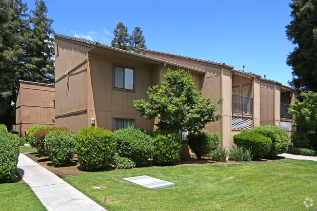
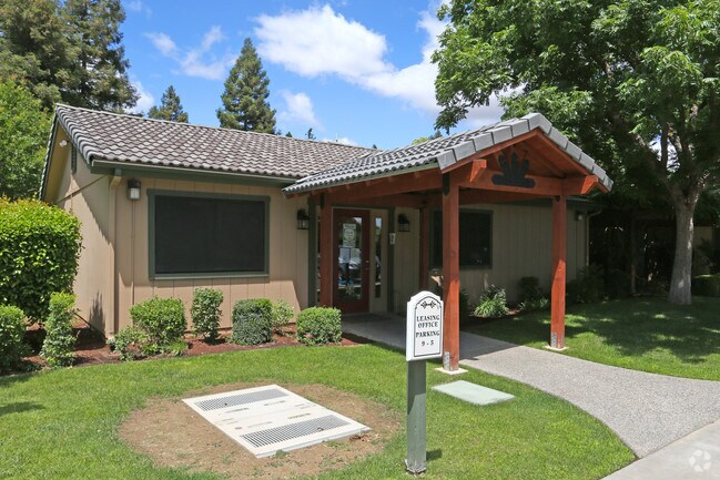
6840 N Maple Ave
410-151-19S
14.25 AC SUR RT IN NW1/4 OF NE1/4 SEC 1 T13R20
Apartment
FRESNO
R3
California
C and X Area of minimal flood hazard, usually depicted on FIRMs as above the 500-year flood level.
14.25 AC
2025
Hoover
2025
Fresno
005407
Fresno, CA
213,952 SF
NEARBY LISTINGS FOR SALE OR LEASE
DEMOGRAPHICS near 6840 N Maple Ave
1 mile
3 mile
5 mile
2025 Total Population
14,198
144,791
308,387
2030 Population
14,305
146,419
312,102
Pop Growth 2025-2030
+ 0.75%
+ 1.12%
+ 1.20%
Average Age
40
38
38
2025 Total Households
5,421
54,973
112,509
HH Growth 2025-2030
+ 0.90%
+ 1.16%
+ 1.23%
Median Household Inc
$92,550
$75,216
$79,582
Avg Household Size
2.50
2.50
2.70
2025 Avg HH Vehicles
2.00
2.00
2.00
Median Home Value
$395,836
$428,283
$439,434
Median Year Built
1982
1983
1980
Nearby Places
Map Layers
Map Styles
 Street
 Aerial
Layers
 Traffic
 Biking
Places
Listings with unknown addresses are not visible on the map
- Restaurants
- Banks
- Shops
- Fitness
- Groceries
PUBLIC TRANSPORTATION
COMMUTER RAIL
Fresno (San Joaquins - Amtrak)
Drive
Walk
Distance
Fresno (San Joaquins - Amtrak)
13 min
9.7 mi
AIRPORT
Fresno Yosemite International
Drive
Walk
Distance
Fresno Yosemite International
12 min
6.6 mi
Freight Ports
Port of Stockton
Drive
Walk
Distance
Port of Stockton
153 min
126.9 mi
Nearby Properties
Address
Land Use
TOTAL SIZE
Lot Size
Zoning
Address
Land Use
TOTAL SIZE
Lot Size
Zoning
574,093 SF
25.54 AC
C3
Address
Land Use
TOTAL SIZE
Lot Size
Zoning
451,977 SF
24.16 AC
SPLIT
Address
Land Use
TOTAL SIZE
Lot Size
Zoning
413,093 SF
33.19 AC
CP
Address
Land Use
TOTAL SIZE
Lot Size
Zoning
693,292 SF
29.86 AC
CP
Address
Land Use
TOTAL SIZE
Lot Size
Zoning
143,370 SF
6.92 AC
CP
Address
Land Use
TOTAL SIZE
Lot Size
Zoning
180,770 SF
19.03 AC
PCC
Address
Land Use
TOTAL SIZE
Lot Size
Zoning
180,161 SF
10.38 AC
Address
Land Use
TOTAL SIZE
Lot Size
Zoning
239,000 SF
20.34 AC
R2
Address
Land Use
TOTAL SIZE
Lot Size
Zoning
239,437 SF
31.16 AC
RA
Address
Land Use
TOTAL SIZE
Lot Size
Zoning
81,545 SF
3.18 AC
CP
Address
Land Use
TOTAL SIZE
Lot Size
Zoning
192,062 SF
11.50 AC
RS5
Address
Land Use
TOTAL SIZE
Lot Size
Zoning
188,913 SF
7.90 AC
Address
Land Use
TOTAL SIZE
Lot Size
Zoning
184,694 SF
9.99 AC
SPLIT
Address
Land Use
TOTAL SIZE
Lot Size
Zoning
119,869 SF
11.08 AC
C1
Address
Land Use
TOTAL SIZE
Lot Size
Zoning
241,133 SF
13.61 AC
R3
Address
Land Use
TOTAL SIZE
Lot Size
Zoning
212,354 SF
13.12 AC
R2
Address
Land Use
TOTAL SIZE
Lot Size
Zoning
174,577 SF
8.40 AC
RM1
Address
Land Use
TOTAL SIZE
Lot Size
Zoning
181,538 SF
0.01 AC
CP
Address
Land Use
TOTAL SIZE
Lot Size
Zoning
104,902 SF
8 AC
C6
Address
Land Use
TOTAL SIZE
Lot Size
Zoning
200,826 SF
19.23 AC
R2
Address
Land Use
TOTAL SIZE
Lot Size
Zoning
152,550 SF
9.23 AC
R3
Address
Land Use
TOTAL SIZE
Lot Size
Zoning
121,491 SF
4.52 AC
R3
Address
Land Use
TOTAL SIZE
Lot Size
Zoning
208,444 SF
11.75 AC
R3
Address
Land Use
TOTAL SIZE
Lot Size
Zoning
175,117 SF
10 AC
C1
Address
Land Use
TOTAL SIZE
Lot Size
Zoning
191,177 SF
19.19 AC
C2
Address
Land Use
TOTAL SIZE
Lot Size
Zoning
157,702 SF
4.61 AC
R2A
Address
Land Use
TOTAL SIZE
Lot Size
Zoning
78,774 SF
2.10 AC
CP
Address
Land Use
TOTAL SIZE
Lot Size
Zoning
132,084 SF
9.68 AC
RM1
Address
Land Use
TOTAL SIZE
Lot Size
Zoning
8.80 AC
AE5
Address
Land Use
TOTAL SIZE
Lot Size
Zoning
129,860 SF
6.10 AC
The World's #1 Commercial Real Estate Marketplace
Connect with us
© 2026 CoStar Group
The information above has been obtained from sources believed reliable. While we do not doubt its accuracy we have not verified it and make no guarantee, warranty or representation about it. It is your responsibility to independently confirm its accuracy and completeness. Any projections, opinions, assumptions, or estimates used are for example only and do not represent the current or future performance of the property. The value of this transaction to you depends on tax and other factors which should be evaluated by your tax, financial, and legal advisors. You and your advisors should conduct a careful, independent investigation of the property to determine to your satisfaction the suitability of the property for your needs.