Property Record
685 Route 12, Flemington, NJ 08822
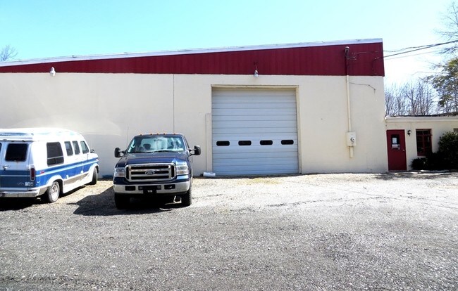

Property Detail
685 Route 12
10-00049-0000-00031
Hunterdon
Warehouse
New Jersey
C5
31
A Areas with a 1% annual chance of flooding and a 26% chance of flooding over the life of a 30-year mortgage.
2.25 AC
2024
Hunterdon
2025
Northern New Jersey
372900
Newark, NJ
NEARBY LISTINGS FOR SALE OR LEASE
-
-
View all Flemington listings for lease on LoopNet.com
DEMOGRAPHICS near 685 Route 12
1 mile
3 mile
5 mile
2025 Total Population
226
3,902
22,409
2030 Population
225
3,946
22,906
Pop Growth 2025-2030
(0.44%)
+ 1.13%
+ 2.22%
Average Age
47
45
43
2025 Total Households
88
1,417
8,229
HH Growth 2025-2030
(1.14%)
+ 1.06%
+ 2.19%
Median Household Inc
$173,333
$162,710
$140,718
Avg Household Size
2.60
2.70
2.70
2025 Avg HH Vehicles
3.00
2.00
2.00
Median Home Value
$656,250
$614,407
$582,986
Median Year Built
1979
1981
1978
Nearby Places
Map Layers
Map Styles
 Street
 Aerial
Layers
 Traffic
 Biking
Places
Listings with unknown addresses are not visible on the map
- Restaurants
- Banks
- Shops
- Fitness
- Groceries
PUBLIC TRANSPORTATION
AIRPORT
Trenton Mercer
Drive
Walk
Distance
Trenton Mercer
43 min
24.6 mi
Lehigh Valley International
Drive
Walk
Distance
Lehigh Valley International
70 min
39.8 mi
Freight Ports
Port of Philadelphia
Drive
Walk
Distance
Port of Philadelphia
79 min
47.0 mi
SALE & LEASE HISTORY
LISTING DATE
SALE/LEASE

Sep 25, 2016
For Lease
Nearby Properties
Address
Land Use
TOTAL SIZE
Lot Size
Zoning
Address
Land Use
TOTAL SIZE
Lot Size
Zoning
54.74 AC
P
Address
Land Use
TOTAL SIZE
Lot Size
Zoning
69,600 SF
15.41 AC
BP
Address
Land Use
TOTAL SIZE
Lot Size
Zoning
9,372 SF
91.51 AC
BUSP
Address
Land Use
TOTAL SIZE
Lot Size
Zoning
4,122 SF
10 AC
R-1
Address
Land Use
TOTAL SIZE
Lot Size
Zoning
3,248 SF
46.12 AC
R-1
Address
Land Use
TOTAL SIZE
Lot Size
Zoning
9.55 AC
R-1
Address
Land Use
TOTAL SIZE
Lot Size
Zoning
85,455 SF
9 AC
BP
Address
Land Use
TOTAL SIZE
Lot Size
Zoning
6,000 SF
4.98 AC
C-1
Address
Land Use
TOTAL SIZE
Lot Size
Zoning
25,750 SF
10 AC
BP
Address
Land Use
TOTAL SIZE
Lot Size
Zoning
21.58 AC
BP
Address
Land Use
TOTAL SIZE
Lot Size
Zoning
10,224 SF
3 AC
CC
Address
Land Use
TOTAL SIZE
Lot Size
Zoning
6,707 SF
1 AC
A-2
Address
Land Use
TOTAL SIZE
Lot Size
Zoning
5 AC
R-3
Address
Land Use
TOTAL SIZE
Lot Size
Zoning
8,097 SF
2 AC
AR-2
Address
Land Use
TOTAL SIZE
Lot Size
Zoning
2,240 SF
95.81 AC
AR70
Address
Land Use
TOTAL SIZE
Lot Size
Zoning
5,431 SF
2 AC
A-2
Address
Land Use
TOTAL SIZE
Lot Size
Zoning
3,760 SF
2 AC
A-2
Address
Land Use
TOTAL SIZE
Lot Size
Zoning
47.86 AC
AR70
Address
Land Use
TOTAL SIZE
Lot Size
Zoning
4,269 SF
1 AC
AR70
Address
Land Use
TOTAL SIZE
Lot Size
Zoning
9,510 SF
4.05 AC
VR
Address
Land Use
TOTAL SIZE
Lot Size
Zoning
2,805 SF
2 AC
R3
Address
Land Use
TOTAL SIZE
Lot Size
Zoning
1,857 SF
88.31 AC
AR70
Address
Land Use
TOTAL SIZE
Lot Size
Zoning
8,729 SF
3.44 AC
BP
Address
Land Use
TOTAL SIZE
Lot Size
Zoning
5,184 SF
8.30 AC
CC
Address
Land Use
TOTAL SIZE
Lot Size
Zoning
1,975 SF
1 AC
AR-2
Address
Land Use
TOTAL SIZE
Lot Size
Zoning
10 AC
AR70
Address
Land Use
TOTAL SIZE
Lot Size
Zoning
69.26 AC
R3
Address
Land Use
TOTAL SIZE
Lot Size
Zoning
Address
Land Use
TOTAL SIZE
Lot Size
Zoning
5,655 SF
3 AC
A-2
Address
Land Use
TOTAL SIZE
Lot Size
Zoning
4,030 SF
0.67 AC
R-3
The World's #1 Commercial Real Estate Marketplace
Connect with us
© 2026 CoStar Group
The information above has been obtained from sources believed reliable. While we do not doubt its accuracy we have not verified it and make no guarantee, warranty or representation about it. It is your responsibility to independently confirm its accuracy and completeness. Any projections, opinions, assumptions, or estimates used are for example only and do not represent the current or future performance of the property. The value of this transaction to you depends on tax and other factors which should be evaluated by your tax, financial, and legal advisors. You and your advisors should conduct a careful, independent investigation of the property to determine to your satisfaction the suitability of the property for your needs.