Property Record
6855 Nw 178Th St, Edmond, OK 73012


NEARBY LISTINGS FOR SALE OR LEASE
Property Detail
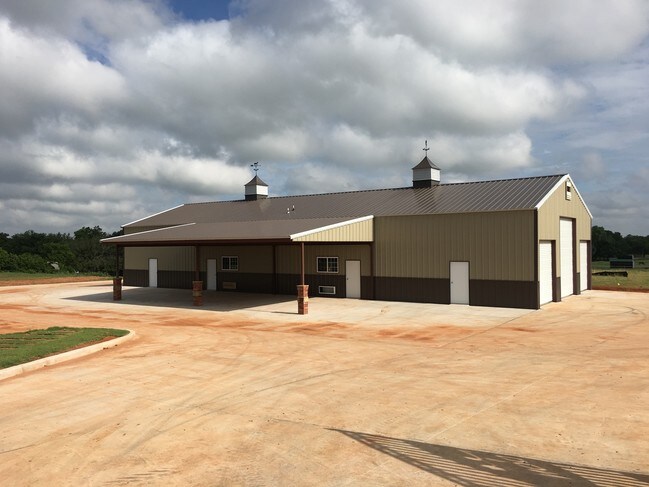
6855 Nw 178Th St
257288560
Deer Creek Township
Lightindustrial
DEER CREEK TOWNSHIP PT SW4 SEC 28 14N 4W BEG 1100.52FT W OF SE/C SW4 TH N538FT W543.32FT S538FT E544.18FT TO BEG CONT 6.71ACRS MORE OR LESS
AE
Oklahoma
40017C0145J
Oklahoma
2023
6.71 AC
2024
North Outlying
108532
Oklahoma City
4,000 SF
Oklahoma City, OK
DEMOGRAPHICS near 6855 Nw 178Th St
1 Mile
3 Mile
5 Mile
2024 Total Population
631
16,607
83,406
2029 Population
655
17,446
87,659
Pop Growth 2024-2029
+ 3.80%
+ 5.05%
+ 5.10%
Average Age
40
34
37
2024 Total Households
209
6,045
32,747
HH Growth 2024-2029
+ 3.35%
+ 5.16%
+ 4.78%
Median Household Inc
$158,088
$116,477
$97,781
Avg Household Size
3.10
2.70
2.50
2024 Avg HH Vehicles
3.00
2.00
2.00
Median Home Value
$482,075
$288,552
$271,357
Median Year Built
2004
2010
2004
Nearby Places
Map Layers
Map Styles
 Street
 Aerial
- Restaurants
- Banks
- Shops
- Fitness
- Groceries
PUBLIC TRANSPORTATION
AIRPORT
Will Rogers World
DRIVE
WALK
Distance
Will Rogers World
36 min
22.5 mi
Freight Ports
Tulsa Port Of Catoosa
DRIVE
WALK
Distance
Tulsa Port Of Catoosa
139 min
126.5 mi
SALE & LEASE HISTORY
LISTING DATE
SALE/LEASE

May 23, 2018
For Lease
May 11, 2017
For Lease
Jun 27, 2022
For Lease
Nearby Properties
Address
Land Use
TOTAL SIZE
Lot Size
Zoning
Address
Land Use
TOTAL SIZE
Lot Size
Zoning
414,006 SF
22.80 AC
PUD
Address
Land Use
TOTAL SIZE
Lot Size
Zoning
333,436 SF
22.82 AC
PUD
Address
Land Use
TOTAL SIZE
Lot Size
Zoning
1,334 SF
35.66 AC
Address
Land Use
TOTAL SIZE
Lot Size
Zoning
0.19 AC
LCR320U*
Address
Land Use
TOTAL SIZE
Lot Size
Zoning
1,334 SF
26.22 AC
Address
Land Use
TOTAL SIZE
Lot Size
Zoning
1,334 SF
17.69 AC
Address
Land Use
TOTAL SIZE
Lot Size
Zoning
73,500 SF
9.93 AC
PUD
Address
Land Use
TOTAL SIZE
Lot Size
Zoning
81,522 SF
5.07 AC
PUD
Address
Land Use
TOTAL SIZE
Lot Size
Zoning
88,085 SF
15.41 AC
PUD
Address
Land Use
TOTAL SIZE
Lot Size
Zoning
13,750 SF
10.03 AC
Address
Land Use
TOTAL SIZE
Lot Size
Zoning
60,223 SF
13.17 AC
PUD
Address
Land Use
TOTAL SIZE
Lot Size
Zoning
11,679 SF
258.81 AC
Address
Land Use
TOTAL SIZE
Lot Size
Zoning
8,423 SF
2.55 AC
PUD
Address
Land Use
TOTAL SIZE
Lot Size
Zoning
86,910 SF
27.44 AC
AA
Address
Land Use
TOTAL SIZE
Lot Size
Zoning
113,884 SF
13.42 AC
Address
Land Use
TOTAL SIZE
Lot Size
Zoning
74.52 AC
R-1
Address
Land Use
TOTAL SIZE
Lot Size
Zoning
60,280 SF
3.33 AC
PUD
Address
Land Use
TOTAL SIZE
Lot Size
Zoning
16,484 SF
2.62 AC
PUD
Address
Land Use
TOTAL SIZE
Lot Size
Zoning
75,310 SF
160.77 AC
Address
Land Use
TOTAL SIZE
Lot Size
Zoning
8,171 SF
4.69 AC
PUD
Address
Land Use
TOTAL SIZE
Lot Size
Zoning
Address
Land Use
TOTAL SIZE
Lot Size
Zoning
10,445 SF
1.13 AC
C-3
Address
Land Use
TOTAL SIZE
Lot Size
Zoning
1.59 AC
PUD
Address
Land Use
TOTAL SIZE
Lot Size
Zoning
10,710 SF
1.45 AC
Address
Land Use
TOTAL SIZE
Lot Size
Zoning
13,125 SF
1.89 AC
PUD
Address
Land Use
TOTAL SIZE
Lot Size
Zoning
11,869 SF
1.34 AC
PUD
Address
Land Use
TOTAL SIZE
Lot Size
Zoning
24,500 SF
0.90 AC
PUD
Address
Land Use
TOTAL SIZE
Lot Size
Zoning
12,592 SF
1.14 AC
C-3
Address
Land Use
TOTAL SIZE
Lot Size
Zoning
25,200 SF
0.89 AC
PUD
The World's #1 Commercial Real Estate Marketplace
Connect with us
© 2025 CoStar Group
The information above has been obtained from sources believed reliable. While we do not doubt its accuracy we have not verified it and make no guarantee, warranty or representation about it. It is your responsibility to independently confirm its accuracy and completeness. Any projections, opinions, assumptions, or estimates used are for example only and do not represent the current or future performance of the property. The value of this transaction to you depends on tax and other factors which should be evaluated by your tax, financial, and legal advisors. You and your advisors should conduct a careful, independent investigation of the property to determine to your satisfaction the suitability of the property for your needs.