Property Record
6858 Lascassas Pike, Lascassas, TN 37085
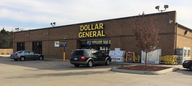

Property Detail
6858 Lascassas Pike
061-029.05-000
Rutherford
Storebuilding
Tennessee
B and X Area of moderate flood hazard, usually the area between the limits of the 100-year and 500-year floods.
5.67 AC
2025
Rutherford County
2025
Nashville
040502
Nashville-Davidson--Murfreesboro--Franklin, TN
11,533 SF
NEARBY LISTINGS FOR SALE OR LEASE
-
-
View all Lascassas listings for sale on LoopNet.com
DEMOGRAPHICS near 6858 Lascassas Pike
1 mile
3 mile
5 mile
2025 Total Population
866
4,685
12,463
2030 Population
949
5,135
13,570
Pop Growth 2025-2030
+ 9.58%
+ 9.61%
+ 8.88%
Average Age
39
39
40
2025 Total Households
301
1,623
4,398
HH Growth 2025-2030
+ 9.63%
+ 9.74%
+ 9.03%
Median Household Inc
$114,705
$112,577
$102,817
Avg Household Size
2.90
2.90
2.80
2025 Avg HH Vehicles
2.00
2.00
2.00
Median Home Value
$485,464
$488,775
$451,475
Median Year Built
2002
2001
1997
Nearby Places
Map Layers
Map Styles
 Street
 Aerial
Layers
 Traffic
 Biking
Places
Listings with unknown addresses are not visible on the map
- Restaurants
- Banks
- Shops
- Fitness
- Groceries
PUBLIC TRANSPORTATION
AIRPORT
Nashville International
Drive
Walk
Distance
Nashville International
50 min
29.6 mi
Freight Ports
Port of Mobile
Drive
Walk
Distance
Port of Mobile
506 min
459.2 mi
Nearby Properties
Address
Land Use
TOTAL SIZE
Lot Size
Zoning
Address
Land Use
TOTAL SIZE
Lot Size
Zoning
102,400 SF
26.65 AC
Address
Land Use
TOTAL SIZE
Lot Size
Zoning
27,415 SF
3.23 AC
Address
Land Use
TOTAL SIZE
Lot Size
Zoning
11,964 SF
0.52 AC
Address
Land Use
TOTAL SIZE
Lot Size
Zoning
45,854 SF
5 AC
Address
Land Use
TOTAL SIZE
Lot Size
Zoning
3,300 SF
5 AC
Address
Land Use
TOTAL SIZE
Lot Size
Zoning
7,058 SF
1.66 AC
Address
Land Use
TOTAL SIZE
Lot Size
Zoning
5,314 SF
0.70 AC
Address
Land Use
TOTAL SIZE
Lot Size
Zoning
5,144 SF
1.30 AC
Address
Land Use
TOTAL SIZE
Lot Size
Zoning
10,500 SF
7.19 AC
Address
Land Use
TOTAL SIZE
Lot Size
Zoning
23.79 AC
Address
Land Use
TOTAL SIZE
Lot Size
Zoning
5,106 SF
1 AC
Address
Land Use
TOTAL SIZE
Lot Size
Zoning
9.30 AC
Address
Land Use
TOTAL SIZE
Lot Size
Zoning
8.35 AC
Address
Land Use
TOTAL SIZE
Lot Size
Zoning
Address
Land Use
TOTAL SIZE
Lot Size
Zoning
7.07 AC
Address
Land Use
TOTAL SIZE
Lot Size
Zoning
Address
Land Use
TOTAL SIZE
Lot Size
Zoning
Address
Land Use
TOTAL SIZE
Lot Size
Zoning
5.01 AC
Address
Land Use
TOTAL SIZE
Lot Size
Zoning
5.01 AC
Address
Land Use
TOTAL SIZE
Lot Size
Zoning
14.50 AC
Address
Land Use
TOTAL SIZE
Lot Size
Zoning
4,360 SF
1.59 AC
Address
Land Use
TOTAL SIZE
Lot Size
Zoning
2,520 SF
0.55 AC
Address
Land Use
TOTAL SIZE
Lot Size
Zoning
8.20 AC
Address
Land Use
TOTAL SIZE
Lot Size
Zoning
2,080 SF
5.70 AC
Address
Land Use
TOTAL SIZE
Lot Size
Zoning
6.53 AC
Address
Land Use
TOTAL SIZE
Lot Size
Zoning
8.08 AC
Address
Land Use
TOTAL SIZE
Lot Size
Zoning
12.99 AC
Address
Land Use
TOTAL SIZE
Lot Size
Zoning
4,876 SF
2.90 AC
Address
Land Use
TOTAL SIZE
Lot Size
Zoning
2,000 SF
3.40 AC
The World's #1 Commercial Real Estate Marketplace
Connect with us
© 2026 CoStar Group
The information above has been obtained from sources believed reliable. While we do not doubt its accuracy we have not verified it and make no guarantee, warranty or representation about it. It is your responsibility to independently confirm its accuracy and completeness. Any projections, opinions, assumptions, or estimates used are for example only and do not represent the current or future performance of the property. The value of this transaction to you depends on tax and other factors which should be evaluated by your tax, financial, and legal advisors. You and your advisors should conduct a careful, independent investigation of the property to determine to your satisfaction the suitability of the property for your needs.