Property Record
686 Gholson Ave, Cincinnati, OH 45229
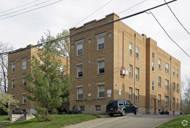

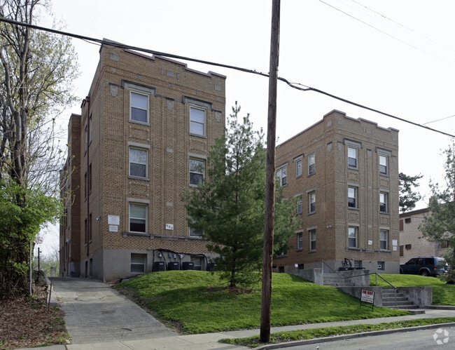
Property Detail
686 Gholson Ave
112-0004-0031
686 GHOLSON AVE 100 X 230.31 LOT 6 ROBT ANDREWS SUB
Apartment
Hamilton
RM20
Ohio
B and X Area of moderate flood hazard, usually the area between the limits of the 100-year and 500-year floods.
6
2025
0.56 AC
2025
North Avondale
006800
Cincinnati/Dayton
20,232 SF
Cincinnati, OH-KY-IN
NEARBY LISTINGS FOR SALE OR LEASE
DEMOGRAPHICS near 686 Gholson Ave
1 mile
3 mile
5 mile
2025 Total Population
20,165
149,473
327,787
2030 Population
20,846
152,625
334,778
Pop Growth 2025-2030
+ 3.38%
+ 2.11%
+ 2.13%
Average Age
37
36
37
2025 Total Households
8,132
65,573
148,456
HH Growth 2025-2030
+ 3.63%
+ 2.21%
+ 2.24%
Median Household Inc
$33,818
$54,873
$58,672
Avg Household Size
2.10
2.00
2.00
2025 Avg HH Vehicles
1.00
1.00
1.00
Median Home Value
$284,794
$281,704
$272,989
Median Year Built
1949
1948
1949
Nearby Places
Map Layers
Map Styles
 Street
 Aerial
Layers
 Traffic
 Biking
Places
Listings with unknown addresses are not visible on the map
- Restaurants
- Banks
- Shops
- Fitness
- Groceries
PUBLIC TRANSPORTATION
COMMUTER RAIL
Drive
Walk
Distance
13 min
6.2 mi
AIRPORT
Cincinnati/Northern Kentucky International
Drive
Walk
Distance
Cincinnati/Northern Kentucky International
30 min
16.4 mi
Nearby Properties
Address
Land Use
TOTAL SIZE
Lot Size
Zoning
Address
Land Use
TOTAL SIZE
Lot Size
Zoning
77.73 AC
IR
Address
Land Use
TOTAL SIZE
Lot Size
Zoning
6.35 AC
IR
Address
Land Use
TOTAL SIZE
Lot Size
Zoning
19.36 AC
Address
Land Use
TOTAL SIZE
Lot Size
Zoning
62.10 AC
Address
Land Use
TOTAL SIZE
Lot Size
Zoning
11.41 AC
IR
Address
Land Use
TOTAL SIZE
Lot Size
Zoning
22.45 AC
Address
Land Use
TOTAL SIZE
Lot Size
Zoning
13.80 AC
Address
Land Use
TOTAL SIZE
Lot Size
Zoning
3.09 AC
Address
Land Use
TOTAL SIZE
Lot Size
Zoning
2.80 AC
IR
Address
Land Use
TOTAL SIZE
Lot Size
Zoning
3.40 AC
IR
Address
Land Use
TOTAL SIZE
Lot Size
Zoning
Address
Land Use
TOTAL SIZE
Lot Size
Zoning
Address
Land Use
TOTAL SIZE
Lot Size
Zoning
27.30 AC
M2
Address
Land Use
TOTAL SIZE
Lot Size
Zoning
11.68 AC
Address
Land Use
TOTAL SIZE
Lot Size
Zoning
7.14 AC
Address
Land Use
TOTAL SIZE
Lot Size
Zoning
26,453 SF
19.91 AC
M2
Address
Land Use
TOTAL SIZE
Lot Size
Zoning
13.32 AC
Address
Land Use
TOTAL SIZE
Lot Size
Zoning
16.67 AC
IR
Address
Land Use
TOTAL SIZE
Lot Size
Zoning
3.17 AC
R2PUD
Address
Land Use
TOTAL SIZE
Lot Size
Zoning
10.76 AC
Address
Land Use
TOTAL SIZE
Lot Size
Zoning
3,184 SF
2.34 AC
IR
Address
Land Use
TOTAL SIZE
Lot Size
Zoning
Address
Land Use
TOTAL SIZE
Lot Size
Zoning
Address
Land Use
TOTAL SIZE
Lot Size
Zoning
2.97 AC
IR
Address
Land Use
TOTAL SIZE
Lot Size
Zoning
29.60 AC
IR
Address
Land Use
TOTAL SIZE
Lot Size
Zoning
11.36 AC
IR
Address
Land Use
TOTAL SIZE
Lot Size
Zoning
0.37 AC
IR
Address
Land Use
TOTAL SIZE
Lot Size
Zoning
Address
Land Use
TOTAL SIZE
Lot Size
Zoning
Address
Land Use
TOTAL SIZE
Lot Size
Zoning
2,916 SF
27.68 AC
The World's #1 Commercial Real Estate Marketplace
Connect with us
© 2026 CoStar Group
The information above has been obtained from sources believed reliable. While we do not doubt its accuracy we have not verified it and make no guarantee, warranty or representation about it. It is your responsibility to independently confirm its accuracy and completeness. Any projections, opinions, assumptions, or estimates used are for example only and do not represent the current or future performance of the property. The value of this transaction to you depends on tax and other factors which should be evaluated by your tax, financial, and legal advisors. You and your advisors should conduct a careful, independent investigation of the property to determine to your satisfaction the suitability of the property for your needs.