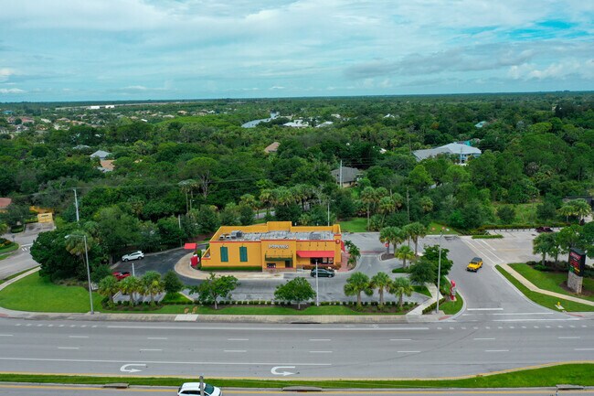
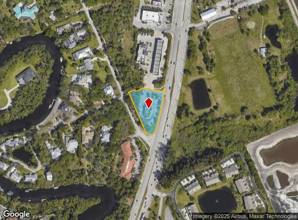
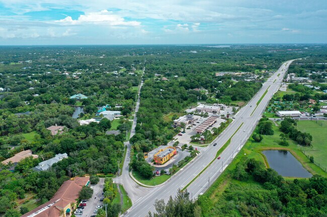
Property Record
6860 S Kanner Hwy, Stuart, FL 34997
NEARBY LISTINGS FOR SALE OR LEASE
Property Detail
6860 S Kanner Hwy
Port St Lucie, FL
Kanner Business Park
55-38-41-431-000-00010-0
LOT 1 KANNER BUSINESS PARK ACCORDING TO THE PLAT THEREOF RECORDED IN PLAT BOOK 17 PAGE 29 PUBLIC RECORDS MARTIN COUNTY FLORIDA (UNITY OF TITLE 2924/2127)
Restaurantdrivein
Martin
X
Florida
12085C0282H
1
2024
1.20 AC
2025
Martin
001103
Port St Lucie/Fort Pierce
3,161 SF
DEMOGRAPHICS near 6860 S Kanner Hwy
1 Mile
3 Mile
5 Mile
2024 Total Population
2,657
25,851
75,417
2029 Population
2,763
26,819
79,092
Pop Growth 2024-2029
+ 3.99%
+ 3.74%
+ 4.87%
Average Age
49
47
48
2024 Total Households
1,120
10,654
32,299
HH Growth 2024-2029
+ 3.66%
+ 3.76%
+ 4.96%
Median Household Inc
$91,042
$72,720
$64,473
Avg Household Size
2.30
2.30
2.20
2024 Avg HH Vehicles
2.00
2.00
2.00
Median Home Value
$413,115
$355,038
$318,047
Median Year Built
1990
1989
1987
Nearby Places
Map Layers
Map Styles
 Street
 Aerial
- Restaurants
- Banks
- Shops
- Fitness
- Groceries
PUBLIC TRANSPORTATION
AIRPORT
Palm Beach International
DRIVE
WALK
Distance
Palm Beach International
46 min
36.5 mi
SALE & LEASE HISTORY
LISTING DATE
SALE/LEASE

Aug 26, 2021
For Sale
Aug 13, 2021
For Sale
Nearby Properties
Address
Land Use
TOTAL SIZE
Lot Size
Zoning
Address
Land Use
TOTAL SIZE
Lot Size
Zoning
232,042 SF
30.99 AC
PUDR
Address
Land Use
TOTAL SIZE
Lot Size
Zoning
13.62 AC
R2
Address
Land Use
TOTAL SIZE
Lot Size
Zoning
118,989 SF
12.43 AC
PUDC
Address
Land Use
TOTAL SIZE
Lot Size
Zoning
15.79 AC
Address
Land Use
TOTAL SIZE
Lot Size
Zoning
85,872 SF
7.91 AC
CPUD
Address
Land Use
TOTAL SIZE
Lot Size
Zoning
126,304 SF
36 AC
R2
Address
Land Use
TOTAL SIZE
Lot Size
Zoning
182,982 SF
28.90 AC
PUDR
Address
Land Use
TOTAL SIZE
Lot Size
Zoning
48,450 SF
7.94 AC
Address
Land Use
TOTAL SIZE
Lot Size
Zoning
106,105 SF
7.41 AC
PUDR
Address
Land Use
TOTAL SIZE
Lot Size
Zoning
102,843 SF
9.03 AC
Address
Land Use
TOTAL SIZE
Lot Size
Zoning
39,801 SF
8.50 AC
LI
Address
Land Use
TOTAL SIZE
Lot Size
Zoning
56,281 SF
28.86 AC
LI
Address
Land Use
TOTAL SIZE
Lot Size
Zoning
50,773 SF
9.40 AC
COR2
Address
Land Use
TOTAL SIZE
Lot Size
Zoning
69,133 SF
6 AC
PUDC
Address
Land Use
TOTAL SIZE
Lot Size
Zoning
63,133 SF
19.65 AC
A1
Address
Land Use
TOTAL SIZE
Lot Size
Zoning
60,542 SF
4.67 AC
Address
Land Use
TOTAL SIZE
Lot Size
Zoning
97,783 SF
6.34 AC
LI
Address
Land Use
TOTAL SIZE
Lot Size
Zoning
63,552 SF
17.36 AC
GC
Address
Land Use
TOTAL SIZE
Lot Size
Zoning
63,874 SF
4.39 AC
PUDC
Address
Land Use
TOTAL SIZE
Lot Size
Zoning
190,638 SF
147 AC
A1
Address
Land Use
TOTAL SIZE
Lot Size
Zoning
35,488 SF
9.10 AC
PS1
Address
Land Use
TOTAL SIZE
Lot Size
Zoning
8,630 SF
24.45 AC
PUDC
Address
Land Use
TOTAL SIZE
Lot Size
Zoning
125,339 SF
23.95 AC
PUDR
Address
Land Use
TOTAL SIZE
Lot Size
Zoning
91,356 SF
7.74 AC
PUDC
Address
Land Use
TOTAL SIZE
Lot Size
Zoning
5.52 AC
LI
Address
Land Use
TOTAL SIZE
Lot Size
Zoning
44,712 SF
15.18 AC
PS2
Address
Land Use
TOTAL SIZE
Lot Size
Zoning
47,906 SF
28.52 AC
RE2A
Address
Land Use
TOTAL SIZE
Lot Size
Zoning
39,555 SF
2.47 AC
PUDC
Address
Land Use
TOTAL SIZE
Lot Size
Zoning
54,508 SF
10.97 AC
A1A
Address
Land Use
TOTAL SIZE
Lot Size
Zoning
45,124 SF
5.81 AC
PUDR
The World's #1 Commercial Real Estate Marketplace
Connect with us
© 2025 CoStar Group
The information above has been obtained from sources believed reliable. While we do not doubt its accuracy we have not verified it and make no guarantee, warranty or representation about it. It is your responsibility to independently confirm its accuracy and completeness. Any projections, opinions, assumptions, or estimates used are for example only and do not represent the current or future performance of the property. The value of this transaction to you depends on tax and other factors which should be evaluated by your tax, financial, and legal advisors. You and your advisors should conduct a careful, independent investigation of the property to determine to your satisfaction the suitability of the property for your needs.