Property Record
6865 Wellington Rd, Manassas, VA 20109


NEARBY LISTINGS FOR SALE OR LEASE
Property Detail
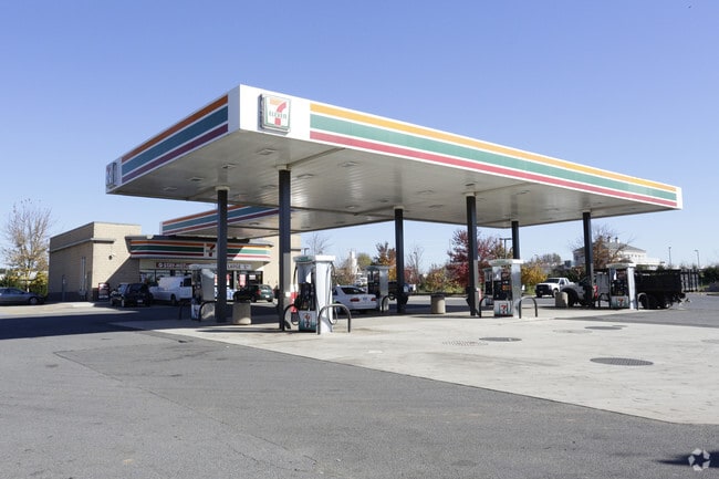
6865 Wellington Rd
Washington, DC
Div Of Prop Guy H Lewis Iii Tr
Washington-Arlington-Alexandria, DC-VA-MD-WV
DIV OF PROP GUY H LEWIS III TR PCL A
7496-99-8770
Prince William
Servicestationmarket
Virginia
2024
9071
2025
1.89 AC
901409
Route 29/I-66 Corridor
3,000 SF
DEMOGRAPHICS near 6865 Wellington Rd
1 Mile
3 Mile
5 Mile
2024 Total Population
1,604
58,870
138,944
2029 Population
1,643
60,459
142,122
Pop Growth 2024-2029
+ 2.43%
+ 2.70%
+ 2.29%
Average Age
35
36
36
2024 Total Households
418
19,434
43,933
HH Growth 2024-2029
+ 2.39%
+ 2.79%
+ 2.37%
Median Household Inc
$198,234
$119,588
$120,470
Avg Household Size
3.60
3.00
3.10
2024 Avg HH Vehicles
2.00
2.00
2.00
Median Home Value
$607,438
$484,039
$481,848
Median Year Built
2004
2000
1999
Nearby Places
Map Layers
Map Styles
 Street
 Aerial
- Restaurants
- Banks
- Shops
- Fitness
- Groceries
PUBLIC TRANSPORTATION
COMMUTER RAIL
Broad Run/Airport (Manassas Line - Virginia Railway Express)
DRIVE
WALK
Distance
Broad Run/Airport (Manassas Line - Virginia Railway Express)
13 min
6.0 mi
Manassas (Manassas Line - Virginia Railway Express)
DRIVE
WALK
Distance
Manassas (Manassas Line - Virginia Railway Express)
14 min
6.2 mi
AIRPORT
Washington Dulles International
DRIVE
WALK
Distance
Washington Dulles International
34 min
20.3 mi
Ronald Reagan Washington Ntl
DRIVE
WALK
Distance
Ronald Reagan Washington Ntl
48 min
34.9 mi
Nearby Properties
Address
Land Use
TOTAL SIZE
Lot Size
Zoning
Address
Land Use
TOTAL SIZE
Lot Size
Zoning
181.29 AC
M1
Address
Land Use
TOTAL SIZE
Lot Size
Zoning
117.22 AC
M1
Address
Land Use
TOTAL SIZE
Lot Size
Zoning
824,085 SF
120.07 AC
MIXED
Address
Land Use
TOTAL SIZE
Lot Size
Zoning
112.48 AC
M2
Address
Land Use
TOTAL SIZE
Lot Size
Zoning
350,906 SF
83.51 AC
M1
Address
Land Use
TOTAL SIZE
Lot Size
Zoning
67.20 AC
M2
Address
Land Use
TOTAL SIZE
Lot Size
Zoning
58.30 AC
M1
Address
Land Use
TOTAL SIZE
Lot Size
Zoning
40.47 AC
PBD
Address
Land Use
TOTAL SIZE
Lot Size
Zoning
52.69 AC
M2
Address
Land Use
TOTAL SIZE
Lot Size
Zoning
395,617 SF
19.08 AC
PMD
Address
Land Use
TOTAL SIZE
Lot Size
Zoning
75,816 SF
29.15 AC
R16
Address
Land Use
TOTAL SIZE
Lot Size
Zoning
29,500 SF
21.97 AC
M1
Address
Land Use
TOTAL SIZE
Lot Size
Zoning
380,264 SF
15.25 AC
PMD
Address
Land Use
TOTAL SIZE
Lot Size
Zoning
240,103 SF
19.93 AC
R16
Address
Land Use
TOTAL SIZE
Lot Size
Zoning
161.28 AC
PBD
Address
Land Use
TOTAL SIZE
Lot Size
Zoning
119.30 AC
M2
Address
Land Use
TOTAL SIZE
Lot Size
Zoning
34.66 AC
PBD
Address
Land Use
TOTAL SIZE
Lot Size
Zoning
298,474 SF
11.60 AC
PMR
Address
Land Use
TOTAL SIZE
Lot Size
Zoning
371,926 SF
38.17 AC
B1
Address
Land Use
TOTAL SIZE
Lot Size
Zoning
111,222 SF
15.75 AC
R16
Address
Land Use
TOTAL SIZE
Lot Size
Zoning
267,292 SF
13.66 AC
R16
Address
Land Use
TOTAL SIZE
Lot Size
Zoning
28.58 AC
M1
Address
Land Use
TOTAL SIZE
Lot Size
Zoning
28.38 AC
PBD
Address
Land Use
TOTAL SIZE
Lot Size
Zoning
28.35 AC
PMD
Address
Land Use
TOTAL SIZE
Lot Size
Zoning
420,634 SF
29.54 AC
M1
Address
Land Use
TOTAL SIZE
Lot Size
Zoning
30.92 AC
PMD
Address
Land Use
TOTAL SIZE
Lot Size
Zoning
414,766 SF
14.93 AC
PBD
Address
Land Use
TOTAL SIZE
Lot Size
Zoning
49.76 AC
PBD
Address
Land Use
TOTAL SIZE
Lot Size
Zoning
82,216 SF
76.98 AC
M1
Address
Land Use
TOTAL SIZE
Lot Size
Zoning
85.01 AC
M2
The World's #1 Commercial Real Estate Marketplace
Connect with us
© 2026 CoStar Group
The information above has been obtained from sources believed reliable. While we do not doubt its accuracy we have not verified it and make no guarantee, warranty or representation about it. It is your responsibility to independently confirm its accuracy and completeness. Any projections, opinions, assumptions, or estimates used are for example only and do not represent the current or future performance of the property. The value of this transaction to you depends on tax and other factors which should be evaluated by your tax, financial, and legal advisors. You and your advisors should conduct a careful, independent investigation of the property to determine to your satisfaction the suitability of the property for your needs.