Property Record
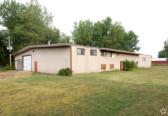
6867 20Th Ave, Hugo, MN 55038


Property Detail
6867 20Th Ave
23-31-22-44-0004
THE E 726 FT OF S 330 FT OF N 660 FT OF SE1/4 OF SE1/4 OFSEC 23 TWP 31 RGE 22, EX RD SUBJ TO EASE OF REC
Commercialnec
ANOKA
AE The base floodplain where base flood elevations are provided. AE Zones are now used on new format FIRMs instead of A1-A30 Zones.
Minnesota
2026
5.50 AC
2026
North Central
050232
Minneapolis/St Paul
10,380 SF
Minneapolis-St. Paul-Bloomington, MN-WI
NEARBY LISTINGS FOR SALE OR LEASE
DEMOGRAPHICS near 6867 20Th Ave
1 mile
3 mile
5 mile
2025 Total Population
4,536
26,648
60,904
2030 Population
4,725
27,972
62,711
Pop Growth 2025-2030
+ 4.17%
+ 4.97%
+ 2.97%
Average Age
39
40
42
2025 Total Households
1,548
9,777
22,309
HH Growth 2025-2030
+ 4.07%
+ 5.08%
+ 2.99%
Median Household Inc
$140,552
$127,979
$120,012
Avg Household Size
2.90
2.70
2.60
2025 Avg HH Vehicles
3.00
2.00
2.00
Median Home Value
$441,687
$437,680
$408,242
Median Year Built
1997
2001
1993
Nearby Places
Map Layers
Map Styles
 Street
 Aerial
Layers
 Traffic
 Biking
Places
Listings with unknown addresses are not visible on the map
- Restaurants
- Banks
- Shops
- Fitness
- Groceries
PUBLIC TRANSPORTATION
AIRPORT
Minneapolis-St Paul International/Wold-Chamberlain
Drive
Walk
Distance
Minneapolis-St Paul International/Wold-Chamberlain
38 min
25.0 mi
SALE & LEASE HISTORY
LISTING DATE
SALE/LEASE

Sep 24, 2016
For Sale
Nearby Properties
Address
Land Use
TOTAL SIZE
Lot Size
Zoning
Address
Land Use
TOTAL SIZE
Lot Size
Zoning
175,536 SF
7.60 AC
Address
Land Use
TOTAL SIZE
Lot Size
Zoning
402,000 SF
27.86 AC
Address
Land Use
TOTAL SIZE
Lot Size
Zoning
141,360 SF
Address
Land Use
TOTAL SIZE
Lot Size
Zoning
78,920 SF
7.50 AC
Address
Land Use
TOTAL SIZE
Lot Size
Zoning
Address
Land Use
TOTAL SIZE
Lot Size
Zoning
99,207 SF
5 AC
Address
Land Use
TOTAL SIZE
Lot Size
Zoning
100,794 SF
Address
Land Use
TOTAL SIZE
Lot Size
Zoning
Address
Land Use
TOTAL SIZE
Lot Size
Zoning
57,522 SF
8.63 AC
Address
Land Use
TOTAL SIZE
Lot Size
Zoning
136,800 SF
Address
Land Use
TOTAL SIZE
Lot Size
Zoning
65,950 SF
9.68 AC
Address
Land Use
TOTAL SIZE
Lot Size
Zoning
130,104 SF
3.35 AC
Address
Land Use
TOTAL SIZE
Lot Size
Zoning
163,329 SF
11.36 AC
Address
Land Use
TOTAL SIZE
Lot Size
Zoning
1,920 SF
42.80 AC
Address
Land Use
TOTAL SIZE
Lot Size
Zoning
86,423 SF
0.82 AC
Address
Land Use
TOTAL SIZE
Lot Size
Zoning
40,036 SF
18.45 AC
Address
Land Use
TOTAL SIZE
Lot Size
Zoning
128,364 SF
19.10 AC
Address
Land Use
TOTAL SIZE
Lot Size
Zoning
137,960 SF
20 AC
Address
Land Use
TOTAL SIZE
Lot Size
Zoning
145,704 SF
7.05 AC
Address
Land Use
TOTAL SIZE
Lot Size
Zoning
60,939 SF
Address
Land Use
TOTAL SIZE
Lot Size
Zoning
Address
Land Use
TOTAL SIZE
Lot Size
Zoning
55,000 SF
Address
Land Use
TOTAL SIZE
Lot Size
Zoning
1 SF
4.40 AC
Address
Land Use
TOTAL SIZE
Lot Size
Zoning
100,383 SF
5.75 AC
Address
Land Use
TOTAL SIZE
Lot Size
Zoning
202,000 SF
11.43 AC
Address
Land Use
TOTAL SIZE
Lot Size
Zoning
20,904 SF
12.50 AC
Address
Land Use
TOTAL SIZE
Lot Size
Zoning
93,800 SF
13.10 AC
Address
Land Use
TOTAL SIZE
Lot Size
Zoning
83,351 SF
Address
Land Use
TOTAL SIZE
Lot Size
Zoning
111.73 AC
Address
Land Use
TOTAL SIZE
Lot Size
Zoning
63,100 SF
3.90 AC
The World's #1 Commercial Real Estate Marketplace
Connect with us
© 2026 CoStar Group
The information above has been obtained from sources believed reliable. While we do not doubt its accuracy we have not verified it and make no guarantee, warranty or representation about it. It is your responsibility to independently confirm its accuracy and completeness. Any projections, opinions, assumptions, or estimates used are for example only and do not represent the current or future performance of the property. The value of this transaction to you depends on tax and other factors which should be evaluated by your tax, financial, and legal advisors. You and your advisors should conduct a careful, independent investigation of the property to determine to your satisfaction the suitability of the property for your needs.