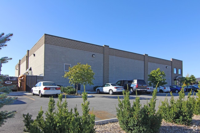
Property Record
6869 S Navigator Dr, West Jordan, UT 84084

NEARBY LISTINGS FOR SALE OR LEASE
Property Detail
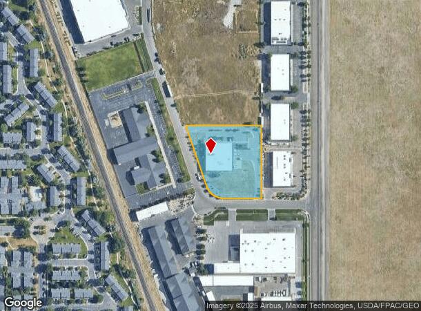
6869 S Navigator Dr
Salt Lake City, UT
Sortech South Subdivision
21-19-355-002-0000
LOT 19, SORTECH SOUTH SUBDIVISION. 9309-9305 9913-1874 9950-3302
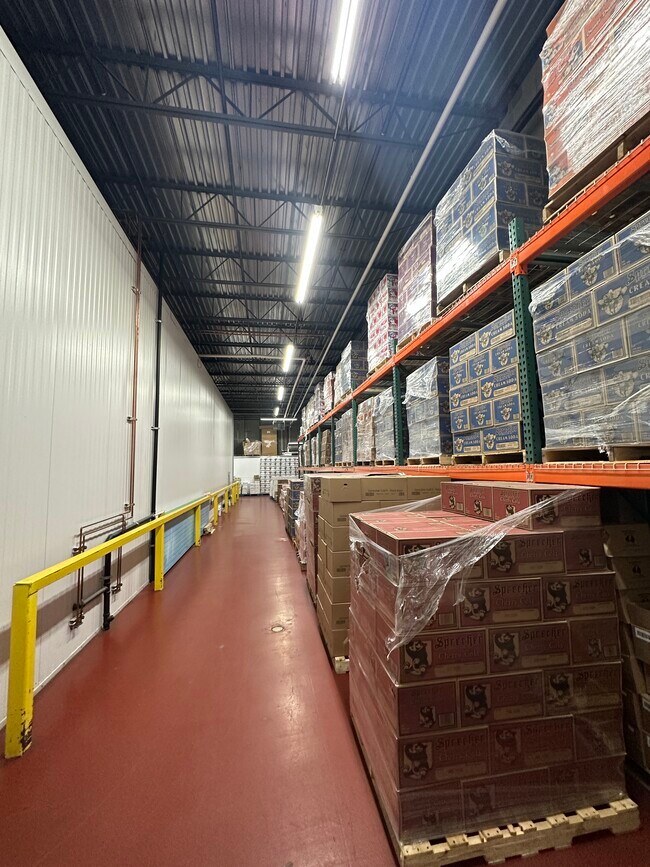
Lightindustrial
Salt Lake
X
Utah
49035C0275G
19
2024
1.93 AC
2025
West Murray
980100
Salt Lake City
17,640 SF
DEMOGRAPHICS near 6869 S Navigator Dr
1 Mile
3 Mile
5 Mile
2024 Total Population
16,838
151,438
323,509
2029 Population
17,150
153,730
328,362
Pop Growth 2024-2029
+ 1.85%
+ 1.51%
+ 1.50%
Average Age
34
35
36
2024 Total Households
5,172
43,480
96,481
HH Growth 2024-2029
+ 1.76%
+ 1.43%
+ 1.45%
Median Household Inc
$81,533
$87,225
$87,203
Avg Household Size
3.20
3.40
3.30
2024 Avg HH Vehicles
2.00
2.00
2.00
Median Home Value
$350,367
$375,199
$394,202
Median Year Built
1994
1990
1990
Nearby Places
Map Layers
Map Styles
 Street
 Aerial
- Restaurants
- Banks
- Shops
- Fitness
- Groceries
PUBLIC TRANSPORTATION
COMMUTER RAIL
South Jordan Station (FrontRunner - Utah Transit Authority (UTA))
DRIVE
WALK
Distance
South Jordan Station (FrontRunner - Utah Transit Authority (UTA))
18 min
10.0 mi
AIRPORT
Salt Lake City International
DRIVE
WALK
Distance
Salt Lake City International
21 min
12.6 mi
Freight Ports
Port of Stockton
DRIVE
WALK
Distance
Port of Stockton
718 min
695.4 mi
SALE & LEASE HISTORY
LISTING DATE
SALE/LEASE

Mar 07, 2023
For Lease
Aug 18, 2023
For Sale
Nearby Properties
Address
Land Use
TOTAL SIZE
Lot Size
Zoning
Address
Land Use
TOTAL SIZE
Lot Size
Zoning
338,177 SF
21.91 AC
M-1
Address
Land Use
TOTAL SIZE
Lot Size
Zoning
895,175 SF
28.95 AC
SSD-X
Address
Land Use
TOTAL SIZE
Lot Size
Zoning
233,853 SF
6.05 AC
HFR
Address
Land Use
TOTAL SIZE
Lot Size
Zoning
308,722 SF
21.29 AC
M-1
Address
Land Use
TOTAL SIZE
Lot Size
Zoning
187.81 AC
P-F
Address
Land Use
TOTAL SIZE
Lot Size
Zoning
362,000 SF
51.81 AC
P-F
Address
Land Use
TOTAL SIZE
Lot Size
Zoning
308,722 SF
20.45 AC
M-1
Address
Land Use
TOTAL SIZE
Lot Size
Zoning
256,167 SF
13.56 AC
P-C
Address
Land Use
TOTAL SIZE
Lot Size
Zoning
410,435 SF
2.43 AC
P-C
Address
Land Use
TOTAL SIZE
Lot Size
Zoning
188,632 SF
12.11 AC
PC
Address
Land Use
TOTAL SIZE
Lot Size
Zoning
77,525 SF
2.35 AC
P-C
Address
Land Use
TOTAL SIZE
Lot Size
Zoning
114.79 AC
PF
Address
Land Use
TOTAL SIZE
Lot Size
Zoning
143,314 SF
2.30 AC
P-C
Address
Land Use
TOTAL SIZE
Lot Size
Zoning
28,515 SF
6.77 AC
PC
Address
Land Use
TOTAL SIZE
Lot Size
Zoning
187,717 SF
15.02 AC
R-M
Address
Land Use
TOTAL SIZE
Lot Size
Zoning
536,706 SF
12.80 AC
SC-2
Address
Land Use
TOTAL SIZE
Lot Size
Zoning
40,042 SF
15.43 AC
R-3-16
Address
Land Use
TOTAL SIZE
Lot Size
Zoning
203,064 SF
5.91 AC
PC
Address
Land Use
TOTAL SIZE
Lot Size
Zoning
836,998 SF
14.25 AC
SC-2
Address
Land Use
TOTAL SIZE
Lot Size
Zoning
250,027 SF
8.46 AC
PF
Address
Land Use
TOTAL SIZE
Lot Size
Zoning
186,337 SF
20 AC
1107
Address
Land Use
TOTAL SIZE
Lot Size
Zoning
268,200 SF
44.38 AC
PF
Address
Land Use
TOTAL SIZE
Lot Size
Zoning
411,226 SF
7.22 AC
SC-2
Address
Land Use
TOTAL SIZE
Lot Size
Zoning
314,994 SF
10 AC
R-3
Address
Land Use
TOTAL SIZE
Lot Size
Zoning
80 AC
PF
Address
Land Use
TOTAL SIZE
Lot Size
Zoning
72 AC
2000
Address
Land Use
TOTAL SIZE
Lot Size
Zoning
90,676 SF
16.65 AC
P-C
Address
Land Use
TOTAL SIZE
Lot Size
Zoning
68.49 AC
PF
Address
Land Use
TOTAL SIZE
Lot Size
Zoning
71,093 SF
29.58 AC
PF
Address
Land Use
TOTAL SIZE
Lot Size
Zoning
135,356 SF
0.01 AC
PF
The World's #1 Commercial Real Estate Marketplace
Connect with us
© 2025 CoStar Group
The information above has been obtained from sources believed reliable. While we do not doubt its accuracy we have not verified it and make no guarantee, warranty or representation about it. It is your responsibility to independently confirm its accuracy and completeness. Any projections, opinions, assumptions, or estimates used are for example only and do not represent the current or future performance of the property. The value of this transaction to you depends on tax and other factors which should be evaluated by your tax, financial, and legal advisors. You and your advisors should conduct a careful, independent investigation of the property to determine to your satisfaction the suitability of the property for your needs.