Property Record
6870 S Highway 95, Mohave Valley, AZ 86440


NEARBY LISTINGS FOR SALE OR LEASE
-
-
View all Mohave Valley listings for sale on LoopNet.com
Property Detail
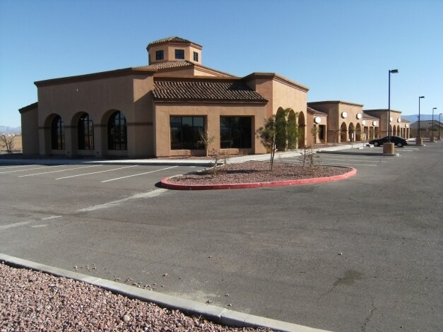
6870 S Highway 95
225-66-163B
El Rio Country Club
Departmentstore
T.18N., R22W., SEC. 11 EL RIO COUNTRY CLUB TRACT 4177A PORTION O F PARCEL F SHOWN AS PARCEL B ON PP 035/009-009A RECORDED 6/23/201 5 FEE #2015027921 CONT. 47,654 SQ FT / 1.094 AC 225-66-163 (225-6 6-163A,B & C) 2016 TAX ROLL
X
Mohave
04015C5075K
Arizona
0
1.09 AC
2026
Prescott & Sedona
940501
Other Market Areas
15,300 SF
Lake Havasu City-Kingman, AZ
DEMOGRAPHICS near 6870 S Highway 95
1 Mile
3 Mile
5 Mile
2024 Total Population
369
10,442
18,591
2029 Population
416
11,588
20,492
Pop Growth 2024-2029
+ 12.74%
+ 10.97%
+ 10.23%
Average Age
51
50
49
2024 Total Households
159
4,528
7,926
HH Growth 2024-2029
+ 13.21%
+ 11.90%
+ 11.06%
Median Household Inc
$54,318
$60,167
$51,814
Avg Household Size
2.30
2.30
2.30
2024 Avg HH Vehicles
2.00
2.00
2.00
Median Home Value
$245,370
$250,710
$241,134
Median Year Built
2003
2000
1997
Nearby Places
Map Layers
Map Styles
 Street
 Aerial
- Restaurants
- Banks
- Shops
- Fitness
- Groceries
PUBLIC TRANSPORTATION
COMMUTER RAIL
Needles Amtrak (Southwest Chief - Amtrak)
DRIVE
WALK
Distance
Needles Amtrak (Southwest Chief - Amtrak)
15 min
8.9 mi
AIRPORT
Laughlin/Bullhead International
DRIVE
WALK
Distance
Laughlin/Bullhead International
31 min
17.7 mi
Freight Ports
Port of San Diego
DRIVE
WALK
Distance
Port of San Diego
368 min
328.1 mi
Nearby Properties
Address
Land Use
TOTAL SIZE
Lot Size
Zoning
Address
Land Use
TOTAL SIZE
Lot Size
Zoning
56,863 SF
15.46 AC
Address
Land Use
TOTAL SIZE
Lot Size
Zoning
198,240 SF
18.79 AC
Address
Land Use
TOTAL SIZE
Lot Size
Zoning
24,425 SF
5.21 AC
Address
Land Use
TOTAL SIZE
Lot Size
Zoning
17,981 SF
6.25 AC
Address
Land Use
TOTAL SIZE
Lot Size
Zoning
36,278 SF
9.36 AC
Address
Land Use
TOTAL SIZE
Lot Size
Zoning
13,880 SF
0.87 AC
Address
Land Use
TOTAL SIZE
Lot Size
Zoning
41,250 SF
2.19 AC
Address
Land Use
TOTAL SIZE
Lot Size
Zoning
18,081 SF
1.71 AC
Address
Land Use
TOTAL SIZE
Lot Size
Zoning
19,894 SF
66.83 AC
Address
Land Use
TOTAL SIZE
Lot Size
Zoning
8,044 SF
0.99 AC
Address
Land Use
TOTAL SIZE
Lot Size
Zoning
10,527 SF
5 AC
Address
Land Use
TOTAL SIZE
Lot Size
Zoning
1,035 SF
9.20 AC
Address
Land Use
TOTAL SIZE
Lot Size
Zoning
7,939 SF
1.46 AC
Address
Land Use
TOTAL SIZE
Lot Size
Zoning
8,332 SF
1.05 AC
Address
Land Use
TOTAL SIZE
Lot Size
Zoning
8,320 SF
5.19 AC
Address
Land Use
TOTAL SIZE
Lot Size
Zoning
22,300 SF
2.50 AC
Address
Land Use
TOTAL SIZE
Lot Size
Zoning
10,605 SF
1.05 AC
Address
Land Use
TOTAL SIZE
Lot Size
Zoning
10,790 SF
1.59 AC
Address
Land Use
TOTAL SIZE
Lot Size
Zoning
7,957 SF
1.05 AC
Address
Land Use
TOTAL SIZE
Lot Size
Zoning
24.19 AC
Address
Land Use
TOTAL SIZE
Lot Size
Zoning
38,128 SF
2.31 AC
Address
Land Use
TOTAL SIZE
Lot Size
Zoning
32,503 SF
1.33 AC
Address
Land Use
TOTAL SIZE
Lot Size
Zoning
9,068 SF
1.01 AC
Address
Land Use
TOTAL SIZE
Lot Size
Zoning
11,745 SF
0.97 AC
Address
Land Use
TOTAL SIZE
Lot Size
Zoning
5,994 SF
0.44 AC
Address
Land Use
TOTAL SIZE
Lot Size
Zoning
4,800 SF
0.53 AC
Address
Land Use
TOTAL SIZE
Lot Size
Zoning
5,166 SF
0.44 AC
Address
Land Use
TOTAL SIZE
Lot Size
Zoning
15,384 SF
1.48 AC
Address
Land Use
TOTAL SIZE
Lot Size
Zoning
6,000 SF
3.10 AC
The World's #1 Commercial Real Estate Marketplace
Connect with us
© 2026 CoStar Group
The information above has been obtained from sources believed reliable. While we do not doubt its accuracy we have not verified it and make no guarantee, warranty or representation about it. It is your responsibility to independently confirm its accuracy and completeness. Any projections, opinions, assumptions, or estimates used are for example only and do not represent the current or future performance of the property. The value of this transaction to you depends on tax and other factors which should be evaluated by your tax, financial, and legal advisors. You and your advisors should conduct a careful, independent investigation of the property to determine to your satisfaction the suitability of the property for your needs.