Property Record
Highway 87 N, Milton, FL 32570

NEARBY LISTINGS FOR SALE OR LEASE
-
-
View all Milton listings for sale on LoopNet.com
Property Detail
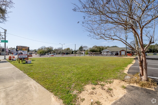
Highway 87 N
Pensacola-Ferry Pass-Brent, FL
Harvest Point Phase I
09-2N-28-0000-00901-0000
*DESCRIPTION UPDATED FOR 2024* COM AT SE CORN OF SECTION 9 TOWNSHP 2 NORTH RANGE 28 WEST S89*4215W ON S SEC LN 1968. 28 FT TO POB & CONT 620.08 FT TO (NEW) E R/W OF HWY 87 THN N 0*1309W ON RD 210.13 FT THN N0*0420W 29.17 FT THN N89*46 50E ON RD 46.86
Commercialacreage
Santa Rosa
X
Florida
12113C0310H
16.66 AC
2024
Avalon Beach/Milton
2025
Pensacola
010505
DEMOGRAPHICS near Highway 87 N
1 mile
3 mile
5 mile
2024 Total Population
2,746
25,604
53,527
2029 Population
3,148
29,409
61,289
Pop Growth 2024-2029
+ 14.64%
+ 14.86%
+ 14.50%
Average Age
42
40
40
2024 Total Households
1,131
9,925
19,560
HH Growth 2024-2029
+ 15.12%
+ 15.23%
+ 15.19%
Median Household Inc
$61,387
$65,340
$71,415
Avg Household Size
2.30
2.50
2.50
2024 Avg HH Vehicles
1.00
2.00
2.00
Median Home Value
$170,542
$202,606
$224,560
Median Year Built
1979
1987
1990
Nearby Places
Map Layers
Map Styles
 Street
 Aerial
Transit
 Traffic
 Biking
Places
Listings with unknown addresses are not visible on the map
- Restaurants
- Banks
- Shops
- Fitness
- Groceries
PUBLIC TRANSPORTATION
AIRPORT
Pensacola International
Drive
Walk
Distance
Pensacola International
42 min
24.2 mi
Freight Ports
Port of Mobile
Drive
Walk
Distance
Port of Mobile
91 min
74.3 mi
SALE & LEASE HISTORY
LISTING DATE
SALE/LEASE

Aug 10, 2018
For Sale
Nearby Properties
Address
Land Use
TOTAL SIZE
Lot Size
Zoning
Address
Land Use
TOTAL SIZE
Lot Size
Zoning
82,994 SF
6 AC
RR1
Address
Land Use
TOTAL SIZE
Lot Size
Zoning
49,540 SF
2.30 AC
HCD
Address
Land Use
TOTAL SIZE
Lot Size
Zoning
22.09 AC
PE
Address
Land Use
TOTAL SIZE
Lot Size
Zoning
48,463 SF
10.64 AC
R3
Address
Land Use
TOTAL SIZE
Lot Size
Zoning
48,242 SF
4.94 AC
HCD
Address
Land Use
TOTAL SIZE
Lot Size
Zoning
20,230 SF
2 AC
R3
Address
Land Use
TOTAL SIZE
Lot Size
Zoning
17,466 SF
10.90 AC
HCD
Address
Land Use
TOTAL SIZE
Lot Size
Zoning
20,354 SF
3.49 AC
HCD
Address
Land Use
TOTAL SIZE
Lot Size
Zoning
15,439 SF
2.80 AC
HCD
Address
Land Use
TOTAL SIZE
Lot Size
Zoning
27,000 SF
5.59 AC
HCD
Address
Land Use
TOTAL SIZE
Lot Size
Zoning
19,547 SF
12.30 AC
HCD
Address
Land Use
TOTAL SIZE
Lot Size
Zoning
16,724 SF
0.95 AC
R3
Address
Land Use
TOTAL SIZE
Lot Size
Zoning
32,230 SF
6.01 AC
HCD
Address
Land Use
TOTAL SIZE
Lot Size
Zoning
21,150 SF
3.20 AC
HCD
Address
Land Use
TOTAL SIZE
Lot Size
Zoning
11,045 SF
1.78 AC
HCD
Address
Land Use
TOTAL SIZE
Lot Size
Zoning
35,930 SF
5.37 AC
R3
Address
Land Use
TOTAL SIZE
Lot Size
Zoning
6,829 SF
58.85 AC
RR1
Address
Land Use
TOTAL SIZE
Lot Size
Zoning
28.71 AC
HCD
Address
Land Use
TOTAL SIZE
Lot Size
Zoning
9,900 SF
2.67 AC
HCD
Address
Land Use
TOTAL SIZE
Lot Size
Zoning
9,911 SF
8.79 AC
HCD
Address
Land Use
TOTAL SIZE
Lot Size
Zoning
12,355 SF
3.75 AC
HCD
Address
Land Use
TOTAL SIZE
Lot Size
Zoning
16,582 SF
5 AC
R3
Address
Land Use
TOTAL SIZE
Lot Size
Zoning
2,400 SF
80 AC
AG-RR
Address
Land Use
TOTAL SIZE
Lot Size
Zoning
11,986 SF
14.16 AC
AG-RR
Address
Land Use
TOTAL SIZE
Lot Size
Zoning
8,894 SF
4.27 AC
HCD
Address
Land Use
TOTAL SIZE
Lot Size
Zoning
28,380 SF
2.38 AC
AG-RR
Address
Land Use
TOTAL SIZE
Lot Size
Zoning
3,148 SF
4.20 AC
HCD
Address
Land Use
TOTAL SIZE
Lot Size
Zoning
10,604 SF
3.70 AC
R2
The World's #1 Commercial Real Estate Marketplace
Connect with us
© 2026 CoStar Group
The information above has been obtained from sources believed reliable. While we do not doubt its accuracy we have not verified it and make no guarantee, warranty or representation about it. It is your responsibility to independently confirm its accuracy and completeness. Any projections, opinions, assumptions, or estimates used are for example only and do not represent the current or future performance of the property. The value of this transaction to you depends on tax and other factors which should be evaluated by your tax, financial, and legal advisors. You and your advisors should conduct a careful, independent investigation of the property to determine to your satisfaction the suitability of the property for your needs.