Property Record
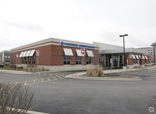
688 Cedar Crossings Dr, New Lenox, IL 60451


NEARBY LISTINGS FOR SALE OR LEASE
Property Detail
688 Cedar Crossings Dr
Chicago-Naperville-Elgin, IL-IN-WI
Century Oaks Crossing
15-08-04-303-004
LOT 1 IN CENTURY OAKS SUB, BEING A RESUB OF LOT 10 IN CEDAR CROSSING PHASE 1 PUD, BEING A SUB OF PRT OF THE S1/2 OF SEC 4, T3
Commercialnec
Will
X
Illinois
17197C0190G
1
2024
1.79 AC
2024
Joliet/Central Will
8811071017
Chicago
DEMOGRAPHICS near 688 Cedar Crossings Dr
1 Mile
3 Mile
5 Mile
2024 Total Population
1,440
30,978
115,092
2029 Population
1,426
30,975
114,831
Pop Growth 2024-2029
(0.97%)
(0.01%)
(0.23%)
Average Age
40
39
39
2024 Total Households
483
10,806
39,779
HH Growth 2024-2029
(1.04%)
(0.02%)
(0.30%)
Median Household Inc
$107,861
$105,333
$92,507
Avg Household Size
2.90
2.80
2.80
2024 Avg HH Vehicles
2.00
2.00
2.00
Median Home Value
$317,112
$315,338
$301,860
Median Year Built
1991
1993
1988
Nearby Places
Map Layers
Map Styles
 Street
 Aerial
- Restaurants
- Banks
- Shops
- Fitness
- Groceries
PUBLIC TRANSPORTATION
COMMUTER RAIL
New Lenox Station (Rock Island District Line - Northeast Illinois Regional Commuter Railroad (Metra))
DRIVE
WALK
Distance
New Lenox Station (Rock Island District Line - Northeast Illinois Regional Commuter Railroad (Metra))
10 min
3.6 mi
Orland Park - 179th Street Station (SouthWest Service - Northeast Illinois Regional Commuter Railroad (Metra))
DRIVE
WALK
Distance
Orland Park - 179th Street Station (SouthWest Service - Northeast Illinois Regional Commuter Railroad (Metra))
9 min
4.8 mi
AIRPORT
Chicago Midway International
DRIVE
WALK
Distance
Chicago Midway International
39 min
29.0 mi
Chicago O'Hare International
DRIVE
WALK
Distance
Chicago O'Hare International
56 min
40.4 mi
Nearby Properties
Address
Land Use
TOTAL SIZE
Lot Size
Zoning
Address
Land Use
TOTAL SIZE
Lot Size
Zoning
Address
Land Use
TOTAL SIZE
Lot Size
Zoning
35.69 AC
Address
Land Use
TOTAL SIZE
Lot Size
Zoning
31.12 AC
Address
Land Use
TOTAL SIZE
Lot Size
Zoning
4.48 AC
Address
Land Use
TOTAL SIZE
Lot Size
Zoning
143.93 AC
Address
Land Use
TOTAL SIZE
Lot Size
Zoning
19.52 AC
Address
Land Use
TOTAL SIZE
Lot Size
Zoning
14,376 SF
234.23 AC
Address
Land Use
TOTAL SIZE
Lot Size
Zoning
Address
Land Use
TOTAL SIZE
Lot Size
Zoning
13.14 AC
Address
Land Use
TOTAL SIZE
Lot Size
Zoning
10.28 AC
Address
Land Use
TOTAL SIZE
Lot Size
Zoning
Address
Land Use
TOTAL SIZE
Lot Size
Zoning
4.51 AC
Address
Land Use
TOTAL SIZE
Lot Size
Zoning
16.31 AC
Address
Land Use
TOTAL SIZE
Lot Size
Zoning
11.57 AC
Address
Land Use
TOTAL SIZE
Lot Size
Zoning
8.79 AC
Address
Land Use
TOTAL SIZE
Lot Size
Zoning
Address
Land Use
TOTAL SIZE
Lot Size
Zoning
568 SF
28.05 AC
Address
Land Use
TOTAL SIZE
Lot Size
Zoning
4.65 AC
Address
Land Use
TOTAL SIZE
Lot Size
Zoning
Address
Land Use
TOTAL SIZE
Lot Size
Zoning
7.69 AC
Address
Land Use
TOTAL SIZE
Lot Size
Zoning
Address
Land Use
TOTAL SIZE
Lot Size
Zoning
3.81 AC
Address
Land Use
TOTAL SIZE
Lot Size
Zoning
Address
Land Use
TOTAL SIZE
Lot Size
Zoning
6.05 AC
Address
Land Use
TOTAL SIZE
Lot Size
Zoning
3.85 AC
Address
Land Use
TOTAL SIZE
Lot Size
Zoning
3.65 AC
Address
Land Use
TOTAL SIZE
Lot Size
Zoning
18.04 AC
Address
Land Use
TOTAL SIZE
Lot Size
Zoning
6,377 SF
5.45 AC
Address
Land Use
TOTAL SIZE
Lot Size
Zoning
3.34 AC
The World's #1 Commercial Real Estate Marketplace
Connect with us
© 2026 CoStar Group
The information above has been obtained from sources believed reliable. While we do not doubt its accuracy we have not verified it and make no guarantee, warranty or representation about it. It is your responsibility to independently confirm its accuracy and completeness. Any projections, opinions, assumptions, or estimates used are for example only and do not represent the current or future performance of the property. The value of this transaction to you depends on tax and other factors which should be evaluated by your tax, financial, and legal advisors. You and your advisors should conduct a careful, independent investigation of the property to determine to your satisfaction the suitability of the property for your needs.