Property Record
6881 E 5Th Pl, Lynden, WA 98264
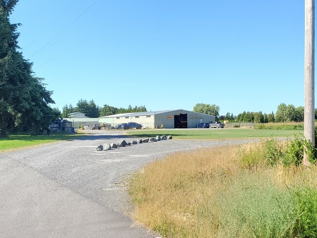
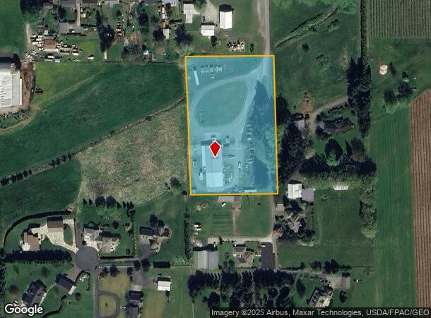
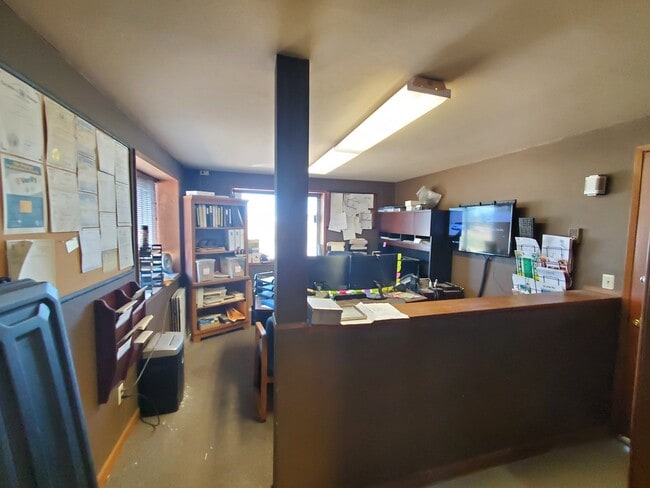
This Property Is For Sale
NEARBY LISTINGS FOR SALE OR LEASE
-
-
View all Lynden listings for sale on LoopNet.com
Property Detail
6881 E 5Th Pl
Bellingham, WA
C N B Short Plat
390308-016476-0000
LOT 2 C N B SHORT PLAT AS REC BOOK 23 SHORT PLATS PG 6
Storebuilding
Whatcom
X
Washington
53073C0715E
2
2024
3.70 AC
2024
Bellingham/Northwest
010701
Other Market Areas
9,792 SF
DEMOGRAPHICS near 6881 E 5Th Pl
1 Mile
3 Mile
5 Mile
2024 Total Population
1,337
6,381
26,901
2029 Population
1,408
6,652
28,337
Pop Growth 2024-2029
+ 5.31%
+ 4.25%
+ 5.34%
Average Age
42
42
41
2024 Total Households
446
2,175
9,621
HH Growth 2024-2029
+ 5.16%
+ 4.09%
+ 5.35%
Median Household Inc
$86,290
$111,000
$100,676
Avg Household Size
2.80
2.80
2.70
2024 Avg HH Vehicles
2.00
3.00
2.00
Median Home Value
$701,878
$713,453
$675,334
Median Year Built
1980
1980
1988
Nearby Places
- Restaurants
- Banks
- Shops
- Fitness
- Groceries
PUBLIC TRANSPORTATION
AIRPORT
Bellingham International
DRIVE
WALK
Distance
Bellingham International
18 min
11.2 mi
Abbotsford International
DRIVE
WALK
Distance
Abbotsford International
34 min
18.4 mi
Vancouver International
DRIVE
WALK
Distance
Vancouver International
70 min
45.9 mi
Freight Ports
Port of Bellingham, WA
DRIVE
WALK
Distance
Port of Bellingham, WA
20 min
13.1 mi
Nearby Properties
Address
Land Use
TOTAL SIZE
Lot Size
Zoning
Address
Land Use
TOTAL SIZE
Lot Size
Zoning
183,406 SF
52.75 AC
R5A
Address
Land Use
TOTAL SIZE
Lot Size
Zoning
71,429 SF
15.65 AC
R10A
Address
Land Use
TOTAL SIZE
Lot Size
Zoning
72,866 SF
18.51 AC
R10A
Address
Land Use
TOTAL SIZE
Lot Size
Zoning
3,209 SF
114.90 AC
AG
Address
Land Use
TOTAL SIZE
Lot Size
Zoning
26,600 SF
5 AC
AG
Address
Land Use
TOTAL SIZE
Lot Size
Zoning
14,331 SF
38.34 AC
AG
Address
Land Use
TOTAL SIZE
Lot Size
Zoning
17,872 SF
1.69 AC
STC
Address
Land Use
TOTAL SIZE
Lot Size
Zoning
1,440 SF
34.27 AC
AG
Address
Land Use
TOTAL SIZE
Lot Size
Zoning
18,666 SF
1.53 AC
STC
Address
Land Use
TOTAL SIZE
Lot Size
Zoning
21,968 SF
39.38 AC
AG
Address
Land Use
TOTAL SIZE
Lot Size
Zoning
5,515 SF
84.63 AC
AG
Address
Land Use
TOTAL SIZE
Lot Size
Zoning
14.81 AC
R5A
Address
Land Use
TOTAL SIZE
Lot Size
Zoning
41,188 SF
3.91 AC
RGC
Address
Land Use
TOTAL SIZE
Lot Size
Zoning
7,241 SF
39.41 AC
R2A
Address
Land Use
TOTAL SIZE
Lot Size
Zoning
5,878 SF
42 AC
AG
Address
Land Use
TOTAL SIZE
Lot Size
Zoning
27,926 SF
13.55 AC
STC
Address
Land Use
TOTAL SIZE
Lot Size
Zoning
3,069 SF
100.59 AC
R2A
Address
Land Use
TOTAL SIZE
Lot Size
Zoning
2,850 SF
138.86 AC
AG
Address
Land Use
TOTAL SIZE
Lot Size
Zoning
14,816 SF
17.26 AC
AG
Address
Land Use
TOTAL SIZE
Lot Size
Zoning
7,891 SF
9.86 AC
R10A
Address
Land Use
TOTAL SIZE
Lot Size
Zoning
20,621 SF
2.91 AC
R5A
Address
Land Use
TOTAL SIZE
Lot Size
Zoning
3,034 SF
39.52 AC
AG
Address
Land Use
TOTAL SIZE
Lot Size
Zoning
3,258 SF
79.40 AC
AG
Address
Land Use
TOTAL SIZE
Lot Size
Zoning
6,403 SF
49.02 AC
AG
Address
Land Use
TOTAL SIZE
Lot Size
Zoning
32,376 SF
5 AC
RR2
Address
Land Use
TOTAL SIZE
Lot Size
Zoning
3,224 SF
3.74 AC
RGC
Address
Land Use
TOTAL SIZE
Lot Size
Zoning
7,515 SF
38.79 AC
AG
Address
Land Use
TOTAL SIZE
Lot Size
Zoning
9,466 SF
0.91 AC
STC
Address
Land Use
TOTAL SIZE
Lot Size
Zoning
3,104 SF
14.77 AC
AG
Address
Land Use
TOTAL SIZE
Lot Size
Zoning
12,000 SF
1.55 AC
RGC
The World's #1 Commercial Real Estate Marketplace
Connect with us
© 2025 CoStar Group
The information above has been obtained from sources believed reliable. While we do not doubt its accuracy we have not verified it and make no guarantee, warranty or representation about it. It is your responsibility to independently confirm its accuracy and completeness. Any projections, opinions, assumptions, or estimates used are for example only and do not represent the current or future performance of the property. The value of this transaction to you depends on tax and other factors which should be evaluated by your tax, financial, and legal advisors. You and your advisors should conduct a careful, independent investigation of the property to determine to your satisfaction the suitability of the property for your needs.