Property Record
6889 Nc 96 Hwy W, Youngsville, NC 27596

NEARBY LISTINGS FOR SALE OR LEASE
Property Detail
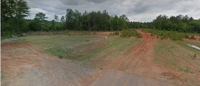
6889 Nc 96 Hwy W
Raleigh-Cary, NC
Garner
004784
Franklin
Vacantlandnec
North Carolina
2023
58.44 AC
2023
Franklin County
060501
Raleigh/Durham
DEMOGRAPHICS near 6889 Nc 96 Hwy W
1 Mile
3 Mile
5 Mile
2024 Total Population
1,576
10,383
37,467
2029 Population
1,928
12,260
43,806
Pop Growth 2024-2029
+ 22.34%
+ 18.08%
+ 16.92%
Average Age
41
41
40
2024 Total Households
618
3,963
13,859
HH Growth 2024-2029
+ 22.33%
+ 18.17%
+ 16.91%
Median Household Inc
$63,234
$75,364
$89,085
Avg Household Size
2.50
2.60
2.70
2024 Avg HH Vehicles
2.00
2.00
2.00
Median Home Value
$274,999
$311,590
$309,215
Median Year Built
2005
2003
2003
Nearby Places
Map Layers
Map Styles
 Street
 Aerial
- Restaurants
- Banks
- Shops
- Fitness
- Groceries
PUBLIC TRANSPORTATION
AIRPORT
Raleigh-Durham International
DRIVE
WALK
Distance
Raleigh-Durham International
41 min
28.2 mi
Freight Ports
Virginia Port Authority - Richmond
DRIVE
WALK
Distance
Virginia Port Authority - Richmond
156 min
131.3 mi
Nearby Properties
Address
Land Use
TOTAL SIZE
Lot Size
Zoning
Address
Land Use
TOTAL SIZE
Lot Size
Zoning
216,580 SF
14.99 AC
FCO GB
Address
Land Use
TOTAL SIZE
Lot Size
Zoning
170,100 SF
15.41 AC
FCO GB
Address
Land Use
TOTAL SIZE
Lot Size
Zoning
20,981 SF
30.74 AC
FCO GB
Address
Land Use
TOTAL SIZE
Lot Size
Zoning
148,249 SF
8.45 AC
L I
Address
Land Use
TOTAL SIZE
Lot Size
Zoning
28,756 SF
100.63 AC
FCO GB
Address
Land Use
TOTAL SIZE
Lot Size
Zoning
34,176 SF
12.93 AC
CU-1
Address
Land Use
TOTAL SIZE
Lot Size
Zoning
112,694 SF
6.85 AC
M U
Address
Land Use
TOTAL SIZE
Lot Size
Zoning
119,496 SF
6.97 AC
L I
Address
Land Use
TOTAL SIZE
Lot Size
Zoning
79,369 SF
4.62 AC
L I
Address
Land Use
TOTAL SIZE
Lot Size
Zoning
100,985 SF
10 AC
M U
Address
Land Use
TOTAL SIZE
Lot Size
Zoning
79,560 SF
9.43 AC
IND
Address
Land Use
TOTAL SIZE
Lot Size
Zoning
58,186 SF
63.99 AC
FCO HI
Address
Land Use
TOTAL SIZE
Lot Size
Zoning
71,262 SF
4.89 AC
L I
Address
Land Use
TOTAL SIZE
Lot Size
Zoning
54,600 SF
4.17 AC
L I
Address
Land Use
TOTAL SIZE
Lot Size
Zoning
79,794 SF
6.68 AC
IND
Address
Land Use
TOTAL SIZE
Lot Size
Zoning
155.86 AC
FCO HI
Address
Land Use
TOTAL SIZE
Lot Size
Zoning
37,600 SF
10 AC
L I
Address
Land Use
TOTAL SIZE
Lot Size
Zoning
46.65 AC
FCO GB
Address
Land Use
TOTAL SIZE
Lot Size
Zoning
60,204 SF
10 AC
IND
Address
Land Use
TOTAL SIZE
Lot Size
Zoning
2,400 SF
1.90 AC
FCO NB
Address
Land Use
TOTAL SIZE
Lot Size
Zoning
50.19 AC
FCO GB
Address
Land Use
TOTAL SIZE
Lot Size
Zoning
54,500 SF
4.06 AC
M U
Address
Land Use
TOTAL SIZE
Lot Size
Zoning
53,293 SF
5.06 AC
M U
Address
Land Use
TOTAL SIZE
Lot Size
Zoning
62,668 SF
5.85 AC
L I
Address
Land Use
TOTAL SIZE
Lot Size
Zoning
86,550 SF
8.13 AC
M U
Address
Land Use
TOTAL SIZE
Lot Size
Zoning
37.25 AC
FCO GB
Address
Land Use
TOTAL SIZE
Lot Size
Zoning
8,880 SF
5.11 AC
C 1
Address
Land Use
TOTAL SIZE
Lot Size
Zoning
33.31 AC
MU-2
Address
Land Use
TOTAL SIZE
Lot Size
Zoning
33,120 SF
2.99 AC
IND
Address
Land Use
TOTAL SIZE
Lot Size
Zoning
12,295 SF
1.98 AC
CU-1
The World's #1 Commercial Real Estate Marketplace
Connect with us
© 2026 CoStar Group
The information above has been obtained from sources believed reliable. While we do not doubt its accuracy we have not verified it and make no guarantee, warranty or representation about it. It is your responsibility to independently confirm its accuracy and completeness. Any projections, opinions, assumptions, or estimates used are for example only and do not represent the current or future performance of the property. The value of this transaction to you depends on tax and other factors which should be evaluated by your tax, financial, and legal advisors. You and your advisors should conduct a careful, independent investigation of the property to determine to your satisfaction the suitability of the property for your needs.