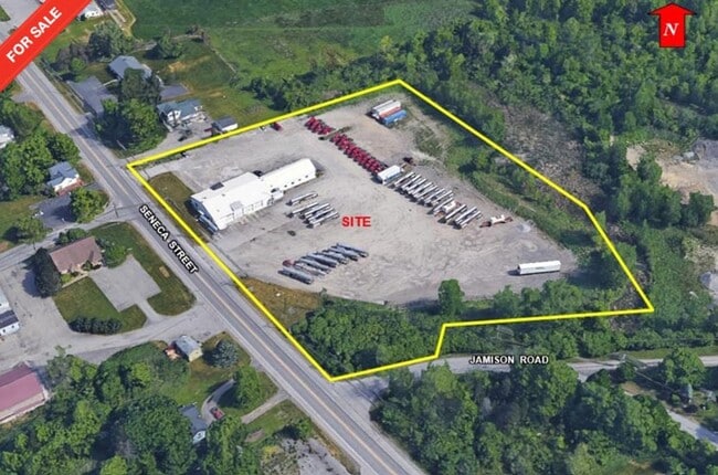
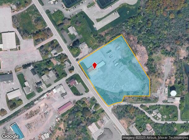
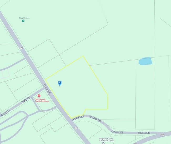
Property Record
6891 Seneca St, Elma, NY 14059
NEARBY LISTINGS FOR SALE OR LEASE
Property Detail
6891 Seneca St
144200-154-000-0002-016-121
Buffalo Creek
Warehouse
Erie
X
New York
36029C0366H
16.121
2025
5.97 AC
2024
Outlying Erie County
014102
Buffalo/Niagara Falls
8,448 SF
Buffalo-Cheektowaga, NY
DEMOGRAPHICS near 6891 Seneca St
1 Mile
3 Mile
5 Mile
2024 Total Population
909
12,539
65,109
2029 Population
901
12,553
65,224
Pop Growth 2024-2029
(0.88%)
+ 0.11%
+ 0.18%
Average Age
46
46
45
2024 Total Households
375
5,229
27,028
HH Growth 2024-2029
(0.80%)
+ 0.02%
+ 0.14%
Median Household Inc
$67,644
$78,103
$87,216
Avg Household Size
2.40
2.30
2.40
2024 Avg HH Vehicles
2.00
2.00
2.00
Median Home Value
$311,224
$291,839
$273,987
Median Year Built
1960
1973
1972
Nearby Places
Map Layers
Map Styles
 Street
 Aerial
- Restaurants
- Banks
- Shops
- Fitness
- Groceries
PUBLIC TRANSPORTATION
COMMUTER RAIL
DRIVE
WALK
Distance
18 min
9.2 mi
DRIVE
WALK
Distance
19 min
9.7 mi
AIRPORT
Buffalo Niagara International
DRIVE
WALK
Distance
Buffalo Niagara International
24 min
12.2 mi
Niagara Falls International
DRIVE
WALK
Distance
Niagara Falls International
49 min
31.2 mi
SALE & LEASE HISTORY
LISTING DATE
SALE/LEASE

Dec 03, 2024
For Sale
Nearby Properties
Address
Land Use
TOTAL SIZE
Lot Size
Zoning
Address
Land Use
TOTAL SIZE
Lot Size
Zoning
129,572 SF
13.10 AC
Address
Land Use
TOTAL SIZE
Lot Size
Zoning
64,283 SF
18.67 AC
10
Address
Land Use
TOTAL SIZE
Lot Size
Zoning
9,952 SF
8.70 AC
10
Address
Land Use
TOTAL SIZE
Lot Size
Zoning
10,771 SF
13.10 AC
B2
Address
Land Use
TOTAL SIZE
Lot Size
Zoning
13,364 SF
407.01 AC
N000
Address
Land Use
TOTAL SIZE
Lot Size
Zoning
39,504 SF
4.13 AC
SR
Address
Land Use
TOTAL SIZE
Lot Size
Zoning
4,511 SF
157.64 AC
R
Address
Land Use
TOTAL SIZE
Lot Size
Zoning
7,872 SF
4.20 AC
10
Address
Land Use
TOTAL SIZE
Lot Size
Zoning
190,420 SF
117.90 AC
Address
Land Use
TOTAL SIZE
Lot Size
Zoning
12,500 SF
4.20 AC
10
Address
Land Use
TOTAL SIZE
Lot Size
Zoning
65,388 SF
7.08 AC
SR
Address
Land Use
TOTAL SIZE
Lot Size
Zoning
7,558 SF
4.50 AC
11
Address
Land Use
TOTAL SIZE
Lot Size
Zoning
49,402 SF
3 AC
10
Address
Land Use
TOTAL SIZE
Lot Size
Zoning
11,264 SF
2.10 AC
10
Address
Land Use
TOTAL SIZE
Lot Size
Zoning
8,264 SF
5.70 AC
10
Address
Land Use
TOTAL SIZE
Lot Size
Zoning
35,928 SF
5.50 AC
12
Address
Land Use
TOTAL SIZE
Lot Size
Zoning
15,000 SF
10.30 AC
10
Address
Land Use
TOTAL SIZE
Lot Size
Zoning
43,950 SF
9.78 AC
B2
Address
Land Use
TOTAL SIZE
Lot Size
Zoning
15,975 SF
2.44 AC
B2
Address
Land Use
TOTAL SIZE
Lot Size
Zoning
218,990 SF
69.57 AC
COMM
Address
Land Use
TOTAL SIZE
Lot Size
Zoning
14,722 SF
1.38 AC
12
Address
Land Use
TOTAL SIZE
Lot Size
Zoning
3,727 SF
248.37 AC
R2
Address
Land Use
TOTAL SIZE
Lot Size
Zoning
331,232 SF
153.79 AC
Address
Land Use
TOTAL SIZE
Lot Size
Zoning
7,156 SF
0.75 AC
11
Address
Land Use
TOTAL SIZE
Lot Size
Zoning
7,680 SF
1.20 AC
04 - FARM
Address
Land Use
TOTAL SIZE
Lot Size
Zoning
5,152 SF
3.35 AC
R1
Address
Land Use
TOTAL SIZE
Lot Size
Zoning
10,136 SF
1.50 AC
10
Address
Land Use
TOTAL SIZE
Lot Size
Zoning
16,938 SF
2.30 AC
10
Address
Land Use
TOTAL SIZE
Lot Size
Zoning
6.50 AC
12
Address
Land Use
TOTAL SIZE
Lot Size
Zoning
5,808 SF
2.67 AC
R3
The World's #1 Commercial Real Estate Marketplace
Connect with us
© 2026 CoStar Group
The information above has been obtained from sources believed reliable. While we do not doubt its accuracy we have not verified it and make no guarantee, warranty or representation about it. It is your responsibility to independently confirm its accuracy and completeness. Any projections, opinions, assumptions, or estimates used are for example only and do not represent the current or future performance of the property. The value of this transaction to you depends on tax and other factors which should be evaluated by your tax, financial, and legal advisors. You and your advisors should conduct a careful, independent investigation of the property to determine to your satisfaction the suitability of the property for your needs.