Property Record
69 Calhoun St, Bluffton, SC 29910
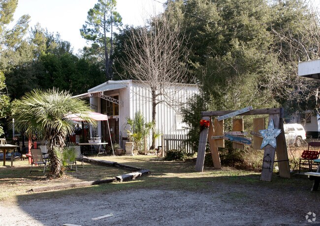

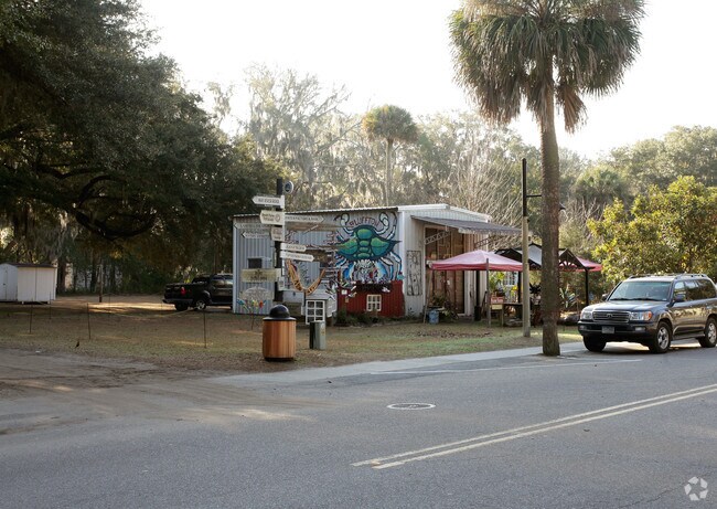
Property Detail
69 Calhoun St
R610-039-00A-0099-0000
LOT 1 PB156 PG18
Commercialnec
Beaufort
6616
South Carolina
2025
1
2025
0.20 AC
002107
Other Market Areas
7,659 SF
Hilton Head Island-Bluffton-Port Royal, SC
NEARBY LISTINGS FOR SALE OR LEASE
DEMOGRAPHICS near 69 Calhoun St
1 mile
3 mile
5 mile
2025 Total Population
4,728
23,299
40,608
2030 Population
4,903
24,029
42,077
Pop Growth 2025-2030
+ 3.70%
+ 3.13%
+ 3.62%
Average Age
38
40
42
2025 Total Households
1,688
8,730
15,549
HH Growth 2025-2030
+ 3.85%
+ 3.36%
+ 3.88%
Median Household Inc
$74,072
$84,980
$91,440
Avg Household Size
2.70
2.60
2.50
2025 Avg HH Vehicles
2.00
2.00
2.00
Median Home Value
$369,148
$442,944
$493,265
Median Year Built
2003
2002
2004
Nearby Places
Map Layers
Map Styles
 Street
 Aerial
Transit
 Traffic
 Biking
Places
Listings with unknown addresses are not visible on the map
- Restaurants
- Banks
- Shops
- Fitness
- Groceries
PUBLIC TRANSPORTATION
AIRPORT
Hilton Head
Drive
Walk
Distance
Hilton Head
23 min
13.0 mi
Savannah/Hilton Head International
Drive
Walk
Distance
Savannah/Hilton Head International
50 min
27.8 mi
Freight Ports
Georgia Ports - Savannah
Drive
Walk
Distance
Georgia Ports - Savannah
43 min
24.5 mi
Nearby Properties
Address
Land Use
TOTAL SIZE
Lot Size
Zoning
Address
Land Use
TOTAL SIZE
Lot Size
Zoning
239,640 SF
17.73 AC
6606
Address
Land Use
TOTAL SIZE
Lot Size
Zoning
212,987 SF
24.53 AC
6616
Address
Land Use
TOTAL SIZE
Lot Size
Zoning
4,689 SF
14.72 AC
6616
Address
Land Use
TOTAL SIZE
Lot Size
Zoning
214,389 SF
28.18 AC
6616
Address
Land Use
TOTAL SIZE
Lot Size
Zoning
35,034 SF
10.32 AC
6616
Address
Land Use
TOTAL SIZE
Lot Size
Zoning
156,459 SF
9.59 AC
Address
Land Use
TOTAL SIZE
Lot Size
Zoning
124,741 SF
10.77 AC
6616
Address
Land Use
TOTAL SIZE
Lot Size
Zoning
121,860 SF
6.14 AC
Address
Land Use
TOTAL SIZE
Lot Size
Zoning
139,215 SF
13.63 AC
6106
Address
Land Use
TOTAL SIZE
Lot Size
Zoning
65,304 SF
27.78 AC
6606
Address
Land Use
TOTAL SIZE
Lot Size
Zoning
193,062 SF
14.20 AC
6616
Address
Land Use
TOTAL SIZE
Lot Size
Zoning
118,810 SF
13.37 AC
6616
Address
Land Use
TOTAL SIZE
Lot Size
Zoning
135,152 SF
14.03 AC
Address
Land Use
TOTAL SIZE
Lot Size
Zoning
69,506 SF
3.24 AC
6616
Address
Land Use
TOTAL SIZE
Lot Size
Zoning
41,192 SF
22.07 AC
Address
Land Use
TOTAL SIZE
Lot Size
Zoning
87,531 SF
21.48 AC
6106
Address
Land Use
TOTAL SIZE
Lot Size
Zoning
119,902 SF
4.16 AC
6606
Address
Land Use
TOTAL SIZE
Lot Size
Zoning
101,762 SF
11.18 AC
6616
Address
Land Use
TOTAL SIZE
Lot Size
Zoning
90,660 SF
5.85 AC
6616
Address
Land Use
TOTAL SIZE
Lot Size
Zoning
132,830 SF
11.91 AC
6616
Address
Land Use
TOTAL SIZE
Lot Size
Zoning
125,348 SF
9.75 AC
6616
Address
Land Use
TOTAL SIZE
Lot Size
Zoning
54,614 SF
142.72 AC
6616
Address
Land Use
TOTAL SIZE
Lot Size
Zoning
137,065 SF
26.18 AC
6616
Address
Land Use
TOTAL SIZE
Lot Size
Zoning
25,668 SF
302.85 AC
6616
Address
Land Use
TOTAL SIZE
Lot Size
Zoning
63,849 SF
10.80 AC
6616
Address
Land Use
TOTAL SIZE
Lot Size
Zoning
67,812 SF
20.19 AC
4206
Address
Land Use
TOTAL SIZE
Lot Size
Zoning
102,252 SF
17.35 AC
6616
Address
Land Use
TOTAL SIZE
Lot Size
Zoning
4.30 AC
6606
Address
Land Use
TOTAL SIZE
Lot Size
Zoning
95,279 SF
11.27 AC
6616
The World's #1 Commercial Real Estate Marketplace
Connect with us
© 2026 CoStar Group
The information above has been obtained from sources believed reliable. While we do not doubt its accuracy we have not verified it and make no guarantee, warranty or representation about it. It is your responsibility to independently confirm its accuracy and completeness. Any projections, opinions, assumptions, or estimates used are for example only and do not represent the current or future performance of the property. The value of this transaction to you depends on tax and other factors which should be evaluated by your tax, financial, and legal advisors. You and your advisors should conduct a careful, independent investigation of the property to determine to your satisfaction the suitability of the property for your needs.