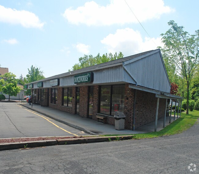
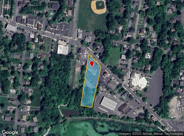
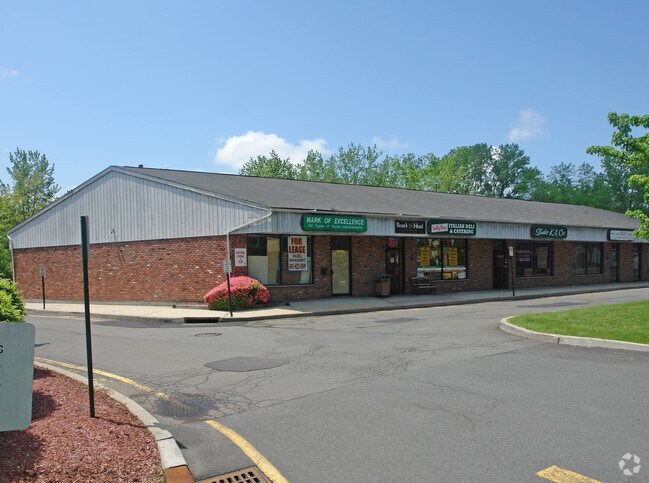
Property Record
69 Lake Rd, Congers, NY 10920
NEARBY LISTINGS FOR SALE OR LEASE
Property Detail
69 Lake Rd
New York-Jersey City-White Plains, NY-NJ
Congers
392089-044-015-0003-043-000-0000
127-D-4
Regionalshoppingcenterormallwithanchorstore
Rockland
X
New York
36087C0114G
43.0
2023
1.20 AC
2024
Clarkstown
010902
Northern New Jersey
6,100 SF
DEMOGRAPHICS near 69 Lake Rd
1 Mile
3 Mile
5 Mile
2024 Total Population
6,831
33,830
141,255
2029 Population
6,771
33,737
139,473
Pop Growth 2024-2029
(0.88%)
(0.27%)
(1.26%)
Average Age
42
43
40
2024 Total Households
2,325
11,484
47,661
HH Growth 2024-2029
(0.90%)
(0.27%)
(1.33%)
Median Household Inc
$127,465
$124,463
$106,982
Avg Household Size
2.80
2.80
2.80
2024 Avg HH Vehicles
2.00
2.00
2.00
Median Home Value
$482,423
$545,787
$510,964
Median Year Built
1972
1970
1967
Nearby Places
- Restaurants
- Banks
- Shops
- Fitness
- Groceries
PUBLIC TRANSPORTATION
AIRPORT
Westchester County
DRIVE
WALK
Distance
Westchester County
33 min
23.6 mi
New York Stewart International
DRIVE
WALK
Distance
New York Stewart International
51 min
34.4 mi
LaGuardia
DRIVE
WALK
Distance
LaGuardia
52 min
36.3 mi
Freight Ports
NY - Red Hook Container Terminal
DRIVE
WALK
Distance
NY - Red Hook Container Terminal
63 min
39.5 mi
SALE & LEASE HISTORY
LISTING DATE
SALE/LEASE

Sep 25, 2016
For Lease
Nearby Properties
Address
Land Use
TOTAL SIZE
Lot Size
Zoning
Address
Land Use
TOTAL SIZE
Lot Size
Zoning
146,101 SF
55 AC
Address
Land Use
TOTAL SIZE
Lot Size
Zoning
316,644 SF
65.70 AC
Address
Land Use
TOTAL SIZE
Lot Size
Zoning
247,711 SF
37.26 AC
Address
Land Use
TOTAL SIZE
Lot Size
Zoning
201.67 AC
Address
Land Use
TOTAL SIZE
Lot Size
Zoning
105,994 SF
2.02 AC
140
Address
Land Use
TOTAL SIZE
Lot Size
Zoning
131,581 SF
2.62 AC
140
Address
Land Use
TOTAL SIZE
Lot Size
Zoning
Address
Land Use
TOTAL SIZE
Lot Size
Zoning
68,910 SF
27 AC
Address
Land Use
TOTAL SIZE
Lot Size
Zoning
Address
Land Use
TOTAL SIZE
Lot Size
Zoning
68,910 SF
6.90 AC
02 - SINGL
Address
Land Use
TOTAL SIZE
Lot Size
Zoning
2,140 SF
1.91 AC
Address
Land Use
TOTAL SIZE
Lot Size
Zoning
133,039 SF
14.80 AC
CS
Address
Land Use
TOTAL SIZE
Lot Size
Zoning
60,423 SF
2.90 AC
Address
Land Use
TOTAL SIZE
Lot Size
Zoning
Address
Land Use
TOTAL SIZE
Lot Size
Zoning
129,218 SF
11.56 AC
Address
Land Use
TOTAL SIZE
Lot Size
Zoning
100,800 SF
13.40 AC
02 - SINGL
Address
Land Use
TOTAL SIZE
Lot Size
Zoning
130,930 SF
11 AC
Address
Land Use
TOTAL SIZE
Lot Size
Zoning
248,709 SF
15.30 AC
Address
Land Use
TOTAL SIZE
Lot Size
Zoning
73,000 SF
5.10 AC
05
Address
Land Use
TOTAL SIZE
Lot Size
Zoning
38,624 SF
5.90 AC
Address
Land Use
TOTAL SIZE
Lot Size
Zoning
106,960 SF
8.04 AC
CS
Address
Land Use
TOTAL SIZE
Lot Size
Zoning
99,725 SF
17.78 AC
03 - MULTI
Address
Land Use
TOTAL SIZE
Lot Size
Zoning
57,392 SF
3.40 AC
Address
Land Use
TOTAL SIZE
Lot Size
Zoning
46,107 SF
8.49 AC
02 - SINGL
Address
Land Use
TOTAL SIZE
Lot Size
Zoning
74.45 AC
166
Address
Land Use
TOTAL SIZE
Lot Size
Zoning
40,194 SF
14 AC
Address
Land Use
TOTAL SIZE
Lot Size
Zoning
47,722 SF
2.65 AC
CS
Address
Land Use
TOTAL SIZE
Lot Size
Zoning
35,921 SF
6.10 AC
02 - SINGL
Address
Land Use
TOTAL SIZE
Lot Size
Zoning
214,974 SF
10.80 AC
Address
Land Use
TOTAL SIZE
Lot Size
Zoning
42,948 SF
3.86 AC
The World's #1 Commercial Real Estate Marketplace
Connect with us
© 2025 CoStar Group
The information above has been obtained from sources believed reliable. While we do not doubt its accuracy we have not verified it and make no guarantee, warranty or representation about it. It is your responsibility to independently confirm its accuracy and completeness. Any projections, opinions, assumptions, or estimates used are for example only and do not represent the current or future performance of the property. The value of this transaction to you depends on tax and other factors which should be evaluated by your tax, financial, and legal advisors. You and your advisors should conduct a careful, independent investigation of the property to determine to your satisfaction the suitability of the property for your needs.