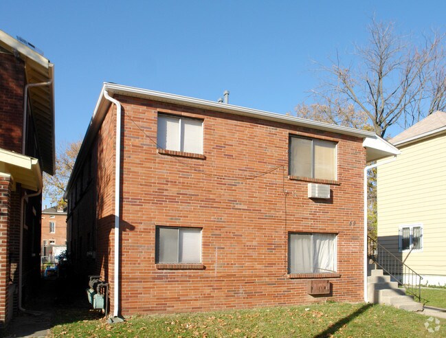
Property Record
69 N 17Th St, Columbus, OH 43203


NEARBY LISTINGS FOR SALE OR LEASE
Property Detail
69 N 17Th St
Columbus
J W Bakers Sub Of Pt Of Half Sec 13 T 5
Columbus, OH
69 N 17TH ST & 40X50FT STRIP ON ALLEY BAKER L 40
010-028405
Franklin
Apartment
Ohio
2024
40
2025
0.14 AC
003600
King-Lincoln Bronzeville
3,150 SF
DEMOGRAPHICS near 69 N 17Th St
1 mile
3 mile
5 mile
2024 Total Population
20,124
160,362
352,159
2029 Population
20,916
163,153
356,331
Pop Growth 2024-2029
+ 3.94%
+ 1.74%
+ 1.18%
Average Age
36
35
35
2024 Total Households
10,268
72,932
151,420
HH Growth 2024-2029
+ 4.23%
+ 1.82%
+ 1.21%
Median Household Inc
$38,325
$52,445
$50,332
Avg Household Size
1.80
2.00
2.10
2024 Avg HH Vehicles
1.00
1.00
1.00
Median Home Value
$300,505
$299,065
$216,953
Median Year Built
1957
1958
1958
Nearby Places
Map Layers
Map Styles
 Street
 Aerial
Transit
 Traffic
 Biking
Places
Listings with unknown addresses are not visible on the map
- Restaurants
- Banks
- Shops
- Fitness
- Groceries
PUBLIC TRANSPORTATION
AIRPORT
John Glenn Columbus International
Drive
Walk
Distance
John Glenn Columbus International
11 min
6.7 mi
Rickenbacker International
Drive
Walk
Distance
Rickenbacker International
24 min
14.1 mi
Nearby Properties
Address
Land Use
TOTAL SIZE
Lot Size
Zoning
Address
Land Use
TOTAL SIZE
Lot Size
Zoning
1,949,795 SF
20.56 AC
Address
Land Use
TOTAL SIZE
Lot Size
Zoning
1,467,891 SF
10.49 AC
Address
Land Use
TOTAL SIZE
Lot Size
Zoning
29,312 SF
10.72 AC
Address
Land Use
TOTAL SIZE
Lot Size
Zoning
717,666 SF
17.99 AC
Address
Land Use
TOTAL SIZE
Lot Size
Zoning
838,846 SF
3.73 AC
Address
Land Use
TOTAL SIZE
Lot Size
Zoning
13.50 AC
Address
Land Use
TOTAL SIZE
Lot Size
Zoning
382,270 SF
319.59 AC
Address
Land Use
TOTAL SIZE
Lot Size
Zoning
304,340 SF
3.86 AC
Address
Land Use
TOTAL SIZE
Lot Size
Zoning
477,854 SF
0.72 AC
Address
Land Use
TOTAL SIZE
Lot Size
Zoning
798,272 SF
9.94 AC
Address
Land Use
TOTAL SIZE
Lot Size
Zoning
832,673 SF
2.87 AC
Address
Land Use
TOTAL SIZE
Lot Size
Zoning
1,099,074 SF
39.47 AC
Address
Land Use
TOTAL SIZE
Lot Size
Zoning
972,594 SF
0.84 AC
Address
Land Use
TOTAL SIZE
Lot Size
Zoning
302,079 SF
77.95 AC
Address
Land Use
TOTAL SIZE
Lot Size
Zoning
385,225 SF
5.89 AC
Address
Land Use
TOTAL SIZE
Lot Size
Zoning
481,704 SF
0.92 AC
Address
Land Use
TOTAL SIZE
Lot Size
Zoning
479,979 SF
5.43 AC
Address
Land Use
TOTAL SIZE
Lot Size
Zoning
1,113,919 SF
1.63 AC
Address
Land Use
TOTAL SIZE
Lot Size
Zoning
1,462,053 SF
0.21 AC
Address
Land Use
TOTAL SIZE
Lot Size
Zoning
484,662 SF
2.28 AC
Address
Land Use
TOTAL SIZE
Lot Size
Zoning
501,624 SF
1.23 AC
Address
Land Use
TOTAL SIZE
Lot Size
Zoning
470,630 SF
0.57 AC
Address
Land Use
TOTAL SIZE
Lot Size
Zoning
339,231 SF
0.73 AC
Address
Land Use
TOTAL SIZE
Lot Size
Zoning
1,013,906 SF
1 AC
Address
Land Use
TOTAL SIZE
Lot Size
Zoning
1,158,978 SF
5.02 AC
Address
Land Use
TOTAL SIZE
Lot Size
Zoning
669,626 SF
0.97 AC
Address
Land Use
TOTAL SIZE
Lot Size
Zoning
892,833 SF
5.27 AC
Address
Land Use
TOTAL SIZE
Lot Size
Zoning
560,146 SF
63.19 AC
Address
Land Use
TOTAL SIZE
Lot Size
Zoning
459,012 SF
3.71 AC
Address
Land Use
TOTAL SIZE
Lot Size
Zoning
657,089 SF
9.74 AC
The World's #1 Commercial Real Estate Marketplace
Connect with us
© 2026 CoStar Group
The information above has been obtained from sources believed reliable. While we do not doubt its accuracy we have not verified it and make no guarantee, warranty or representation about it. It is your responsibility to independently confirm its accuracy and completeness. Any projections, opinions, assumptions, or estimates used are for example only and do not represent the current or future performance of the property. The value of this transaction to you depends on tax and other factors which should be evaluated by your tax, financial, and legal advisors. You and your advisors should conduct a careful, independent investigation of the property to determine to your satisfaction the suitability of the property for your needs.