Property Record
69 N Common St, Lynn, MA 01902
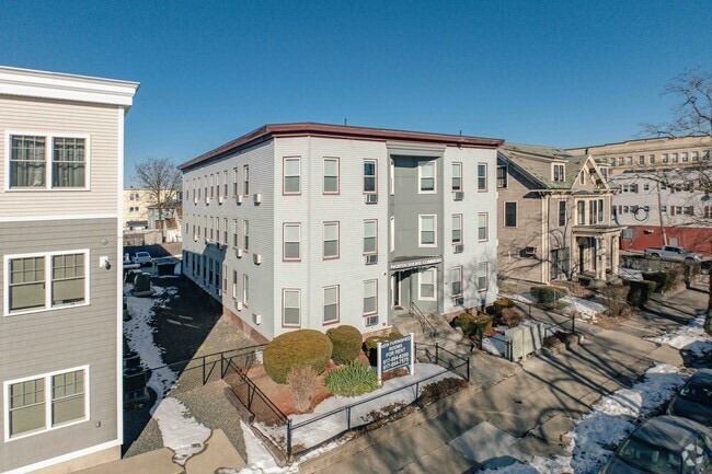


Property Detail
69 N Common St
LYNN-000053-000722-000028
Essex
Transientlodging
Massachusetts
R5
28
B and X Area of moderate flood hazard, usually the area between the limits of the 100-year and 500-year floods.
0.15 AC
2025
North Suburbs-Essex
2025
Boston
206100
Boston-Cambridge-Newton, MA-NH
10,980 SF
NEARBY LISTINGS FOR SALE OR LEASE
DEMOGRAPHICS near 69 N Common St
1 mile
3 mile
5 mile
2025 Total Population
48,111
133,378
292,316
2030 Population
48,626
135,273
297,238
Pop Growth 2025-2030
+ 1.07%
+ 1.42%
+ 1.68%
Average Age
36
39
40
2025 Total Households
16,550
48,242
109,442
HH Growth 2025-2030
+ 1.27%
+ 1.52%
+ 1.82%
Median Household Inc
$53,961
$78,358
$88,089
Avg Household Size
2.70
2.70
2.60
2025 Avg HH Vehicles
1.00
2.00
2.00
Median Home Value
$487,894
$609,847
$648,806
Median Year Built
1948
1949
1955
Nearby Places
Map Layers
Map Styles
 Street
 Aerial
Transit
 Traffic
 Biking
Places
Listings with unknown addresses are not visible on the map
- Restaurants
- Banks
- Shops
- Fitness
- Groceries
PUBLIC TRANSPORTATION
TRANSIT/SUBWAY
Lynn (Newburyport/Rockport Line - Massachusetts Bay Transportation Authority Commuter Rail (Purple Line))
Drive
Walk
Distance
Lynn (Newburyport/Rockport Line - Massachusetts Bay Transportation Authority Commuter Rail (Purple Line))
3 min
12 min
0.6 mi
COMMUTER RAIL
River Works (Newburyport/Rockport Line - Massachusetts Bay Transportation Authority Commuter Rail (Purple Line))
Drive
Walk
Distance
River Works (Newburyport/Rockport Line - Massachusetts Bay Transportation Authority Commuter Rail (Purple Line))
5 min
1.8 mi
Swampscott (Newburyport/Rockport Line - Massachusetts Bay Transportation Authority Commuter Rail (Purple Line))
Drive
Walk
Distance
Swampscott (Newburyport/Rockport Line - Massachusetts Bay Transportation Authority Commuter Rail (Purple Line))
6 min
2.5 mi
AIRPORT
General Edward Lawrence Logan International
Drive
Walk
Distance
General Edward Lawrence Logan International
17 min
9.1 mi
Manchester Boston Regional
Drive
Walk
Distance
Manchester Boston Regional
72 min
49.8 mi
SALE & LEASE HISTORY
LISTING DATE
SALE/LEASE

Oct 24, 2025
For Sale
Jan 06, 2022
For Sale
Dec 05, 2024
For Sale
Nearby Properties
Address
Land Use
TOTAL SIZE
Lot Size
Zoning
Address
Land Use
TOTAL SIZE
Lot Size
Zoning
195,446 SF
12.98 AC
R2
Address
Land Use
TOTAL SIZE
Lot Size
Zoning
9.73 AC
R5
Address
Land Use
TOTAL SIZE
Lot Size
Zoning
224,840 SF
2.18 AC
RC1
Address
Land Use
TOTAL SIZE
Lot Size
Zoning
277,750 SF
13.47 AC
LI
Address
Land Use
TOTAL SIZE
Lot Size
Zoning
11,840 SF
0.67 AC
CBD
Address
Land Use
TOTAL SIZE
Lot Size
Zoning
4.51 AC
R5
Address
Land Use
TOTAL SIZE
Lot Size
Zoning
345,298 SF
5.74 AC
WF1
Address
Land Use
TOTAL SIZE
Lot Size
Zoning
154,524 SF
5.90 AC
B3
Address
Land Use
TOTAL SIZE
Lot Size
Zoning
190,000 SF
24.42 AC
N/A
Address
Land Use
TOTAL SIZE
Lot Size
Zoning
8.47 AC
PC
Address
Land Use
TOTAL SIZE
Lot Size
Zoning
303,568 SF
1.11 AC
LI
Address
Land Use
TOTAL SIZE
Lot Size
Zoning
8.74 AC
WF1A
Address
Land Use
TOTAL SIZE
Lot Size
Zoning
151.89 AC
PC
Address
Land Use
TOTAL SIZE
Lot Size
Zoning
169,840 SF
16.70 AC
NA
Address
Land Use
TOTAL SIZE
Lot Size
Zoning
514,553 SF
57.16 AC
R4
Address
Land Use
TOTAL SIZE
Lot Size
Zoning
24.85 AC
R4
Address
Land Use
TOTAL SIZE
Lot Size
Zoning
123,903 SF
0.88 AC
CBD
Address
Land Use
TOTAL SIZE
Lot Size
Zoning
3.22 AC
R5
Address
Land Use
TOTAL SIZE
Lot Size
Zoning
15,240 SF
11.49 AC
WF3
Address
Land Use
TOTAL SIZE
Lot Size
Zoning
5.40 AC
R5
Address
Land Use
TOTAL SIZE
Lot Size
Zoning
98,516 SF
5.01 AC
R1
Address
Land Use
TOTAL SIZE
Lot Size
Zoning
25.02 AC
WF1A
Address
Land Use
TOTAL SIZE
Lot Size
Zoning
68,296 SF
6.01 AC
R2
Address
Land Use
TOTAL SIZE
Lot Size
Zoning
84,681 SF
3.53 AC
R5
Address
Land Use
TOTAL SIZE
Lot Size
Zoning
77,392 SF
6.82 AC
B3
Address
Land Use
TOTAL SIZE
Lot Size
Zoning
229,416 SF
14.81 AC
N/A
Address
Land Use
TOTAL SIZE
Lot Size
Zoning
76,589 SF
4.57 AC
R4
Address
Land Use
TOTAL SIZE
Lot Size
Zoning
65.50 AC
WF1
Address
Land Use
TOTAL SIZE
Lot Size
Zoning
7.28 AC
R3
The World's #1 Commercial Real Estate Marketplace
Connect with us
© 2026 CoStar Group
The information above has been obtained from sources believed reliable. While we do not doubt its accuracy we have not verified it and make no guarantee, warranty or representation about it. It is your responsibility to independently confirm its accuracy and completeness. Any projections, opinions, assumptions, or estimates used are for example only and do not represent the current or future performance of the property. The value of this transaction to you depends on tax and other factors which should be evaluated by your tax, financial, and legal advisors. You and your advisors should conduct a careful, independent investigation of the property to determine to your satisfaction the suitability of the property for your needs.