Property Record
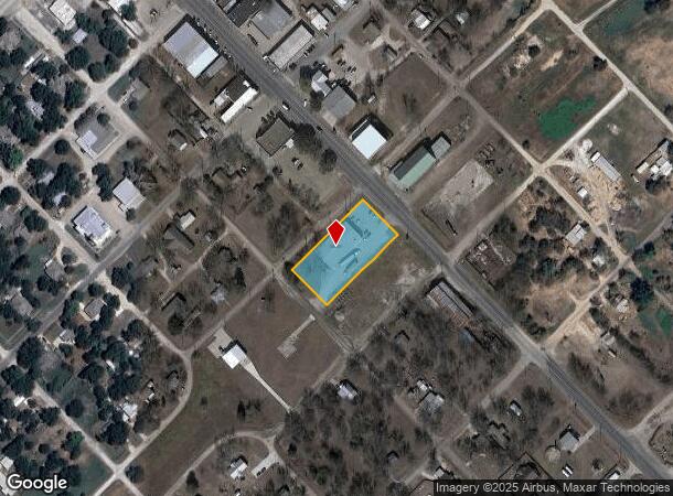
69 N Magnolia Ave, Hubbard, TX 76648
NEARBY LISTINGS FOR SALE OR LEASE
-
-
View all Hubbard listings for sale on LoopNet.com
Property Detail
69 N Magnolia Ave
378543
N Berkley A-
Commercialnec
N BERKLEY A-36 TR 28 1.033 AC
X
Hill
48349C0675D
Texas
2025
1.03 AC
2025
Central Texas Area
961400
Other Market Areas
27,456 SF
DEMOGRAPHICS near 69 N Magnolia Ave
1 Mile
3 Mile
5 Mile
2024 Total Population
1,780
2,113
2,758
2029 Population
1,981
2,350
3,054
Pop Growth 2024-2029
+ 11.29%
+ 11.22%
+ 10.73%
Average Age
41
41
42
2024 Total Households
694
822
1,075
HH Growth 2024-2029
+ 11.10%
+ 11.07%
+ 10.51%
Median Household Inc
$34,838
$39,422
$41,725
Avg Household Size
2.50
2.50
2.50
2024 Avg HH Vehicles
2.00
2.00
2.00
Median Home Value
$88,627
$91,666
$97,201
Median Year Built
1974
1976
1978
Nearby Places
Map Layers
Map Styles
 Street
 Aerial
- Restaurants
- Banks
- Shops
- Fitness
- Groceries
Nearby Properties
Address
Land Use
TOTAL SIZE
Lot Size
Zoning
Address
Land Use
TOTAL SIZE
Lot Size
Zoning
97,200 SF
49.39 AC
Address
Land Use
TOTAL SIZE
Lot Size
Zoning
28,492 SF
1.70 AC
Address
Land Use
TOTAL SIZE
Lot Size
Zoning
7,200 SF
149.24 AC
Address
Land Use
TOTAL SIZE
Lot Size
Zoning
11,700 SF
33.09 AC
Address
Land Use
TOTAL SIZE
Lot Size
Zoning
2,694 SF
321.14 AC
Address
Land Use
TOTAL SIZE
Lot Size
Zoning
375.19 AC
Address
Land Use
TOTAL SIZE
Lot Size
Zoning
11,000 SF
0.48 AC
Address
Land Use
TOTAL SIZE
Lot Size
Zoning
255.81 AC
Address
Land Use
TOTAL SIZE
Lot Size
Zoning
800 SF
220.46 AC
Address
Land Use
TOTAL SIZE
Lot Size
Zoning
320 AC
Address
Land Use
TOTAL SIZE
Lot Size
Zoning
6,365 SF
0.29 AC
Address
Land Use
TOTAL SIZE
Lot Size
Zoning
1,200 SF
315.22 AC
Address
Land Use
TOTAL SIZE
Lot Size
Zoning
24,430 SF
0.80 AC
Address
Land Use
TOTAL SIZE
Lot Size
Zoning
15,660 SF
3.61 AC
Address
Land Use
TOTAL SIZE
Lot Size
Zoning
14,240 SF
0.96 AC
Address
Land Use
TOTAL SIZE
Lot Size
Zoning
20,078 SF
1.88 AC
Address
Land Use
TOTAL SIZE
Lot Size
Zoning
4,938 SF
194.61 AC
Address
Land Use
TOTAL SIZE
Lot Size
Zoning
19,702 SF
1.04 AC
Address
Land Use
TOTAL SIZE
Lot Size
Zoning
7,814 SF
0.16 AC
Address
Land Use
TOTAL SIZE
Lot Size
Zoning
268.23 AC
Address
Land Use
TOTAL SIZE
Lot Size
Zoning
2,023 SF
215.75 AC
Address
Land Use
TOTAL SIZE
Lot Size
Zoning
42,541 SF
2.66 AC
Address
Land Use
TOTAL SIZE
Lot Size
Zoning
75,500 SF
0.32 AC
Address
Land Use
TOTAL SIZE
Lot Size
Zoning
652 SF
175.06 AC
Address
Land Use
TOTAL SIZE
Lot Size
Zoning
244.76 AC
Address
Land Use
TOTAL SIZE
Lot Size
Zoning
164.92 AC
Address
Land Use
TOTAL SIZE
Lot Size
Zoning
159.15 AC
Address
Land Use
TOTAL SIZE
Lot Size
Zoning
18,936 SF
2.70 AC
Address
Land Use
TOTAL SIZE
Lot Size
Zoning
9,840 SF
0.96 AC
The World's #1 Commercial Real Estate Marketplace
Connect with us
© 2025 CoStar Group
The information above has been obtained from sources believed reliable. While we do not doubt its accuracy we have not verified it and make no guarantee, warranty or representation about it. It is your responsibility to independently confirm its accuracy and completeness. Any projections, opinions, assumptions, or estimates used are for example only and do not represent the current or future performance of the property. The value of this transaction to you depends on tax and other factors which should be evaluated by your tax, financial, and legal advisors. You and your advisors should conduct a careful, independent investigation of the property to determine to your satisfaction the suitability of the property for your needs.