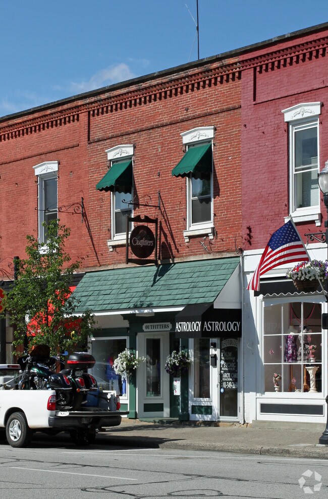
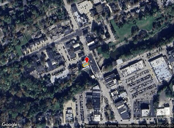
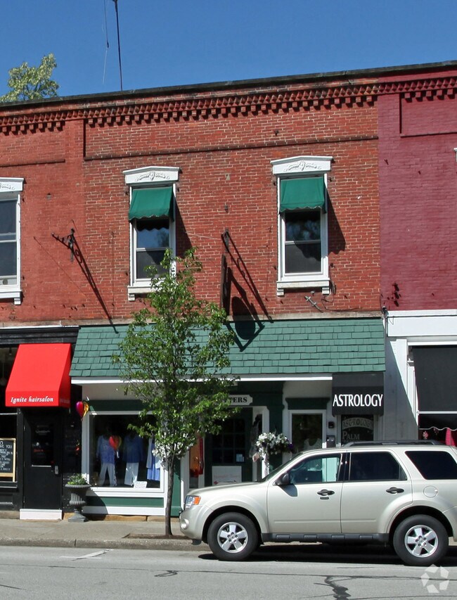
Property Record
69 N Main St, Chagrin Falls, OH 44022
NEARBY LISTINGS FOR SALE OR LEASE
Property Detail
69 N Main St
Cleveland-Elyria, OH
Graves Allotment
932-06-013
20 GRAVES &S/L148 SP 43 1/2 NP 0150
Storebuilding
Cuyahoga
X
Ohio
39035C0242E
150
2024
0.03 AC
2024
Southeast
195900
Cleveland
3,084 SF
DEMOGRAPHICS near 69 N Main St
1 mile
3 mile
5 mile
2024 Total Population
4,943
19,216
51,163
2029 Population
4,877
19,041
50,535
Pop Growth 2024-2029
(1.34%)
(0.91%)
(1.23%)
Average Age
45
45
44
2024 Total Households
2,197
7,406
19,201
HH Growth 2024-2029
(1.50%)
(1.04%)
(1.34%)
Median Household Inc
$93,546
$136,875
$127,976
Avg Household Size
2.20
2.50
2.60
2024 Avg HH Vehicles
2.00
2.00
2.00
Median Home Value
$412,720
$438,233
$413,909
Median Year Built
1956
1967
1972
Nearby Places
Map Layers
Map Styles
 Street
 Aerial
Transit
 Traffic
 Biking
Places
Listings with unknown addresses are not visible on the map
- Restaurants
- Banks
- Shops
- Fitness
- Groceries
PUBLIC TRANSPORTATION
AIRPORT
Cleveland-Hopkins International
Drive
Walk
Distance
Cleveland-Hopkins International
44 min
27.4 mi
Nearby Properties
Address
Land Use
TOTAL SIZE
Lot Size
Zoning
Address
Land Use
TOTAL SIZE
Lot Size
Zoning
7,531 SF
85.32 AC
R3A
Address
Land Use
TOTAL SIZE
Lot Size
Zoning
255.11 AC
U-1
Address
Land Use
TOTAL SIZE
Lot Size
Zoning
225,206 SF
55.30 AC
PI
Address
Land Use
TOTAL SIZE
Lot Size
Zoning
441.72 AC
1F-2
Address
Land Use
TOTAL SIZE
Lot Size
Zoning
54,482 SF
24.19 AC
U-1
Address
Land Use
TOTAL SIZE
Lot Size
Zoning
176.15 AC
U1
Address
Land Use
TOTAL SIZE
Lot Size
Zoning
2,620 SF
15.81 AC
R5A
Address
Land Use
TOTAL SIZE
Lot Size
Zoning
42,274 SF
48.61 AC
U-1
Address
Land Use
TOTAL SIZE
Lot Size
Zoning
50,867 SF
212.96 AC
U-4
Address
Land Use
TOTAL SIZE
Lot Size
Zoning
33,007 SF
18.40 AC
Address
Land Use
TOTAL SIZE
Lot Size
Zoning
93,610 SF
4.45 AC
RL
Address
Land Use
TOTAL SIZE
Lot Size
Zoning
77,296 SF
3.33 AC
RB
Address
Land Use
TOTAL SIZE
Lot Size
Zoning
67,861 SF
24.84 AC
R1A
Address
Land Use
TOTAL SIZE
Lot Size
Zoning
76.89 AC
U-1
Address
Land Use
TOTAL SIZE
Lot Size
Zoning
2,042 SF
310.34 AC
U-1
Address
Land Use
TOTAL SIZE
Lot Size
Zoning
15,590 SF
4.50 AC
U-1
Address
Land Use
TOTAL SIZE
Lot Size
Zoning
775 SF
124 AC
U-1
Address
Land Use
TOTAL SIZE
Lot Size
Zoning
48.36 AC
Address
Land Use
TOTAL SIZE
Lot Size
Zoning
19,057 SF
148.23 AC
U-1
Address
Land Use
TOTAL SIZE
Lot Size
Zoning
86,896 SF
1.55 AC
PI
Address
Land Use
TOTAL SIZE
Lot Size
Zoning
58,075 SF
10.63 AC
PI
Address
Land Use
TOTAL SIZE
Lot Size
Zoning
125,740 SF
33.72 AC
RL
Address
Land Use
TOTAL SIZE
Lot Size
Zoning
20,604 SF
56.58 AC
U-1
Address
Land Use
TOTAL SIZE
Lot Size
Zoning
11,702 SF
12.40 AC
1F-2
Address
Land Use
TOTAL SIZE
Lot Size
Zoning
20,550 SF
8.21 AC
U-1
Address
Land Use
TOTAL SIZE
Lot Size
Zoning
36,827 SF
6.54 AC
R5A
Address
Land Use
TOTAL SIZE
Lot Size
Zoning
13,086 SF
0.82 AC
R1-60
Address
Land Use
TOTAL SIZE
Lot Size
Zoning
13,375 SF
10.40 AC
R5
Address
Land Use
TOTAL SIZE
Lot Size
Zoning
43,221 SF
14.17 AC
LIR
Address
Land Use
TOTAL SIZE
Lot Size
Zoning
36,733 SF
1.34 AC
U-1
The World's #1 Commercial Real Estate Marketplace
Connect with us
© 2026 CoStar Group
The information above has been obtained from sources believed reliable. While we do not doubt its accuracy we have not verified it and make no guarantee, warranty or representation about it. It is your responsibility to independently confirm its accuracy and completeness. Any projections, opinions, assumptions, or estimates used are for example only and do not represent the current or future performance of the property. The value of this transaction to you depends on tax and other factors which should be evaluated by your tax, financial, and legal advisors. You and your advisors should conduct a careful, independent investigation of the property to determine to your satisfaction the suitability of the property for your needs.