Property Record
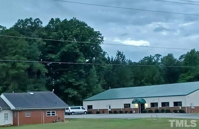
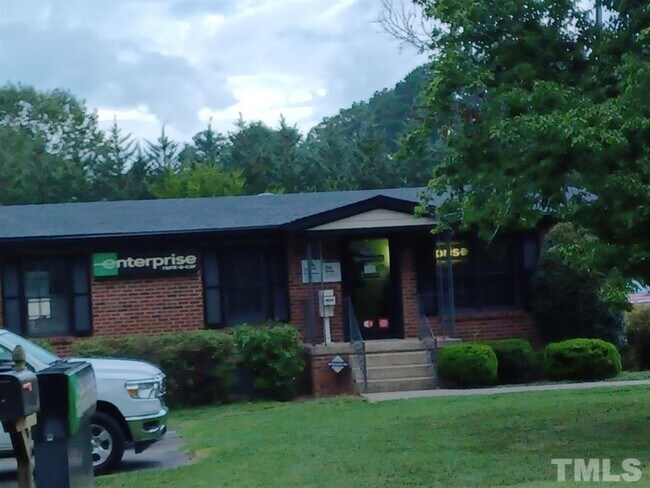
69 Robins Nest Ln, Pittsboro, NC 27312

NEARBY LISTINGS FOR SALE OR LEASE
Property Detail
69 Robins Nest Ln
Durham-Chapel Hill, NC
Sanford Rd Commercial
0007730
LOT 1 AC 0.686 BK 2008 PG 100
Policefirecivildefense
Chatham
X
North Carolina
3710974100K
1
2025
0.69 AC
2025
Chatham County
020801
Raleigh/Durham
7,200 SF
DEMOGRAPHICS near 69 Robins Nest Ln
1 Mile
3 Mile
5 Mile
2024 Total Population
1,611
6,309
10,697
2029 Population
1,804
7,220
12,261
Pop Growth 2024-2029
+ 11.98%
+ 14.44%
+ 14.62%
Average Age
45
44
45
2024 Total Households
596
2,574
4,446
HH Growth 2024-2029
+ 12.08%
+ 14.65%
+ 14.78%
Median Household Inc
$93,028
$67,252
$64,896
Avg Household Size
2.50
2.40
2.30
2024 Avg HH Vehicles
2.00
2.00
2.00
Median Home Value
$274,404
$305,943
$324,191
Median Year Built
2000
1999
1998
Nearby Places
Map Layers
Map Styles
 Street
 Aerial
- Restaurants
- Banks
- Shops
- Fitness
- Groceries
PUBLIC TRANSPORTATION
AIRPORT
Raleigh-Durham International
DRIVE
WALK
Distance
Raleigh-Durham International
46 min
31.8 mi
Freight Ports
Port of Wilmington
DRIVE
WALK
Distance
Port of Wilmington
195 min
164.2 mi
SALE & LEASE HISTORY
LISTING DATE
SALE/LEASE

Mar 12, 2024
For Sale
Nearby Properties
Address
Land Use
TOTAL SIZE
Lot Size
Zoning
Address
Land Use
TOTAL SIZE
Lot Size
Zoning
89,964 SF
11.24 AC
C-2
Address
Land Use
TOTAL SIZE
Lot Size
Zoning
60,000 SF
6.59 AC
PDD
Address
Land Use
TOTAL SIZE
Lot Size
Zoning
139,350 SF
19.85 AC
C-2
Address
Land Use
TOTAL SIZE
Lot Size
Zoning
34,430 SF
53.71 AC
O-I
Address
Land Use
TOTAL SIZE
Lot Size
Zoning
43.50 AC
PIETJ
Address
Land Use
TOTAL SIZE
Lot Size
Zoning
37,358 SF
15.49 AC
PDD
Address
Land Use
TOTAL SIZE
Lot Size
Zoning
31,230 SF
24.23 AC
O-I
Address
Land Use
TOTAL SIZE
Lot Size
Zoning
2,900 SF
28.48 AC
M-1
Address
Land Use
TOTAL SIZE
Lot Size
Zoning
19,611 SF
2.03 AC
O-I
Address
Land Use
TOTAL SIZE
Lot Size
Zoning
50,495 SF
7.20 AC
O-I
Address
Land Use
TOTAL SIZE
Lot Size
Zoning
72.61 AC
M-2
Address
Land Use
TOTAL SIZE
Lot Size
Zoning
41,352 SF
4.75 AC
R-12
Address
Land Use
TOTAL SIZE
Lot Size
Zoning
1,424 SF
7.01 AC
C-2
Address
Land Use
TOTAL SIZE
Lot Size
Zoning
2,193 SF
5.76 AC
PDD
Address
Land Use
TOTAL SIZE
Lot Size
Zoning
48,725 SF
6.54 AC
C-2
Address
Land Use
TOTAL SIZE
Lot Size
Zoning
20,049 SF
4.42 AC
C-2
Address
Land Use
TOTAL SIZE
Lot Size
Zoning
19,128 SF
0.56 AC
C-4
Address
Land Use
TOTAL SIZE
Lot Size
Zoning
227.03 AC
R-15
Address
Land Use
TOTAL SIZE
Lot Size
Zoning
3,944 SF
5.82 AC
R-12
Address
Land Use
TOTAL SIZE
Lot Size
Zoning
214.26 AC
PDD
Address
Land Use
TOTAL SIZE
Lot Size
Zoning
2,247 SF
6.76 AC
MUPD
Address
Land Use
TOTAL SIZE
Lot Size
Zoning
44,952 SF
4.15 AC
C-2
Address
Land Use
TOTAL SIZE
Lot Size
Zoning
18,729 SF
1.41 AC
C-4
Address
Land Use
TOTAL SIZE
Lot Size
Zoning
33,258 SF
3.69 AC
C-2
Address
Land Use
TOTAL SIZE
Lot Size
Zoning
11,841 SF
2 AC
PDD
Address
Land Use
TOTAL SIZE
Lot Size
Zoning
10,032 SF
1.37 AC
C-1 (CU)
Address
Land Use
TOTAL SIZE
Lot Size
Zoning
2,634 SF
146.42 AC
R-15
Address
Land Use
TOTAL SIZE
Lot Size
Zoning
17,952 SF
20.30 AC
M-2
Address
Land Use
TOTAL SIZE
Lot Size
Zoning
2,170 SF
33.63 AC
M-2
Address
Land Use
TOTAL SIZE
Lot Size
Zoning
21,266 SF
0.64 AC
C-2 (CU)
The World's #1 Commercial Real Estate Marketplace
Connect with us
© 2025 CoStar Group
The information above has been obtained from sources believed reliable. While we do not doubt its accuracy we have not verified it and make no guarantee, warranty or representation about it. It is your responsibility to independently confirm its accuracy and completeness. Any projections, opinions, assumptions, or estimates used are for example only and do not represent the current or future performance of the property. The value of this transaction to you depends on tax and other factors which should be evaluated by your tax, financial, and legal advisors. You and your advisors should conduct a careful, independent investigation of the property to determine to your satisfaction the suitability of the property for your needs.