Property Record
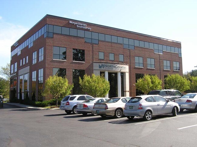
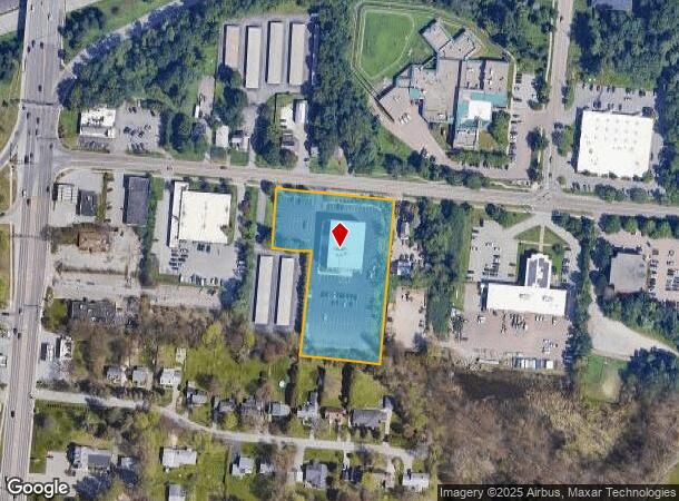
69 Swift St, South Burlington, VT 05403
NEARBY LISTINGS FOR SALE OR LEASE
Property Detail
69 Swift St
(188) 1700-00069
1.18A BLDG
Financialbuilding
Chittenden
X
Vermont
50007C0254D
1.18 AC
2024
Vermont North Area
2024
Other Market Areas
003304
Burlington-South Burlington, VT
DEMOGRAPHICS near 69 Swift St
1 Mile
3 Mile
5 Mile
2024 Total Population
7,800
54,362
79,938
2029 Population
7,941
55,159
81,092
Pop Growth 2024-2029
+ 1.81%
+ 1.47%
+ 1.44%
Average Age
40
36
37
2024 Total Households
3,530
22,174
33,034
HH Growth 2024-2029
+ 1.87%
+ 1.59%
+ 1.57%
Median Household Inc
$93,478
$75,230
$75,239
Avg Household Size
2.10
2.10
2.10
2024 Avg HH Vehicles
2.00
2.00
2.00
Median Home Value
$432,830
$409,731
$394,676
Median Year Built
1979
1974
1975
Nearby Places
Map Layers
Map Styles
 Street
 Aerial
- Restaurants
- Banks
- Shops
- Fitness
- Groceries
PUBLIC TRANSPORTATION
COMMUTER RAIL
DRIVE
WALK
Distance
6 min
2.6 mi
DRIVE
WALK
Distance
14 min
8.9 mi
AIRPORT
Patrick Leahy Burlington International
DRIVE
WALK
Distance
Patrick Leahy Burlington International
17 min
7.1 mi
Plattsburgh International
DRIVE
WALK
Distance
Plattsburgh International
70 min
36.6 mi
Nearby Properties
Address
Land Use
TOTAL SIZE
Lot Size
Zoning
Address
Land Use
TOTAL SIZE
Lot Size
Zoning
2,542,351 SF
34.82 AC
I
Address
Land Use
TOTAL SIZE
Lot Size
Zoning
168,175 SF
I
Address
Land Use
TOTAL SIZE
Lot Size
Zoning
2.96 AC
I
Address
Land Use
TOTAL SIZE
Lot Size
Zoning
12.26 AC
I
Address
Land Use
TOTAL SIZE
Lot Size
Zoning
Address
Land Use
TOTAL SIZE
Lot Size
Zoning
232,277 SF
17.20 AC
I
Address
Land Use
TOTAL SIZE
Lot Size
Zoning
Address
Land Use
TOTAL SIZE
Lot Size
Zoning
Address
Land Use
TOTAL SIZE
Lot Size
Zoning
167,016 SF
2.30 AC
I
Address
Land Use
TOTAL SIZE
Lot Size
Zoning
1.70 AC
FD6
Address
Land Use
TOTAL SIZE
Lot Size
Zoning
19.86 AC
I
Address
Land Use
TOTAL SIZE
Lot Size
Zoning
98,123 SF
I
Address
Land Use
TOTAL SIZE
Lot Size
Zoning
20.87 AC
RL
Address
Land Use
TOTAL SIZE
Lot Size
Zoning
Address
Land Use
TOTAL SIZE
Lot Size
Zoning
157,081 SF
I
Address
Land Use
TOTAL SIZE
Lot Size
Zoning
1.16 AC
FD6
Address
Land Use
TOTAL SIZE
Lot Size
Zoning
181,068 SF
I
Address
Land Use
TOTAL SIZE
Lot Size
Zoning
140,910 SF
2.72 AC
I
Address
Land Use
TOTAL SIZE
Lot Size
Zoning
2.06 AC
FD6
Address
Land Use
TOTAL SIZE
Lot Size
Zoning
11.82 AC
ELM
Address
Land Use
TOTAL SIZE
Lot Size
Zoning
Address
Land Use
TOTAL SIZE
Lot Size
Zoning
216,574 SF
15.36 AC
Address
Land Use
TOTAL SIZE
Lot Size
Zoning
6.50 AC
I
Address
Land Use
TOTAL SIZE
Lot Size
Zoning
68,321 SF
4.60 AC
I
Address
Land Use
TOTAL SIZE
Lot Size
Zoning
Address
Land Use
TOTAL SIZE
Lot Size
Zoning
119,561 SF
1.86 AC
FD5
Address
Land Use
TOTAL SIZE
Lot Size
Zoning
140.43 AC
I
Address
Land Use
TOTAL SIZE
Lot Size
Zoning
107,141 SF
I
Address
Land Use
TOTAL SIZE
Lot Size
Zoning
Address
Land Use
TOTAL SIZE
Lot Size
Zoning
14.89 AC
ELM
The World's #1 Commercial Real Estate Marketplace
Connect with us
© 2026 CoStar Group
The information above has been obtained from sources believed reliable. While we do not doubt its accuracy we have not verified it and make no guarantee, warranty or representation about it. It is your responsibility to independently confirm its accuracy and completeness. Any projections, opinions, assumptions, or estimates used are for example only and do not represent the current or future performance of the property. The value of this transaction to you depends on tax and other factors which should be evaluated by your tax, financial, and legal advisors. You and your advisors should conduct a careful, independent investigation of the property to determine to your satisfaction the suitability of the property for your needs.