Property Record
69 Terminal St, Albany, NY 12206
NEARBY LISTINGS FOR SALE OR LEASE
Property Detail
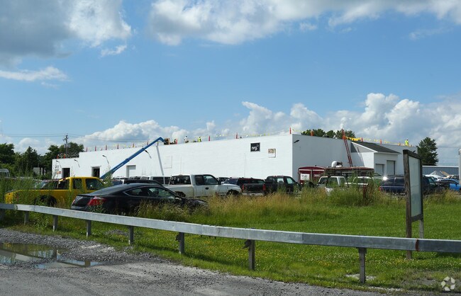
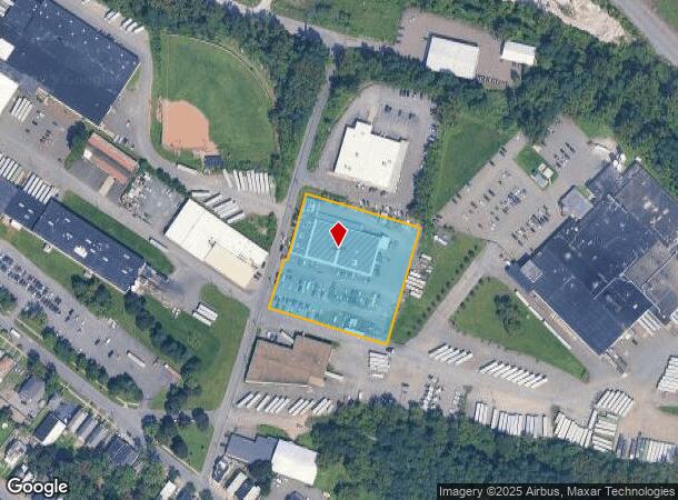
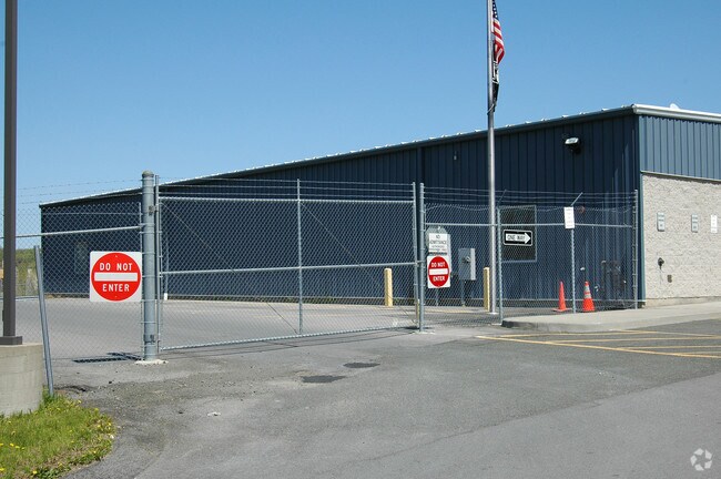
69 Terminal St
010100-065-006-0001-004-000-0000
1 CONCRETE WAREHOUSE 1002028
Warehouse
Albany
X
New York
36001C0192D
4.000
2025
2.25 AC
2024
Greater Albany
000700
Albany/Schenectady/Troy
23,768 SF
Albany-Schenectady-Troy, NY
DEMOGRAPHICS near 69 Terminal St
1 Mile
3 Mile
5 Mile
2024 Total Population
19,500
115,758
198,416
2029 Population
19,079
114,178
196,284
Pop Growth 2024-2029
(2.16%)
(1.36%)
(1.07%)
Average Age
35
38
39
2024 Total Households
7,762
51,394
83,612
HH Growth 2024-2029
(2.28%)
(1.35%)
(1.11%)
Median Household Inc
$38,665
$58,122
$68,458
Avg Household Size
2.20
2.10
2.10
2024 Avg HH Vehicles
1.00
1.00
1.00
Median Home Value
$143,264
$223,214
$240,196
Median Year Built
1948
1952
1959
Nearby Places
- Restaurants
- Banks
- Shops
- Fitness
- Groceries
PUBLIC TRANSPORTATION
COMMUTER RAIL
DRIVE
WALK
Distance
11 min
3.8 mi
AIRPORT
Albany International
DRIVE
WALK
Distance
Albany International
18 min
8.2 mi
SALE & LEASE HISTORY
LISTING DATE
SALE/LEASE

Jul 17, 2017
For Lease
Nearby Properties
Address
Land Use
TOTAL SIZE
Lot Size
Zoning
Address
Land Use
TOTAL SIZE
Lot Size
Zoning
901,573 SF
38 AC
CO
Address
Land Use
TOTAL SIZE
Lot Size
Zoning
111,628 SF
303.87 AC
CO
Address
Land Use
TOTAL SIZE
Lot Size
Zoning
11,372 SF
30 AC
CO
Address
Land Use
TOTAL SIZE
Lot Size
Zoning
674,048 SF
7.40 AC
CO
Address
Land Use
TOTAL SIZE
Lot Size
Zoning
599,952 SF
28.30 AC
CO
Address
Land Use
TOTAL SIZE
Lot Size
Zoning
442,188 SF
15.10 AC
CO
Address
Land Use
TOTAL SIZE
Lot Size
Zoning
567,019 SF
1.42 AC
CO
Address
Land Use
TOTAL SIZE
Lot Size
Zoning
502,950 SF
12.50 AC
CO
Address
Land Use
TOTAL SIZE
Lot Size
Zoning
1.42 AC
C3
Address
Land Use
TOTAL SIZE
Lot Size
Zoning
133,984 SF
205.20 AC
C2
Address
Land Use
TOTAL SIZE
Lot Size
Zoning
368,685 SF
3.10 AC
CO
Address
Land Use
TOTAL SIZE
Lot Size
Zoning
152,951 SF
3.70 AC
CO
Address
Land Use
TOTAL SIZE
Lot Size
Zoning
197,169 SF
5 AC
CO
Address
Land Use
TOTAL SIZE
Lot Size
Zoning
358,360 SF
10.10 AC
CO
Address
Land Use
TOTAL SIZE
Lot Size
Zoning
206.10 AC
C2
Address
Land Use
TOTAL SIZE
Lot Size
Zoning
541,564 SF
7.40 AC
C3
Address
Land Use
TOTAL SIZE
Lot Size
Zoning
207.50 AC
CM
Address
Land Use
TOTAL SIZE
Lot Size
Zoning
802,560 SF
5.70 AC
R4
Address
Land Use
TOTAL SIZE
Lot Size
Zoning
9,208 SF
290.80 AC
LC
Address
Land Use
TOTAL SIZE
Lot Size
Zoning
191.95 AC
LC
Address
Land Use
TOTAL SIZE
Lot Size
Zoning
156,056 SF
1.31 AC
CO
Address
Land Use
TOTAL SIZE
Lot Size
Zoning
177,030 SF
0.06 AC
C3
Address
Land Use
TOTAL SIZE
Lot Size
Zoning
595,472 SF
6.06 AC
CO
Address
Land Use
TOTAL SIZE
Lot Size
Zoning
199,495 SF
5.40 AC
CO
Address
Land Use
TOTAL SIZE
Lot Size
Zoning
889,560 SF
0.50 AC
CO
Address
Land Use
TOTAL SIZE
Lot Size
Zoning
12,660 SF
15.60 AC
CO
Address
Land Use
TOTAL SIZE
Lot Size
Zoning
166,812 SF
0.78 AC
CO
Address
Land Use
TOTAL SIZE
Lot Size
Zoning
428,555 SF
1.20 AC
C3
Address
Land Use
TOTAL SIZE
Lot Size
Zoning
11,900 SF
28.60 AC
86
Address
Land Use
TOTAL SIZE
Lot Size
Zoning
105.28 AC
C2
The World's #1 Commercial Real Estate Marketplace
Connect with us
© 2025 CoStar Group
The information above has been obtained from sources believed reliable. While we do not doubt its accuracy we have not verified it and make no guarantee, warranty or representation about it. It is your responsibility to independently confirm its accuracy and completeness. Any projections, opinions, assumptions, or estimates used are for example only and do not represent the current or future performance of the property. The value of this transaction to you depends on tax and other factors which should be evaluated by your tax, financial, and legal advisors. You and your advisors should conduct a careful, independent investigation of the property to determine to your satisfaction the suitability of the property for your needs.