Property Record
69 W Main St, Rossville, IN 46065


NEARBY LISTINGS FOR SALE OR LEASE
Property Detail
69 W Main St
Frankfort, IN
Carters Add
12-01-25-103-005.000-016
020-28008-00 CARTER'S ADD LOT 20
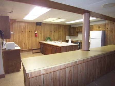
Officebuilding
Clinton
X
Indiana
18015C0290C
20
0
0.20 AC
2024
Lafayette/Kokomo
950300
Other Market Areas
10,062 SF
DEMOGRAPHICS near 69 W Main St
1 Mile
3 Mile
5 Mile
2024 Total Population
1,714
2,667
4,408
2029 Population
1,680
2,624
4,356
Pop Growth 2024-2029
(1.98%)
(1.61%)
(1.18%)
Average Age
40
40
40
2024 Total Households
670
1,026
1,668
HH Growth 2024-2029
(1.94%)
(1.66%)
(1.20%)
Median Household Inc
$61,376
$66,385
$73,768
Avg Household Size
2.50
2.50
2.60
2024 Avg HH Vehicles
2.00
2.00
2.00
Median Home Value
$178,455
$187,676
$196,752
Median Year Built
1974
1973
1972
Nearby Places
Map Layers
Map Styles
 Street
 Aerial
- Restaurants
- Banks
- Shops
- Fitness
- Groceries
Nearby Properties
Address
Land Use
TOTAL SIZE
Lot Size
Zoning
Address
Land Use
TOTAL SIZE
Lot Size
Zoning
14,364 SF
3.47 AC
Address
Land Use
TOTAL SIZE
Lot Size
Zoning
41,958 SF
10.59 AC
Address
Land Use
TOTAL SIZE
Lot Size
Zoning
78.65 AC
Address
Land Use
TOTAL SIZE
Lot Size
Zoning
16,000 SF
2.27 AC
Address
Land Use
TOTAL SIZE
Lot Size
Zoning
5,823 SF
6.68 AC
Address
Land Use
TOTAL SIZE
Lot Size
Zoning
15,270 SF
Address
Land Use
TOTAL SIZE
Lot Size
Zoning
6,323 SF
1.10 AC
Address
Land Use
TOTAL SIZE
Lot Size
Zoning
10,686 SF
3 AC
Address
Land Use
TOTAL SIZE
Lot Size
Zoning
8,816 SF
0.46 AC
Address
Land Use
TOTAL SIZE
Lot Size
Zoning
8,912 SF
0.45 AC
Address
Land Use
TOTAL SIZE
Lot Size
Zoning
160 AC
Address
Land Use
TOTAL SIZE
Lot Size
Zoning
10,080 SF
0.90 AC
Address
Land Use
TOTAL SIZE
Lot Size
Zoning
155.31 AC
Address
Land Use
TOTAL SIZE
Lot Size
Zoning
158.28 AC
Address
Land Use
TOTAL SIZE
Lot Size
Zoning
14,904 SF
1.23 AC
Address
Land Use
TOTAL SIZE
Lot Size
Zoning
47.92 AC
Address
Land Use
TOTAL SIZE
Lot Size
Zoning
8,400 SF
1.50 AC
Address
Land Use
TOTAL SIZE
Lot Size
Zoning
135.52 AC
Address
Land Use
TOTAL SIZE
Lot Size
Zoning
119.52 AC
Address
Land Use
TOTAL SIZE
Lot Size
Zoning
4.59 AC
Address
Land Use
TOTAL SIZE
Lot Size
Zoning
127.57 AC
Address
Land Use
TOTAL SIZE
Lot Size
Zoning
8.50 AC
Address
Land Use
TOTAL SIZE
Lot Size
Zoning
5,000 SF
1.20 AC
Address
Land Use
TOTAL SIZE
Lot Size
Zoning
7,689 SF
3.56 AC
Address
Land Use
TOTAL SIZE
Lot Size
Zoning
41.83 AC
Address
Land Use
TOTAL SIZE
Lot Size
Zoning
2,541 SF
114.76 AC
Address
Land Use
TOTAL SIZE
Lot Size
Zoning
127.63 AC
Address
Land Use
TOTAL SIZE
Lot Size
Zoning
2,331 SF
0.40 AC
Address
Land Use
TOTAL SIZE
Lot Size
Zoning
100 AC
The World's #1 Commercial Real Estate Marketplace
Connect with us
© 2025 CoStar Group
The information above has been obtained from sources believed reliable. While we do not doubt its accuracy we have not verified it and make no guarantee, warranty or representation about it. It is your responsibility to independently confirm its accuracy and completeness. Any projections, opinions, assumptions, or estimates used are for example only and do not represent the current or future performance of the property. The value of this transaction to you depends on tax and other factors which should be evaluated by your tax, financial, and legal advisors. You and your advisors should conduct a careful, independent investigation of the property to determine to your satisfaction the suitability of the property for your needs.