Property Record
690 Long Pond Rd, Rochester, NY 14612
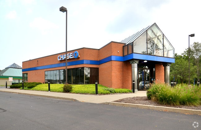
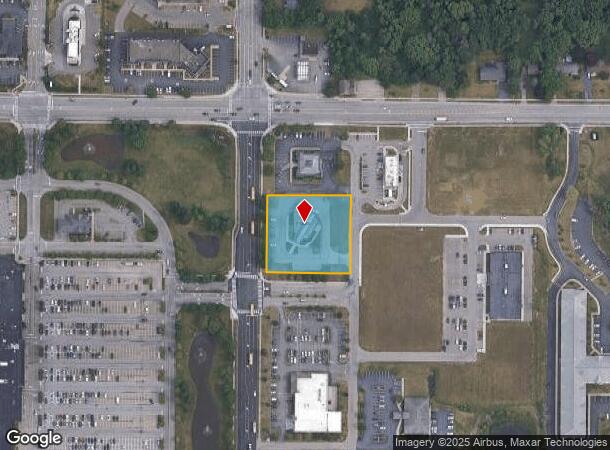
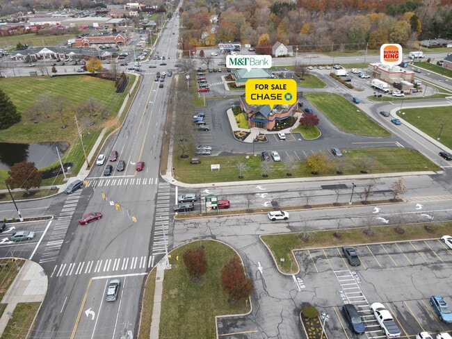

This Property Is For Sale
NEARBY LISTINGS FOR SALE OR LEASE
Property Detail
690 Long Pond Rd
262800-045-030-0004-020-112
Resub Of Gordon Howe Resu8bdivision
Financialbuilding
Monroe
X
New York
36055C0064H
20.112
2025
1.21 AC
2024
Northwest
013604
Rochester
4,770 SF
Rochester, NY
DEMOGRAPHICS near 690 Long Pond Rd
1 Mile
3 Mile
5 Mile
2024 Total Population
8,500
60,661
120,772
2029 Population
8,485
59,925
119,147
Pop Growth 2024-2029
(0.18%)
(1.21%)
(1.35%)
Average Age
47
44
43
2024 Total Households
3,497
25,520
52,126
HH Growth 2024-2029
(0.03%)
(1.31%)
(1.42%)
Median Household Inc
$87,710
$74,387
$65,961
Avg Household Size
2.30
2.30
2.30
2024 Avg HH Vehicles
2.00
2.00
2.00
Median Home Value
$181,775
$169,419
$157,941
Median Year Built
1985
1977
1968
Nearby Places
- Restaurants
- Banks
- Shops
- Fitness
- Groceries
PUBLIC TRANSPORTATION
AIRPORT
Frederick Douglass/Greater Rochester International
DRIVE
WALK
Distance
Frederick Douglass/Greater Rochester International
17 min
12.3 mi
Freight Ports
Albany, NY Port
DRIVE
WALK
Distance
Albany, NY Port
282 min
238.2 mi
Nearby Properties
Address
Land Use
TOTAL SIZE
Lot Size
Zoning
Address
Land Use
TOTAL SIZE
Lot Size
Zoning
Address
Land Use
TOTAL SIZE
Lot Size
Zoning
352,001 SF
76.90 AC
Address
Land Use
TOTAL SIZE
Lot Size
Zoning
330,700 SF
66.90 AC
Address
Land Use
TOTAL SIZE
Lot Size
Zoning
180,406 SF
28.80 AC
Address
Land Use
TOTAL SIZE
Lot Size
Zoning
65,000 SF
5.10 AC
Address
Land Use
TOTAL SIZE
Lot Size
Zoning
37,487 SF
47.63 AC
Address
Land Use
TOTAL SIZE
Lot Size
Zoning
4,728 SF
34.54 AC
03 - MULTI
Address
Land Use
TOTAL SIZE
Lot Size
Zoning
225,793 SF
32.60 AC
Address
Land Use
TOTAL SIZE
Lot Size
Zoning
227,808 SF
69.10 AC
Address
Land Use
TOTAL SIZE
Lot Size
Zoning
3,710 SF
30.20 AC
05 - COMME
Address
Land Use
TOTAL SIZE
Lot Size
Zoning
Address
Land Use
TOTAL SIZE
Lot Size
Zoning
145,943 SF
16.15 AC
05 - COMME
Address
Land Use
TOTAL SIZE
Lot Size
Zoning
9,360 SF
23.50 AC
05 - COMME
Address
Land Use
TOTAL SIZE
Lot Size
Zoning
14,800 SF
14.91 AC
05 - COMME
Address
Land Use
TOTAL SIZE
Lot Size
Zoning
136,148 SF
12.53 AC
Address
Land Use
TOTAL SIZE
Lot Size
Zoning
15,762 SF
17.38 AC
05 - COMME
Address
Land Use
TOTAL SIZE
Lot Size
Zoning
0.84 AC
Address
Land Use
TOTAL SIZE
Lot Size
Zoning
99,308 SF
6.80 AC
05 - COMME
Address
Land Use
TOTAL SIZE
Lot Size
Zoning
9,661 SF
19.62 AC
05 - COMME
Address
Land Use
TOTAL SIZE
Lot Size
Zoning
4,540 SF
14.65 AC
Address
Land Use
TOTAL SIZE
Lot Size
Zoning
108,401 SF
67.82 AC
05 - COMME
Address
Land Use
TOTAL SIZE
Lot Size
Zoning
Address
Land Use
TOTAL SIZE
Lot Size
Zoning
7,120 SF
23.10 AC
Address
Land Use
TOTAL SIZE
Lot Size
Zoning
Address
Land Use
TOTAL SIZE
Lot Size
Zoning
78,957 SF
90.80 AC
02 - SINGL
Address
Land Use
TOTAL SIZE
Lot Size
Zoning
14,080 SF
15.20 AC
05 - COMME
Address
Land Use
TOTAL SIZE
Lot Size
Zoning
2,572 SF
26.40 AC
Address
Land Use
TOTAL SIZE
Lot Size
Zoning
93,865 SF
62.80 AC
Address
Land Use
TOTAL SIZE
Lot Size
Zoning
12,100 SF
15.63 AC
05 - COMME
Address
Land Use
TOTAL SIZE
Lot Size
Zoning
76,739 SF
12.79 AC
The World's #1 Commercial Real Estate Marketplace
Connect with us
© 2025 CoStar Group
The information above has been obtained from sources believed reliable. While we do not doubt its accuracy we have not verified it and make no guarantee, warranty or representation about it. It is your responsibility to independently confirm its accuracy and completeness. Any projections, opinions, assumptions, or estimates used are for example only and do not represent the current or future performance of the property. The value of this transaction to you depends on tax and other factors which should be evaluated by your tax, financial, and legal advisors. You and your advisors should conduct a careful, independent investigation of the property to determine to your satisfaction the suitability of the property for your needs.