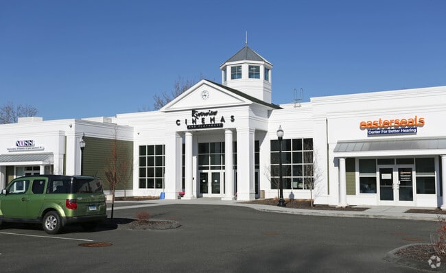
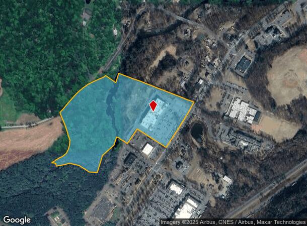
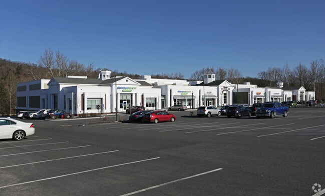
Property Record
690 Main St S, Southbury, CT 06488
NEARBY LISTINGS FOR SALE OR LEASE
Property Detail
690 Main St S
SBUR-000024-000080-000005
New Haven
Timberlandforesttreesagricultural
Connecticut
X
5
09009C0228H
23.55 AC
2025
Southbury
2025
Westchester/So Connecticut
348124
New Haven-Milford, CT
52,482 SF
DEMOGRAPHICS near 690 Main St S
1 Mile
3 Mile
5 Mile
2024 Total Population
1,897
17,939
33,680
2029 Population
1,924
17,862
33,600
Pop Growth 2024-2029
+ 1.42%
(0.43%)
(0.24%)
Average Age
55
50
47
2024 Total Households
852
7,774
13,741
HH Growth 2024-2029
+ 1.53%
(0.86%)
(0.54%)
Median Household Inc
$70,540
$101,562
$112,061
Avg Household Size
2.00
2.20
2.40
2024 Avg HH Vehicles
2.00
2.00
2.00
Median Home Value
$212,385
$349,482
$388,959
Median Year Built
1975
1976
1977
Nearby Places
Map Layers
Map Styles
 Street
 Aerial
- Restaurants
- Banks
- Shops
- Fitness
- Groceries
PUBLIC TRANSPORTATION
AIRPORT
Tweed/New Haven
DRIVE
WALK
Distance
Tweed/New Haven
51 min
27.8 mi
Westchester County
DRIVE
WALK
Distance
Westchester County
63 min
49.4 mi
Freight Ports
Port of New Haven
DRIVE
WALK
Distance
Port of New Haven
46 min
24.9 mi
SALE & LEASE HISTORY
LISTING DATE
SALE/LEASE

Sep 25, 2016
For Lease
Nearby Properties
Address
Land Use
TOTAL SIZE
Lot Size
Zoning
Address
Land Use
TOTAL SIZE
Lot Size
Zoning
102,919 SF
227.90 AC
R-60C
Address
Land Use
TOTAL SIZE
Lot Size
Zoning
635.11 AC
R-60
Address
Land Use
TOTAL SIZE
Lot Size
Zoning
20.50 AC
PDD-8
Address
Land Use
TOTAL SIZE
Lot Size
Zoning
23.58 AC
B-3A
Address
Land Use
TOTAL SIZE
Lot Size
Zoning
5.57 AC
R5
Address
Land Use
TOTAL SIZE
Lot Size
Zoning
55.79 AC
R-30A
Address
Land Use
TOTAL SIZE
Lot Size
Zoning
7.58 AC
PDD-9
Address
Land Use
TOTAL SIZE
Lot Size
Zoning
185,641 SF
22.35 AC
PDD
Address
Land Use
TOTAL SIZE
Lot Size
Zoning
15.61 AC
R-30
Address
Land Use
TOTAL SIZE
Lot Size
Zoning
100,291 SF
19.40 AC
R-30
Address
Land Use
TOTAL SIZE
Lot Size
Zoning
7.07 AC
B-3C
Address
Land Use
TOTAL SIZE
Lot Size
Zoning
48,796 SF
13.53 AC
PDD
Address
Land Use
TOTAL SIZE
Lot Size
Zoning
219.58 AC
R-30A
Address
Land Use
TOTAL SIZE
Lot Size
Zoning
36,353 SF
5.13 AC
R-30
Address
Land Use
TOTAL SIZE
Lot Size
Zoning
32,428 SF
8 AC
R-30
Address
Land Use
TOTAL SIZE
Lot Size
Zoning
66,745 SF
13.52 AC
Address
Land Use
TOTAL SIZE
Lot Size
Zoning
42,938 SF
9.42 AC
R-60
Address
Land Use
TOTAL SIZE
Lot Size
Zoning
68,970 SF
10.50 AC
R-60
Address
Land Use
TOTAL SIZE
Lot Size
Zoning
32,264 SF
15.92 AC
R-60
Address
Land Use
TOTAL SIZE
Lot Size
Zoning
3,764 SF
457 AC
R-80
Address
Land Use
TOTAL SIZE
Lot Size
Zoning
3.59 AC
B-2D
Address
Land Use
TOTAL SIZE
Lot Size
Zoning
18,137 SF
33.54 AC
R-60
Address
Land Use
TOTAL SIZE
Lot Size
Zoning
86,000 SF
7.19 AC
B-3
Address
Land Use
TOTAL SIZE
Lot Size
Zoning
3.73 AC
R-60
Address
Land Use
TOTAL SIZE
Lot Size
Zoning
13,578 SF
2.38 AC
B-2A
Address
Land Use
TOTAL SIZE
Lot Size
Zoning
14,110 SF
1.40 AC
B-2D
Address
Land Use
TOTAL SIZE
Lot Size
Zoning
22,885 SF
8.49 AC
R-30
Address
Land Use
TOTAL SIZE
Lot Size
Zoning
13,217 SF
2.03 AC
B2-C
Address
Land Use
TOTAL SIZE
Lot Size
Zoning
7.18 AC
PDD17
The World's #1 Commercial Real Estate Marketplace
Connect with us
© 2026 CoStar Group
The information above has been obtained from sources believed reliable. While we do not doubt its accuracy we have not verified it and make no guarantee, warranty or representation about it. It is your responsibility to independently confirm its accuracy and completeness. Any projections, opinions, assumptions, or estimates used are for example only and do not represent the current or future performance of the property. The value of this transaction to you depends on tax and other factors which should be evaluated by your tax, financial, and legal advisors. You and your advisors should conduct a careful, independent investigation of the property to determine to your satisfaction the suitability of the property for your needs.