Property Record
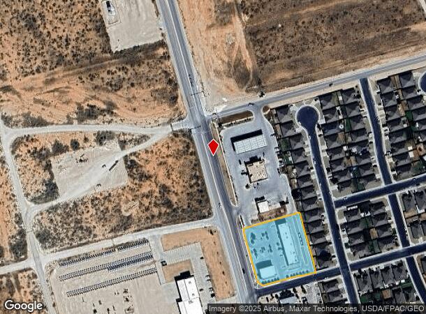
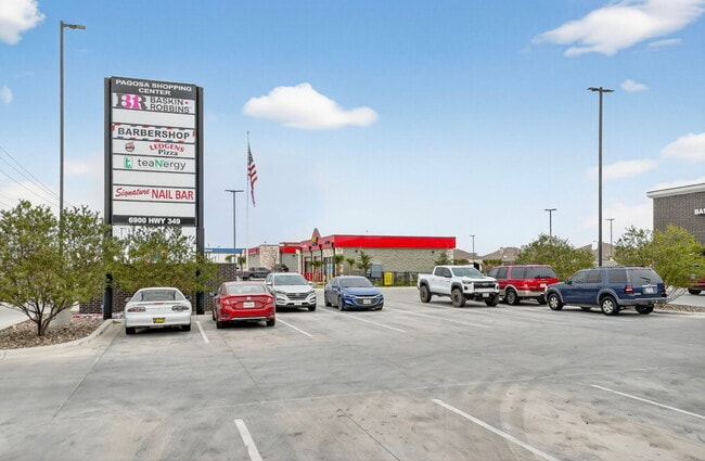
6900 N State Highway 349, Midland, TX 79705
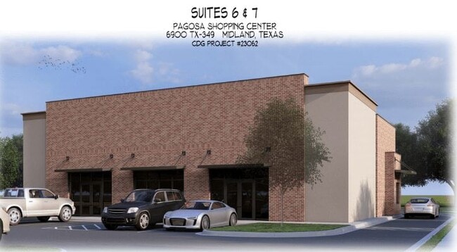
Current Lease Availabilities
General Retail LEASE
$28.00 - $30.00 SF/YR
2,000 - 2,184 SF
NEARBY LISTINGS FOR SALE OR LEASE
Property Detail
6900 N State Highway 349
Other Market Areas
Lone Star Business Park
Midland, TX
ACRES: 1.840 BLK: 002 LOT: 008 ADDN: LONE STAR BUSINESS PARK SEC 3
00056340.002.0080
Midland
Officebuilding
Texas
2025
8
2025
1.84 AC
010123
Midland & Odessa
3,750 SF
DEMOGRAPHICS near 6900 N State Highway 349
1 Mile
3 Mile
5 Mile
2024 Total Population
3,143
18,139
60,570
2029 Population
3,428
19,589
63,340
Pop Growth 2024-2029
+ 9.07%
+ 7.99%
+ 4.57%
Average Age
28
32
35
2024 Total Households
1,074
6,524
22,553
HH Growth 2024-2029
+ 9.40%
+ 8.23%
+ 4.82%
Median Household Inc
$97,545
$100,797
$94,990
Avg Household Size
2.90
2.70
2.60
2024 Avg HH Vehicles
2.00
2.00
2.00
Median Home Value
$308,190
$337,672
$310,725
Median Year Built
2011
2010
1988
Nearby Places
Map Layers
Map Styles
 Street
 Aerial
- Restaurants
- Banks
- Shops
- Fitness
- Groceries
PUBLIC TRANSPORTATION
AIRPORT
Midland International Air And Space Port
DRIVE
WALK
Distance
Midland International Air And Space Port
23 min
17.2 mi
Freight Ports
Calhoun Port
DRIVE
WALK
Distance
Calhoun Port
532 min
476.8 mi
Nearby Properties
Address
Land Use
TOTAL SIZE
Lot Size
Zoning
Address
Land Use
TOTAL SIZE
Lot Size
Zoning
9,988 SF
17.46 AC
Address
Land Use
TOTAL SIZE
Lot Size
Zoning
8,290 SF
12.79 AC
Address
Land Use
TOTAL SIZE
Lot Size
Zoning
218,400 SF
14.12 AC
Address
Land Use
TOTAL SIZE
Lot Size
Zoning
904 SF
11.34 AC
MF1
Address
Land Use
TOTAL SIZE
Lot Size
Zoning
1,980 SF
10.25 AC
MF1
Address
Land Use
TOTAL SIZE
Lot Size
Zoning
16,016 SF
2 AC
Address
Land Use
TOTAL SIZE
Lot Size
Zoning
23,136 SF
6.61 AC
MF1
Address
Land Use
TOTAL SIZE
Lot Size
Zoning
34,040 SF
576.92 AC
PDRC
Address
Land Use
TOTAL SIZE
Lot Size
Zoning
4,060 SF
3.43 AC
PDHD
Address
Land Use
TOTAL SIZE
Lot Size
Zoning
2,397 SF
2.30 AC
LR1
Address
Land Use
TOTAL SIZE
Lot Size
Zoning
72,360 SF
10.56 AC
Address
Land Use
TOTAL SIZE
Lot Size
Zoning
831 SF
8.42 AC
AE
Address
Land Use
TOTAL SIZE
Lot Size
Zoning
3,000 SF
2.75 AC
Address
Land Use
TOTAL SIZE
Lot Size
Zoning
9,543 SF
1.96 AC
PDOC
Address
Land Use
TOTAL SIZE
Lot Size
Zoning
875 SF
3.22 AC
PDID
Address
Land Use
TOTAL SIZE
Lot Size
Zoning
125.42 AC
AE
Address
Land Use
TOTAL SIZE
Lot Size
Zoning
3,500 SF
10.12 AC
AE
Address
Land Use
TOTAL SIZE
Lot Size
Zoning
9,464 SF
1.35 AC
Address
Land Use
TOTAL SIZE
Lot Size
Zoning
20,000 SF
5 AC
PDID
Address
Land Use
TOTAL SIZE
Lot Size
Zoning
500 SF
20 AC
Address
Land Use
TOTAL SIZE
Lot Size
Zoning
3,900 SF
10.98 AC
PDID
Address
Land Use
TOTAL SIZE
Lot Size
Zoning
7,585 SF
2.50 AC
LR2
Address
Land Use
TOTAL SIZE
Lot Size
Zoning
24,964 SF
1.27 AC
Address
Land Use
TOTAL SIZE
Lot Size
Zoning
13,750 SF
1.46 AC
Address
Land Use
TOTAL SIZE
Lot Size
Zoning
8,405 SF
2.27 AC
PDID
Address
Land Use
TOTAL SIZE
Lot Size
Zoning
26,700 SF
4.09 AC
PDID
Address
Land Use
TOTAL SIZE
Lot Size
Zoning
9,750 SF
2.45 AC
Address
Land Use
TOTAL SIZE
Lot Size
Zoning
76,915 SF
2.52 AC
LR2
The World's #1 Commercial Real Estate Marketplace
Connect with us
© 2026 CoStar Group
The information above has been obtained from sources believed reliable. While we do not doubt its accuracy we have not verified it and make no guarantee, warranty or representation about it. It is your responsibility to independently confirm its accuracy and completeness. Any projections, opinions, assumptions, or estimates used are for example only and do not represent the current or future performance of the property. The value of this transaction to you depends on tax and other factors which should be evaluated by your tax, financial, and legal advisors. You and your advisors should conduct a careful, independent investigation of the property to determine to your satisfaction the suitability of the property for your needs.