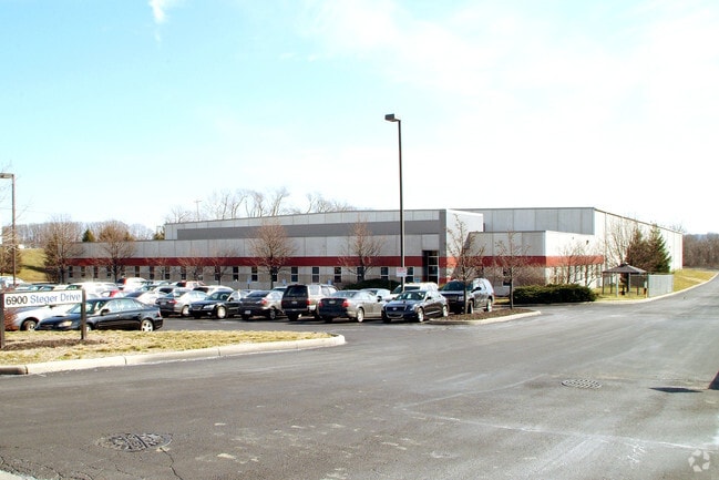
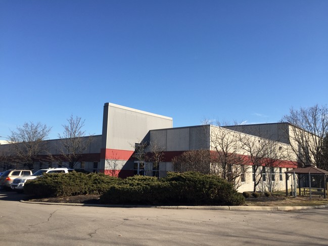
Property Record
6900 Steger Dr, Cincinnati, OH 45237


Property Detail
6900 Steger Dr
Cincinnati, OH-KY-IN
COR SEYMOUR AVE & STEGER DR 9.003 ACS LOT 8 IAMS RESEARCH PARK EAST SUB PH IV
117-0003-0152
Hamilton
Warehouse
Ohio
PD
8
B and X Area of moderate flood hazard, usually the area between the limits of the 100-year and 500-year floods.
9 AC
2025
Central/Midtown
2025
Cincinnati/Dayton
027100
NEARBY LISTINGS FOR SALE OR LEASE
DEMOGRAPHICS near 6900 Steger Dr
1 mile
3 mile
5 mile
2025 Total Population
12,604
99,090
290,003
2030 Population
12,751
99,667
293,674
Pop Growth 2025-2030
+ 1.17%
+ 0.58%
+ 1.27%
Average Age
42
39
39
2025 Total Households
5,655
42,931
127,953
HH Growth 2025-2030
+ 1.29%
+ 0.63%
+ 1.29%
Median Household Inc
$40,925
$57,237
$62,654
Avg Household Size
2.00
2.20
2.10
2025 Avg HH Vehicles
2.00
2.00
2.00
Median Home Value
$169,319
$228,234
$254,904
Median Year Built
1952
1949
1952
Nearby Places
Map Layers
Map Styles
 Street
 Aerial
Layers
 Traffic
 Biking
Places
Listings with unknown addresses are not visible on the map
- Restaurants
- Banks
- Shops
- Fitness
- Groceries
PUBLIC TRANSPORTATION
AIRPORT
Cincinnati/Northern Kentucky International
Drive
Walk
Distance
Cincinnati/Northern Kentucky International
39 min
22.9 mi
SALE & LEASE HISTORY
LISTING DATE
SALE/LEASE

Feb 02, 2018
For Lease
Nearby Properties
Address
Land Use
TOTAL SIZE
Lot Size
Zoning
Address
Land Use
TOTAL SIZE
Lot Size
Zoning
62.10 AC
Address
Land Use
TOTAL SIZE
Lot Size
Zoning
Address
Land Use
TOTAL SIZE
Lot Size
Zoning
10.76 AC
Address
Land Use
TOTAL SIZE
Lot Size
Zoning
8.05 AC
Address
Land Use
TOTAL SIZE
Lot Size
Zoning
Address
Land Use
TOTAL SIZE
Lot Size
Zoning
3.34 AC
Address
Land Use
TOTAL SIZE
Lot Size
Zoning
29.67 AC
RM20
Address
Land Use
TOTAL SIZE
Lot Size
Zoning
6.34 AC
Address
Land Use
TOTAL SIZE
Lot Size
Zoning
11,639 SF
7.87 AC
R2
Address
Land Use
TOTAL SIZE
Lot Size
Zoning
14.15 AC
Address
Land Use
TOTAL SIZE
Lot Size
Zoning
23.45 AC
Address
Land Use
TOTAL SIZE
Lot Size
Zoning
15.61 AC
Address
Land Use
TOTAL SIZE
Lot Size
Zoning
330,335 SF
0.80 AC
R3
Address
Land Use
TOTAL SIZE
Lot Size
Zoning
42.41 AC
Address
Land Use
TOTAL SIZE
Lot Size
Zoning
344,923 SF
18.47 AC
RM20
Address
Land Use
TOTAL SIZE
Lot Size
Zoning
0.74 AC
R2PUD
Address
Land Use
TOTAL SIZE
Lot Size
Zoning
Address
Land Use
TOTAL SIZE
Lot Size
Zoning
16.71 AC
Address
Land Use
TOTAL SIZE
Lot Size
Zoning
2.22 AC
Address
Land Use
TOTAL SIZE
Lot Size
Zoning
437,072 SF
8.03 AC
R2
Address
Land Use
TOTAL SIZE
Lot Size
Zoning
4.14 AC
M2PUD
Address
Land Use
TOTAL SIZE
Lot Size
Zoning
Address
Land Use
TOTAL SIZE
Lot Size
Zoning
4.64 AC
SF20
Address
Land Use
TOTAL SIZE
Lot Size
Zoning
Address
Land Use
TOTAL SIZE
Lot Size
Zoning
Address
Land Use
TOTAL SIZE
Lot Size
Zoning
88.15 AC
ML
Address
Land Use
TOTAL SIZE
Lot Size
Zoning
11,664 SF
29.27 AC
RM20
Address
Land Use
TOTAL SIZE
Lot Size
Zoning
Address
Land Use
TOTAL SIZE
Lot Size
Zoning
8,720 SF
33.28 AC
R3
Address
Land Use
TOTAL SIZE
Lot Size
Zoning
38,102 SF
6.26 AC
SF10
The World's #1 Commercial Real Estate Marketplace
Connect with us
© 2026 CoStar Group
The information above has been obtained from sources believed reliable. While we do not doubt its accuracy we have not verified it and make no guarantee, warranty or representation about it. It is your responsibility to independently confirm its accuracy and completeness. Any projections, opinions, assumptions, or estimates used are for example only and do not represent the current or future performance of the property. The value of this transaction to you depends on tax and other factors which should be evaluated by your tax, financial, and legal advisors. You and your advisors should conduct a careful, independent investigation of the property to determine to your satisfaction the suitability of the property for your needs.