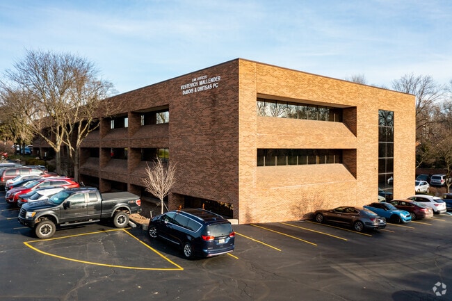
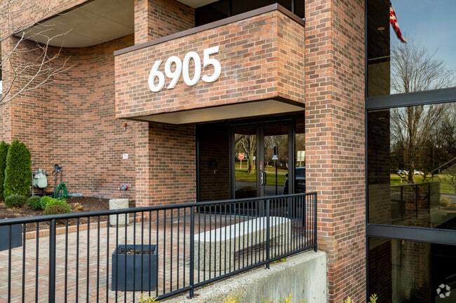
Property Record
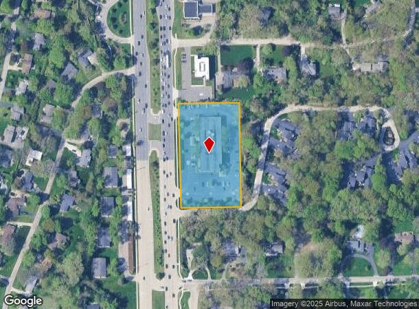
6905 Telegraph Rd, Bloomfield Hills, MI 48301
Current Lease Availabilities
NEARBY LISTINGS FOR SALE OR LEASE
Property Detail
6905 Telegraph Rd
19-33-152-010
Alexander Place Subdivision
Officebuilding
T2N, R10E, SEC 33 PART OF SW 1/4 OF NW 1/4 BEG AT PT DIST S 88-40-52 E 88.45 FT & N 01-12-58 E 60 FT FROM W 1/4 COR, TH N
X
Oakland
26125C0516F
Michigan
2024
2.55 AC
2025
Birmingham
150900
Detroit
56,181 SF
Detroit-Warren-Dearborn, MI
DEMOGRAPHICS near 6905 Telegraph Rd
1 Mile
3 Mile
5 Mile
2024 Total Population
5,568
50,753
178,972
2029 Population
5,524
50,226
177,511
Pop Growth 2024-2029
(0.79%)
(1.04%)
(0.82%)
Average Age
46
44
44
2024 Total Households
2,178
19,485
74,470
HH Growth 2024-2029
(0.73%)
(1.08%)
(0.77%)
Median Household Inc
$128,199
$141,038
$107,289
Avg Household Size
2.50
2.60
2.30
2024 Avg HH Vehicles
2.00
2.00
2.00
Median Home Value
$575,794
$568,970
$398,389
Median Year Built
1966
1966
1968
Nearby Places
Map Layers
Map Styles
 Street
 Aerial
- Restaurants
- Banks
- Shops
- Fitness
- Groceries
PUBLIC TRANSPORTATION
COMMUTER RAIL
DRIVE
WALK
Distance
14 min
5.6 mi
DRIVE
WALK
Distance
14 min
7.5 mi
AIRPORT
Windsor International
DRIVE
WALK
Distance
Windsor International
53 min
31.0 mi
Detroit Metro Wayne County
DRIVE
WALK
Distance
Detroit Metro Wayne County
48 min
31.8 mi
Nearby Properties
Address
Land Use
TOTAL SIZE
Lot Size
Zoning
Address
Land Use
TOTAL SIZE
Lot Size
Zoning
544,945 SF
23.89 AC
BI
Address
Land Use
TOTAL SIZE
Lot Size
Zoning
439,171 SF
28.57 AC
RMM
Address
Land Use
TOTAL SIZE
Lot Size
Zoning
167,882 SF
16.18 AC
BI
Address
Land Use
TOTAL SIZE
Lot Size
Zoning
233,598 SF
17.24 AC
RS
Address
Land Use
TOTAL SIZE
Lot Size
Zoning
367,101 SF
37.77 AC
R-E
Address
Land Use
TOTAL SIZE
Lot Size
Zoning
246,695 SF
18.46 AC
BI
Address
Land Use
TOTAL SIZE
Lot Size
Zoning
255,136 SF
21.19 AC
AI
Address
Land Use
TOTAL SIZE
Lot Size
Zoning
63,550 SF
4.18 AC
AI
Address
Land Use
TOTAL SIZE
Lot Size
Zoning
306,250 SF
14.60 AC
RC
Address
Land Use
TOTAL SIZE
Lot Size
Zoning
280,984 SF
11.88 AC
ERO-M
Address
Land Use
TOTAL SIZE
Lot Size
Zoning
96,774 SF
6.34 AC
BI
Address
Land Use
TOTAL SIZE
Lot Size
Zoning
218,023 SF
21.80 AC
AI
Address
Land Use
TOTAL SIZE
Lot Size
Zoning
257,000 SF
10.56 AC
RC
Address
Land Use
TOTAL SIZE
Lot Size
Zoning
12.70 AC
RS
Address
Land Use
TOTAL SIZE
Lot Size
Zoning
37,006 SF
5.12 AC
B-3
Address
Land Use
TOTAL SIZE
Lot Size
Zoning
289,820 SF
20.40 AC
RM
Address
Land Use
TOTAL SIZE
Lot Size
Zoning
87,062 SF
8.74 AC
R-4
Address
Land Use
TOTAL SIZE
Lot Size
Zoning
158 SF
17.44 AC
RM
Address
Land Use
TOTAL SIZE
Lot Size
Zoning
190,413 SF
10.49 AC
RS
Address
Land Use
TOTAL SIZE
Lot Size
Zoning
246,976 SF
13.20 AC
RC
Address
Land Use
TOTAL SIZE
Lot Size
Zoning
491,000 SF
11.62 AC
RC
Address
Land Use
TOTAL SIZE
Lot Size
Zoning
67,645 SF
6.17 AC
BI
Address
Land Use
TOTAL SIZE
Lot Size
Zoning
71,588 SF
3.72 AC
BI
Address
Land Use
TOTAL SIZE
Lot Size
Zoning
173,754 SF
9.22 AC
RMM
Address
Land Use
TOTAL SIZE
Lot Size
Zoning
80,884 SF
6.81 AC
B-3
Address
Land Use
TOTAL SIZE
Lot Size
Zoning
60,603 SF
6.52 AC
BI
Address
Land Use
TOTAL SIZE
Lot Size
Zoning
46,288 SF
155.56 AC
MM
Address
Land Use
TOTAL SIZE
Lot Size
Zoning
143,825 SF
10.21 AC
RC
Address
Land Use
TOTAL SIZE
Lot Size
Zoning
176,141 SF
6.41 AC
BI
Address
Land Use
TOTAL SIZE
Lot Size
Zoning
176,052 SF
6.43 AC
BI
The World's #1 Commercial Real Estate Marketplace
Connect with us
© 2026 CoStar Group
The information above has been obtained from sources believed reliable. While we do not doubt its accuracy we have not verified it and make no guarantee, warranty or representation about it. It is your responsibility to independently confirm its accuracy and completeness. Any projections, opinions, assumptions, or estimates used are for example only and do not represent the current or future performance of the property. The value of this transaction to you depends on tax and other factors which should be evaluated by your tax, financial, and legal advisors. You and your advisors should conduct a careful, independent investigation of the property to determine to your satisfaction the suitability of the property for your needs.