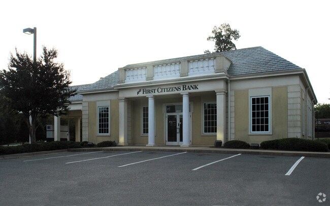
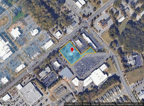
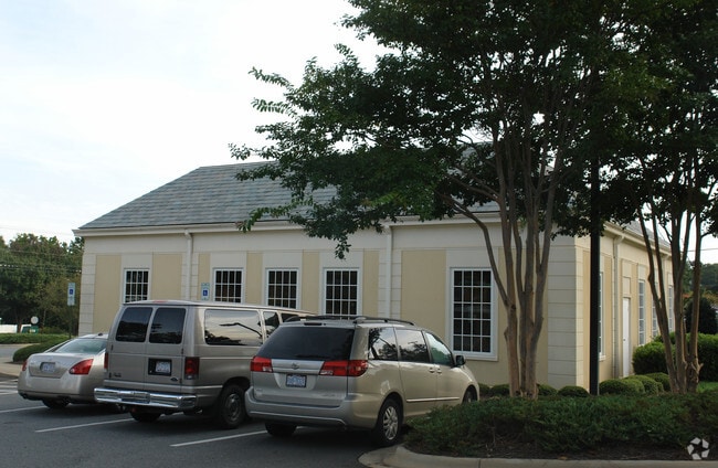
Property Record
6908 Matthews Mint Hill Rd, Mint Hill, NC 28227
NEARBY LISTINGS FOR SALE OR LEASE
-
-
View all Mint Hill listings for sale on LoopNet.com
Property Detail
6908 Matthews Mint Hill Rd
195-182-36
Mecklenburg
Commercialnec
North Carolina
X
36
3710550200K
1.48 AC
0
East
2025
Charlotte
005713
Charlotte-Concord-Gastonia, NC-SC
2,428 SF
DEMOGRAPHICS near 6908 Matthews Mint Hill Rd
1 Mile
3 Mile
5 Mile
2024 Total Population
4,260
35,027
126,018
2029 Population
4,503
37,147
134,222
Pop Growth 2024-2029
+ 5.70%
+ 6.05%
+ 6.51%
Average Age
44
42
39
2024 Total Households
1,603
12,742
46,414
HH Growth 2024-2029
+ 5.68%
+ 6.07%
+ 6.51%
Median Household Inc
$90,590
$87,279
$69,434
Avg Household Size
2.60
2.70
2.70
2024 Avg HH Vehicles
2.00
2.00
2.00
Median Home Value
$368,359
$354,091
$288,105
Median Year Built
1999
1990
1991
Nearby Places
Map Layers
Map Styles
 Street
 Aerial
- Restaurants
- Banks
- Shops
- Fitness
- Groceries
PUBLIC TRANSPORTATION
AIRPORT
Concord-Padgett Regional
DRIVE
WALK
Distance
Concord-Padgett Regional
26 min
19.0 mi
Charlotte/Douglas International
DRIVE
WALK
Distance
Charlotte/Douglas International
36 min
19.7 mi
Nearby Properties
Address
Land Use
TOTAL SIZE
Lot Size
Zoning
Address
Land Use
TOTAL SIZE
Lot Size
Zoning
539,702 SF
83.70 AC
I
Address
Land Use
TOTAL SIZE
Lot Size
Zoning
258,047 SF
64.31 AC
I-CUD
Address
Land Use
TOTAL SIZE
Lot Size
Zoning
205,701 SF
13.73 AC
OACUD
Address
Land Use
TOTAL SIZE
Lot Size
Zoning
78,372 SF
14.08 AC
IGCUD
Address
Land Use
TOTAL SIZE
Lot Size
Zoning
112,203 SF
6.80 AC
R
Address
Land Use
TOTAL SIZE
Lot Size
Zoning
96,660 SF
8.44 AC
BGCUD
Address
Land Use
TOTAL SIZE
Lot Size
Zoning
86,432 SF
20.01 AC
I
Address
Land Use
TOTAL SIZE
Lot Size
Zoning
40,890 SF
2.92 AC
O-A DO-B(C
Address
Land Use
TOTAL SIZE
Lot Size
Zoning
80,888 SF
8.20 AC
Address
Land Use
TOTAL SIZE
Lot Size
Zoning
77,438 SF
4.26 AC
BD
Address
Land Use
TOTAL SIZE
Lot Size
Zoning
36,480 SF
12.21 AC
NRD STALLI
Address
Land Use
TOTAL SIZE
Lot Size
Zoning
67,080 SF
7.99 AC
Address
Land Use
TOTAL SIZE
Lot Size
Zoning
72,768 SF
5.08 AC
OACUD
Address
Land Use
TOTAL SIZE
Lot Size
Zoning
77,876 SF
26.47 AC
R
Address
Land Use
TOTAL SIZE
Lot Size
Zoning
45,974 SF
9.85 AC
O-A DO-B(C
Address
Land Use
TOTAL SIZE
Lot Size
Zoning
65,097 SF
8.01 AC
NS
Address
Land Use
TOTAL SIZE
Lot Size
Zoning
73,255 SF
13.35 AC
R
Address
Land Use
TOTAL SIZE
Lot Size
Zoning
60,402 SF
10.46 AC
BP
Address
Land Use
TOTAL SIZE
Lot Size
Zoning
34,114 SF
8.50 AC
R(CD)
Address
Land Use
TOTAL SIZE
Lot Size
Zoning
18.70 AC
R
Address
Land Use
TOTAL SIZE
Lot Size
Zoning
54,876 SF
6.35 AC
R
Address
Land Use
TOTAL SIZE
Lot Size
Zoning
95,075 SF
6.10 AC
R17MF
Address
Land Use
TOTAL SIZE
Lot Size
Zoning
50,431 SF
5.17 AC
BPCUD
Address
Land Use
TOTAL SIZE
Lot Size
Zoning
36,214 SF
31.65 AC
R
Address
Land Use
TOTAL SIZE
Lot Size
Zoning
75.94 AC
R-15
Address
Land Use
TOTAL SIZE
Lot Size
Zoning
30,966 SF
2.97 AC
BPCUD
Address
Land Use
TOTAL SIZE
Lot Size
Zoning
21,001 SF
20.22 AC
R
Address
Land Use
TOTAL SIZE
Lot Size
Zoning
54,308 SF
7.54 AC
BPCUD
Address
Land Use
TOTAL SIZE
Lot Size
Zoning
20,808 SF
1.56 AC
B-D DO-B
Address
Land Use
TOTAL SIZE
Lot Size
Zoning
44,478 SF
5.41 AC
B-P(CD)
The World's #1 Commercial Real Estate Marketplace
Connect with us
© 2025 CoStar Group
The information above has been obtained from sources believed reliable. While we do not doubt its accuracy we have not verified it and make no guarantee, warranty or representation about it. It is your responsibility to independently confirm its accuracy and completeness. Any projections, opinions, assumptions, or estimates used are for example only and do not represent the current or future performance of the property. The value of this transaction to you depends on tax and other factors which should be evaluated by your tax, financial, and legal advisors. You and your advisors should conduct a careful, independent investigation of the property to determine to your satisfaction the suitability of the property for your needs.