Property Record
690A County Road 690A, Freeport, TX 77541


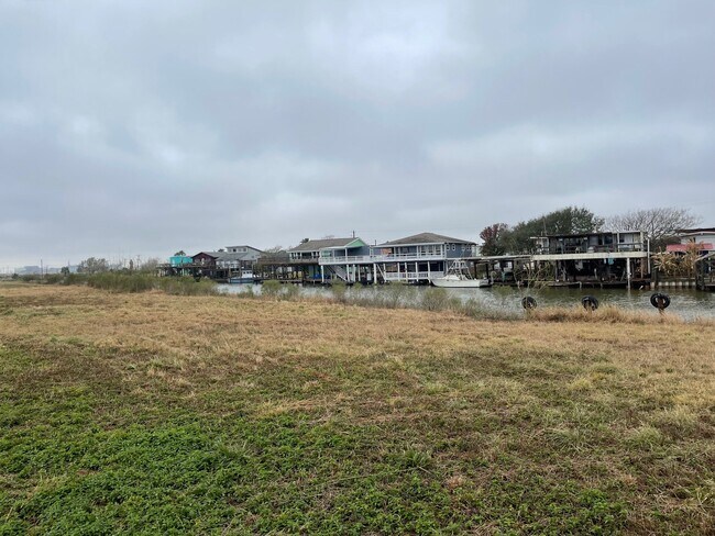
Property Detail
690A County Road 690A
Houston-Pasadena-The Woodlands, TX
B C I C DIV 9 (A0051 F J CALVIT) LOT 120 ACRES 5.
2109-0076-000
BRAZORIA
Vacantlandnec
Texas
1080
120
AE The base floodplain where base flood elevations are provided. AE Zones are now used on new format FIRMs instead of A1-A30 Zones.
5 AC
2024
South Hwy 35
2025
Houston
664200
NEARBY LISTINGS FOR SALE OR LEASE
-
-
View all Freeport listings for sale on LoopNet.com
DEMOGRAPHICS near 690A County Road 690A
1 mile
3 mile
5 mile
2025 Total Population
723
2,616
13,651
2030 Population
837
3,019
15,569
Pop Growth 2025-2030
+ 15.77%
+ 15.41%
+ 14.05%
Average Age
45
43
40
2025 Total Households
314
1,111
5,194
HH Growth 2025-2030
+ 15.92%
+ 15.66%
+ 14.94%
Median Household Inc
$65,500
$58,834
$52,630
Avg Household Size
2.30
2.40
2.60
2025 Avg HH Vehicles
2.00
2.00
2.00
Median Home Value
$271,211
$230,671
$216,959
Median Year Built
1996
1995
1979
Nearby Places
Map Layers
Map Styles
 Street
 Aerial
Layers
 Traffic
 Biking
Places
Listings with unknown addresses are not visible on the map
- Restaurants
- Banks
- Shops
- Fitness
- Groceries
Nearby Properties
Address
Land Use
TOTAL SIZE
Lot Size
Zoning
Address
Land Use
TOTAL SIZE
Lot Size
Zoning
33.09 AC
0050
Address
Land Use
TOTAL SIZE
Lot Size
Zoning
Address
Land Use
TOTAL SIZE
Lot Size
Zoning
56,600 SF
5 AC
0010
Address
Land Use
TOTAL SIZE
Lot Size
Zoning
1,661.99 AC
Address
Land Use
TOTAL SIZE
Lot Size
Zoning
60,536 SF
5 AC
0520
Address
Land Use
TOTAL SIZE
Lot Size
Zoning
1,079.82 AC
0001
Address
Land Use
TOTAL SIZE
Lot Size
Zoning
930.22 AC
0035
Address
Land Use
TOTAL SIZE
Lot Size
Zoning
41,504 SF
2.83 AC
1100
Address
Land Use
TOTAL SIZE
Lot Size
Zoning
25,400 SF
Address
Land Use
TOTAL SIZE
Lot Size
Zoning
29,466 SF
11.19 AC
0261
Address
Land Use
TOTAL SIZE
Lot Size
Zoning
5,025 SF
7.36 AC
0010
Address
Land Use
TOTAL SIZE
Lot Size
Zoning
556.91 AC
0025
Address
Land Use
TOTAL SIZE
Lot Size
Zoning
13,560 SF
11.27 AC
Address
Land Use
TOTAL SIZE
Lot Size
Zoning
32,533 SF
1.68 AC
0500
Address
Land Use
TOTAL SIZE
Lot Size
Zoning
9,640 SF
3.41 AC
Address
Land Use
TOTAL SIZE
Lot Size
Zoning
58,256 SF
8.17 AC
0555
Address
Land Use
TOTAL SIZE
Lot Size
Zoning
6,032 SF
14.82 AC
0009
Address
Land Use
TOTAL SIZE
Lot Size
Zoning
517.62 AC
0029
Address
Land Use
TOTAL SIZE
Lot Size
Zoning
305.67 AC
Address
Land Use
TOTAL SIZE
Lot Size
Zoning
7,140 SF
0.42 AC
Address
Land Use
TOTAL SIZE
Lot Size
Zoning
22,160 SF
1.92 AC
1170
Address
Land Use
TOTAL SIZE
Lot Size
Zoning
20,217 SF
3.69 AC
Address
Land Use
TOTAL SIZE
Lot Size
Zoning
18,950 SF
17.77 AC
0165
Address
Land Use
TOTAL SIZE
Lot Size
Zoning
8,742 SF
1.10 AC
0029
Address
Land Use
TOTAL SIZE
Lot Size
Zoning
1,784 SF
12.57 AC
0008
Address
Land Use
TOTAL SIZE
Lot Size
Zoning
22,000 SF
4.27 AC
Address
Land Use
TOTAL SIZE
Lot Size
Zoning
6,550 SF
2.68 AC
Address
Land Use
TOTAL SIZE
Lot Size
Zoning
2,226 SF
3.64 AC
Address
Land Use
TOTAL SIZE
Lot Size
Zoning
24.76 AC
0150
Address
Land Use
TOTAL SIZE
Lot Size
Zoning
19,980 SF
4.55 AC
0090
The World's #1 Commercial Real Estate Marketplace
Connect with us
© 2026 CoStar Group
The information above has been obtained from sources believed reliable. While we do not doubt its accuracy we have not verified it and make no guarantee, warranty or representation about it. It is your responsibility to independently confirm its accuracy and completeness. Any projections, opinions, assumptions, or estimates used are for example only and do not represent the current or future performance of the property. The value of this transaction to you depends on tax and other factors which should be evaluated by your tax, financial, and legal advisors. You and your advisors should conduct a careful, independent investigation of the property to determine to your satisfaction the suitability of the property for your needs.