Property Record
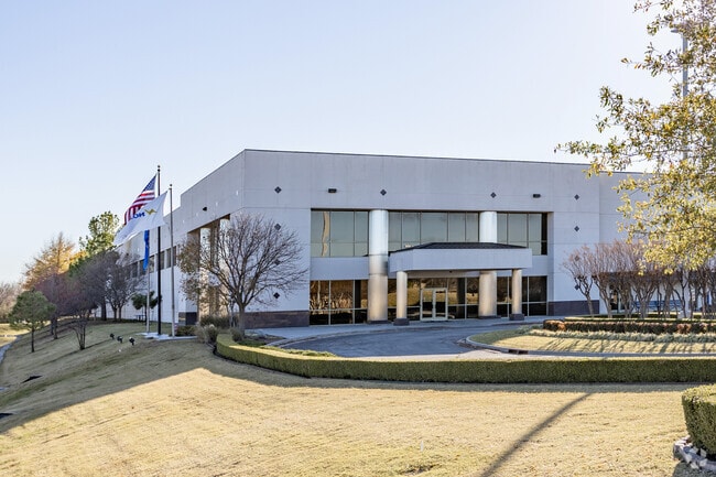
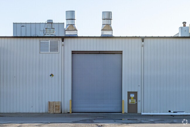
6910 N Whirlpool Dr, Tulsa, OK 74117
NEARBY LISTINGS FOR SALE OR LEASE
Property Detail
6910 N Whirlpool Dr
91333-13-33-57910
Unplatted
Lightindustrial
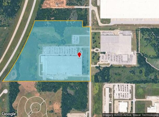
PRT N/2 SE & PRT S/2 NE BEG NEC SE TH S1320.29 W2134.43 TO PT ON EL HWY 75 ROW NE257.89 NE ON CRV LF1417.04 TO PT IN S/2 NE E1147.06 S148.33 TO PT ON SL NE & NL SE E200 POB SEC 33 21 13 56.419ACS
X
Tulsa
40143C0120L
Oklahoma
2025
56.42 AC
2025
Northeast Tulsa
005808
Tulsa
473,599 SF
Tulsa, OK
DEMOGRAPHICS near 6910 N Whirlpool Dr
1 Mile
3 Mile
5 Mile
2024 Total Population
81
7,463
46,728
2029 Population
85
7,878
48,924
Pop Growth 2024-2029
+ 4.94%
+ 5.56%
+ 4.70%
Average Age
41
39
37
2024 Total Households
30
2,707
17,192
HH Growth 2024-2029
+ 3.33%
+ 5.65%
+ 4.71%
Median Household Inc
$72,499
$60,882
$45,505
Avg Household Size
2.60
2.70
2.60
2024 Avg HH Vehicles
2.00
2.00
2.00
Median Home Value
$242,857
$226,428
$130,850
Median Year Built
1997
1986
1973
Nearby Places
Map Layers
Map Styles
 Street
 Aerial
- Restaurants
- Banks
- Shops
- Fitness
- Groceries
PUBLIC TRANSPORTATION
AIRPORT
Tulsa International
DRIVE
WALK
Distance
Tulsa International
15 min
8.5 mi
Freight Ports
Tulsa Port Of Catoosa
DRIVE
WALK
Distance
Tulsa Port Of Catoosa
22 min
14.1 mi
Nearby Properties
Address
Land Use
TOTAL SIZE
Lot Size
Zoning
Address
Land Use
TOTAL SIZE
Lot Size
Zoning
3,235,512 SF
71.56 AC
IM
Address
Land Use
TOTAL SIZE
Lot Size
Zoning
873,896 SF
50 AC
IM
Address
Land Use
TOTAL SIZE
Lot Size
Zoning
209,620 SF
19.59 AC
IM
Address
Land Use
TOTAL SIZE
Lot Size
Zoning
429,912 SF
59.57 AC
IM
Address
Land Use
TOTAL SIZE
Lot Size
Zoning
65,354 SF
41.54 AC
AG
Address
Land Use
TOTAL SIZE
Lot Size
Zoning
63,108 SF
33.82 AC
AG
Address
Land Use
TOTAL SIZE
Lot Size
Zoning
457,823 SF
25.72 AC
IM
Address
Land Use
TOTAL SIZE
Lot Size
Zoning
67,909 SF
48.73 AC
IM
Address
Land Use
TOTAL SIZE
Lot Size
Zoning
16,196 SF
9.73 AC
IL
Address
Land Use
TOTAL SIZE
Lot Size
Zoning
859,108 SF
86.24 AC
IM
Address
Land Use
TOTAL SIZE
Lot Size
Zoning
229,485 SF
16.77 AC
IM
Address
Land Use
TOTAL SIZE
Lot Size
Zoning
32,300 SF
20.88 AC
NCU
Address
Land Use
TOTAL SIZE
Lot Size
Zoning
133,467 SF
11.37 AC
CS
Address
Land Use
TOTAL SIZE
Lot Size
Zoning
5,670 SF
96.05 AC
AG
Address
Land Use
TOTAL SIZE
Lot Size
Zoning
419,821 SF
38.38 AC
IM
Address
Land Use
TOTAL SIZE
Lot Size
Zoning
29,065 SF
111.30 AC
RS
Address
Land Use
TOTAL SIZE
Lot Size
Zoning
61.50 AC
Address
Land Use
TOTAL SIZE
Lot Size
Zoning
6,800 SF
347.73 AC
RS3
Address
Land Use
TOTAL SIZE
Lot Size
Zoning
9,566 SF
8.26 AC
IL
Address
Land Use
TOTAL SIZE
Lot Size
Zoning
137,320 SF
40.12 AC
IM
Address
Land Use
TOTAL SIZE
Lot Size
Zoning
83,000 SF
10.51 AC
IM
Address
Land Use
TOTAL SIZE
Lot Size
Zoning
175,614 SF
33.58 AC
IM
Address
Land Use
TOTAL SIZE
Lot Size
Zoning
1 SF
228.69 AC
AG
Address
Land Use
TOTAL SIZE
Lot Size
Zoning
14,836 SF
9.39 AC
AGR
Address
Land Use
TOTAL SIZE
Lot Size
Zoning
85,489 SF
17.99 AC
IM
Address
Land Use
TOTAL SIZE
Lot Size
Zoning
13.64 AC
O
Address
Land Use
TOTAL SIZE
Lot Size
Zoning
1,200 SF
38.79 AC
AG
Address
Land Use
TOTAL SIZE
Lot Size
Zoning
136,660 SF
29.88 AC
IM
Address
Land Use
TOTAL SIZE
Lot Size
Zoning
108,900 SF
9.84 AC
IM
The World's #1 Commercial Real Estate Marketplace
Connect with us
© 2025 CoStar Group
The information above has been obtained from sources believed reliable. While we do not doubt its accuracy we have not verified it and make no guarantee, warranty or representation about it. It is your responsibility to independently confirm its accuracy and completeness. Any projections, opinions, assumptions, or estimates used are for example only and do not represent the current or future performance of the property. The value of this transaction to you depends on tax and other factors which should be evaluated by your tax, financial, and legal advisors. You and your advisors should conduct a careful, independent investigation of the property to determine to your satisfaction the suitability of the property for your needs.