Property Record
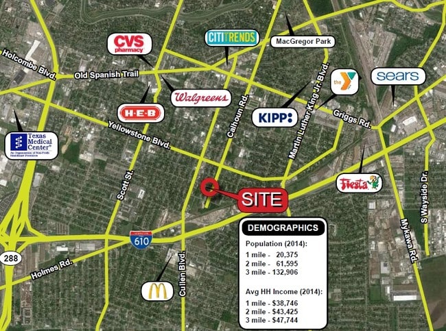
6912 Calhoun Rd, Houston, TX 77021

This Property Is For Sale
Current Lease Availabilities
Property Detail
6912 Calhoun Rd
Houston-Pasadena-The Woodlands, TX
LTS 18 19 20 21 & TR 22 BLK D GRAND PARK ANNEX
0581580000018
HARRIS
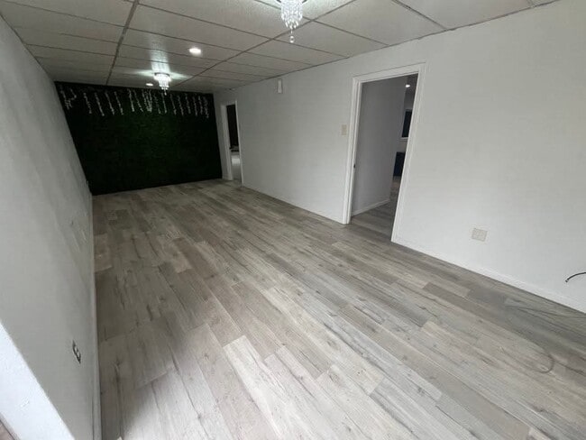
Warehouse
Texas
B and X Area of moderate flood hazard, usually the area between the limits of the 100-year and 500-year floods.
18
2024
0.50 AC
2025
South Inner Loop
313500
Houston
14,596 SF
NEARBY LISTINGS FOR SALE OR LEASE
DEMOGRAPHICS near 6912 Calhoun Rd
1 mile
3 mile
5 mile
2025 Total Population
20,345
154,786
420,191
2030 Population
21,975
166,834
453,664
Pop Growth 2025-2030
+ 8.01%
+ 7.78%
+ 7.97%
Average Age
37
36
37
2025 Total Households
7,186
58,671
173,269
HH Growth 2025-2030
+ 8.20%
+ 8.46%
+ 8.51%
Median Household Inc
$33,365
$47,837
$63,331
Avg Household Size
2.70
2.40
2.30
2025 Avg HH Vehicles
1.00
1.00
1.00
Median Home Value
$164,379
$206,654
$286,815
Median Year Built
1962
1974
1980
Nearby Places
Map Layers
Map Styles
 Street
 Aerial
Transit
 Traffic
 Biking
Places
Listings with unknown addresses are not visible on the map
- Restaurants
- Banks
- Shops
- Fitness
- Groceries
PUBLIC TRANSPORTATION
COMMUTER RAIL
Drive
Walk
Distance
14 min
8.0 mi
AIRPORT
William P Hobby
Drive
Walk
Distance
William P Hobby
21 min
9.3 mi
George Bush Intcntl/Houston
Drive
Walk
Distance
George Bush Intcntl/Houston
36 min
25.2 mi
Freight Ports
Port of Houston
Drive
Walk
Distance
Port of Houston
18 min
9.1 mi
Nearby Properties
Address
Land Use
TOTAL SIZE
Lot Size
Zoning
Address
Land Use
TOTAL SIZE
Lot Size
Zoning
1,359,194 SF
Address
Land Use
TOTAL SIZE
Lot Size
Zoning
577,327 SF
28.80 AC
Address
Land Use
TOTAL SIZE
Lot Size
Zoning
396,888 SF
2.02 AC
Address
Land Use
TOTAL SIZE
Lot Size
Zoning
486,076 SF
3.79 AC
Address
Land Use
TOTAL SIZE
Lot Size
Zoning
453,987 SF
4.33 AC
Address
Land Use
TOTAL SIZE
Lot Size
Zoning
527,457 SF
6.21 AC
Address
Land Use
TOTAL SIZE
Lot Size
Zoning
706,892 SF
5.86 AC
Address
Land Use
TOTAL SIZE
Lot Size
Zoning
557,397 SF
5.58 AC
Address
Land Use
TOTAL SIZE
Lot Size
Zoning
372,028 SF
26.56 AC
Address
Land Use
TOTAL SIZE
Lot Size
Zoning
643,698 SF
6.57 AC
Address
Land Use
TOTAL SIZE
Lot Size
Zoning
365,485 SF
13.94 AC
Address
Land Use
TOTAL SIZE
Lot Size
Zoning
397,924 SF
3.64 AC
Address
Land Use
TOTAL SIZE
Lot Size
Zoning
257,963 SF
6.39 AC
Address
Land Use
TOTAL SIZE
Lot Size
Zoning
518,025 SF
18.09 AC
Address
Land Use
TOTAL SIZE
Lot Size
Zoning
474,970 SF
6.95 AC
Address
Land Use
TOTAL SIZE
Lot Size
Zoning
460,438 SF
3.37 AC
Address
Land Use
TOTAL SIZE
Lot Size
Zoning
542,367 SF
18.58 AC
Address
Land Use
TOTAL SIZE
Lot Size
Zoning
476,754 SF
4.14 AC
Address
Land Use
TOTAL SIZE
Lot Size
Zoning
378,704 SF
4.24 AC
Address
Land Use
TOTAL SIZE
Lot Size
Zoning
370,098 SF
4.22 AC
Address
Land Use
TOTAL SIZE
Lot Size
Zoning
278,362 SF
1.70 AC
Address
Land Use
TOTAL SIZE
Lot Size
Zoning
159,235 SF
1.49 AC
Address
Land Use
TOTAL SIZE
Lot Size
Zoning
310,171 SF
2.35 AC
Address
Land Use
TOTAL SIZE
Lot Size
Zoning
204,180 SF
1.02 AC
Address
Land Use
TOTAL SIZE
Lot Size
Zoning
757,830 SF
31.03 AC
Address
Land Use
TOTAL SIZE
Lot Size
Zoning
261,482 SF
11.62 AC
Address
Land Use
TOTAL SIZE
Lot Size
Zoning
245,307 SF
1.67 AC
Address
Land Use
TOTAL SIZE
Lot Size
Zoning
358,709 SF
2.66 AC
Address
Land Use
TOTAL SIZE
Lot Size
Zoning
389,108 SF
37.39 AC
Address
Land Use
TOTAL SIZE
Lot Size
Zoning
210,000 SF
7.33 AC
The World's #1 Commercial Real Estate Marketplace
Connect with us
© 2026 CoStar Group
The information above has been obtained from sources believed reliable. While we do not doubt its accuracy we have not verified it and make no guarantee, warranty or representation about it. It is your responsibility to independently confirm its accuracy and completeness. Any projections, opinions, assumptions, or estimates used are for example only and do not represent the current or future performance of the property. The value of this transaction to you depends on tax and other factors which should be evaluated by your tax, financial, and legal advisors. You and your advisors should conduct a careful, independent investigation of the property to determine to your satisfaction the suitability of the property for your needs.