Property Record
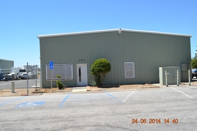
6915 Sycamore Rd, Atascadero, CA 93422


Property Detail
6915 Sycamore Rd
San Luis Obispo-Paso Robles, CA
CY ATAS ATAS PM 24/100 PAR A
028-131-029
San Luis Obispo
Lightindustrial
California
IP
a
AE The base floodplain where base flood elevations are provided. AE Zones are now used on new format FIRMs instead of A1-A30 Zones.
1.69 AC
2024
North 101 Corridor
2025
San Luis Obispo/Paso Robles
012502
NEARBY LISTINGS FOR SALE OR LEASE
DEMOGRAPHICS near 6915 Sycamore Rd
1 mile
3 mile
5 mile
2025 Total Population
3,506
22,633
33,354
2030 Population
3,428
22,208
32,707
Pop Growth 2025-2030
(2.22%)
(1.88%)
(1.94%)
Average Age
40
41
42
2025 Total Households
1,358
8,746
12,802
HH Growth 2025-2030
(2.58%)
(2.16%)
(2.23%)
Median Household Inc
$73,803
$91,111
$95,712
Avg Household Size
2.50
2.50
2.50
2025 Avg HH Vehicles
2.00
2.00
2.00
Median Home Value
$704,720
$713,496
$761,408
Median Year Built
1975
1977
1981
Nearby Places
Map Layers
Map Styles
 Street
 Aerial
Layers
 Traffic
 Biking
Places
Listings with unknown addresses are not visible on the map
- Restaurants
- Banks
- Shops
- Fitness
- Groceries
PUBLIC TRANSPORTATION
AIRPORT
San Luis County Regional
Drive
Walk
Distance
San Luis County Regional
37 min
24.7 mi
SALE & LEASE HISTORY
LISTING DATE
SALE/LEASE

Mar 19, 2019
For Lease
Feb 10, 2026
For Lease
Nearby Properties
Address
Land Use
TOTAL SIZE
Lot Size
Zoning
Address
Land Use
TOTAL SIZE
Lot Size
Zoning
1.78 AC
CPK
Address
Land Use
TOTAL SIZE
Lot Size
Zoning
57,534 SF
6.10 AC
CR
Address
Land Use
TOTAL SIZE
Lot Size
Zoning
54,912 SF
4 AC
MF20
Address
Land Use
TOTAL SIZE
Lot Size
Zoning
89,617 SF
6.97 AC
CPK
Address
Land Use
TOTAL SIZE
Lot Size
Zoning
1,468 SF
3.72 AC
MF20
Address
Land Use
TOTAL SIZE
Lot Size
Zoning
68,381 SF
3.40 AC
MF20
Address
Land Use
TOTAL SIZE
Lot Size
Zoning
49,652 SF
3.84 AC
CR
Address
Land Use
TOTAL SIZE
Lot Size
Zoning
18,800 SF
0.45 AC
DC
Address
Land Use
TOTAL SIZE
Lot Size
Zoning
39,765 SF
2.43 AC
CR
Address
Land Use
TOTAL SIZE
Lot Size
Zoning
7,114 SF
32.04 AC
AG
Address
Land Use
TOTAL SIZE
Lot Size
Zoning
14,932 SF
0.64 AC
DC
Address
Land Use
TOTAL SIZE
Lot Size
Zoning
2.94 AC
CR
Address
Land Use
TOTAL SIZE
Lot Size
Zoning
42,993 SF
1.72 AC
CR
Address
Land Use
TOTAL SIZE
Lot Size
Zoning
5.02 AC
MF20
Address
Land Use
TOTAL SIZE
Lot Size
Zoning
30,992 SF
2.05 AC
CT
Address
Land Use
TOTAL SIZE
Lot Size
Zoning
34,661 SF
1.57 AC
MF20
Address
Land Use
TOTAL SIZE
Lot Size
Zoning
15.05 AC
RSFY
Address
Land Use
TOTAL SIZE
Lot Size
Zoning
82,131 SF
2.95 AC
MF20
Address
Land Use
TOTAL SIZE
Lot Size
Zoning
0.91 AC
CP
Address
Land Use
TOTAL SIZE
Lot Size
Zoning
6.95 AC
MF20
Address
Land Use
TOTAL SIZE
Lot Size
Zoning
3.94 AC
CR
Address
Land Use
TOTAL SIZE
Lot Size
Zoning
Address
Land Use
TOTAL SIZE
Lot Size
Zoning
59,321 SF
3.92 AC
P
Address
Land Use
TOTAL SIZE
Lot Size
Zoning
18,000 SF
0.91 AC
CT
Address
Land Use
TOTAL SIZE
Lot Size
Zoning
2.33 AC
CR
Address
Land Use
TOTAL SIZE
Lot Size
Zoning
4.34 AC
MF20
Address
Land Use
TOTAL SIZE
Lot Size
Zoning
21,814 SF
33.47 AC
CR
Address
Land Use
TOTAL SIZE
Lot Size
Zoning
1.64 AC
CR
Address
Land Use
TOTAL SIZE
Lot Size
Zoning
17,161 SF
1.38 AC
CP
Address
Land Use
TOTAL SIZE
Lot Size
Zoning
69,680 SF
5.69 AC
CR
The World's #1 Commercial Real Estate Marketplace
Connect with us
© 2026 CoStar Group
The information above has been obtained from sources believed reliable. While we do not doubt its accuracy we have not verified it and make no guarantee, warranty or representation about it. It is your responsibility to independently confirm its accuracy and completeness. Any projections, opinions, assumptions, or estimates used are for example only and do not represent the current or future performance of the property. The value of this transaction to you depends on tax and other factors which should be evaluated by your tax, financial, and legal advisors. You and your advisors should conduct a careful, independent investigation of the property to determine to your satisfaction the suitability of the property for your needs.