Property Record
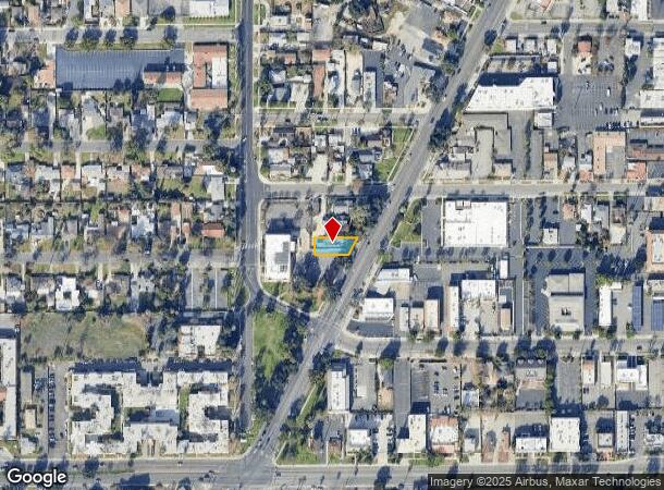
6919 Magnolia Ave, Riverside, CA 92506
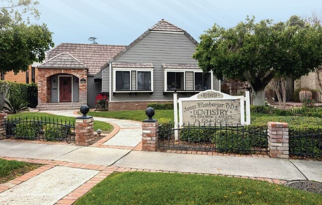
This Property Is For Sale
NEARBY LISTINGS FOR SALE OR LEASE
Property Detail
6919 Magnolia Ave
Riverside-San Bernardino-Ontario, CA
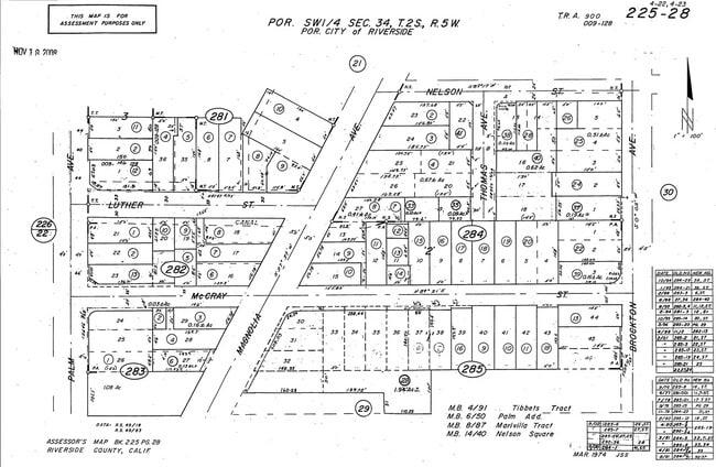
Palm Add
225-283-006
.13 ACRES M/L IN POR LOT 28 AND LOT 27 MB 006/050 PALM ADD
Storebuilding
Riverside
X
California
06065C0710H
28
2024
0.13 AC
2025
Riverside
031100
Inland Empire (California)
DEMOGRAPHICS near 6919 Magnolia Ave
1 Mile
3 Mile
5 Mile
2024 Total Population
18,938
109,128
284,512
2029 Population
20,038
114,812
299,129
Pop Growth 2024-2029
+ 5.81%
+ 5.21%
+ 5.14%
Average Age
37
37
36
2024 Total Households
6,127
33,446
83,803
HH Growth 2024-2029
+ 5.42%
+ 4.77%
+ 4.75%
Median Household Inc
$77,138
$79,655
$76,206
Avg Household Size
2.90
3.00
3.10
2024 Avg HH Vehicles
2.00
2.00
2.00
Median Home Value
$431,833
$456,423
$461,966
Median Year Built
1958
1964
1973
Nearby Places
- Restaurants
- Banks
- Shops
- Fitness
- Groceries
PUBLIC TRANSPORTATION
COMMUTER RAIL
Riverside-Downtown (91 Line - Southern California Regional Rail Authority (Metrolink), Inland Empire-Orange County Line - Southern California Regional Rail Authority (Metrolink), Riverside Line - Southern California Regional Rail Authority (Metrolink))
DRIVE
WALK
Distance
Riverside-Downtown (91 Line - Southern California Regional Rail Authority (Metrolink), Inland Empire-Orange County Line - Southern California Regional Rail Authority (Metrolink), Riverside Line - Southern California Regional Rail Authority (Metrolink))
7 min
3.4 mi
Pedley (Riverside Line - Southern California Regional Rail Authority (Metrolink))
DRIVE
WALK
Distance
Pedley (Riverside Line - Southern California Regional Rail Authority (Metrolink))
10 min
5.9 mi
AIRPORT
Ontario International
DRIVE
WALK
Distance
Ontario International
26 min
16.5 mi
Freight Ports
Port of Long Beach
DRIVE
WALK
Distance
Port of Long Beach
69 min
53.7 mi
Nearby Properties
Address
Land Use
TOTAL SIZE
Lot Size
Zoning
Address
Land Use
TOTAL SIZE
Lot Size
Zoning
412,950 SF
23.16 AC
C2
Address
Land Use
TOTAL SIZE
Lot Size
Zoning
247,416 SF
10.17 AC
Address
Land Use
TOTAL SIZE
Lot Size
Zoning
154,680 SF
3.13 AC
R1
Address
Land Use
TOTAL SIZE
Lot Size
Zoning
350,278 SF
1.21 AC
Address
Land Use
TOTAL SIZE
Lot Size
Zoning
32,830 SF
6.66 AC
Address
Land Use
TOTAL SIZE
Lot Size
Zoning
169,980 SF
10.51 AC
C3
Address
Land Use
TOTAL SIZE
Lot Size
Zoning
139,454 SF
0.97 AC
DSP
Address
Land Use
TOTAL SIZE
Lot Size
Zoning
37,729 SF
3.23 AC
Address
Land Use
TOTAL SIZE
Lot Size
Zoning
87,600 SF
0.39 AC
Address
Land Use
TOTAL SIZE
Lot Size
Zoning
129,739 SF
5.08 AC
Address
Land Use
TOTAL SIZE
Lot Size
Zoning
249,729 SF
15.60 AC
R3
Address
Land Use
TOTAL SIZE
Lot Size
Zoning
179,589 SF
18.62 AC
Address
Land Use
TOTAL SIZE
Lot Size
Zoning
8.75 AC
R1065
Address
Land Use
TOTAL SIZE
Lot Size
Zoning
14,068 SF
6.61 AC
R3
Address
Land Use
TOTAL SIZE
Lot Size
Zoning
127,770 SF
12.94 AC
Address
Land Use
TOTAL SIZE
Lot Size
Zoning
163,325 SF
6.42 AC
R1
Address
Land Use
TOTAL SIZE
Lot Size
Zoning
69,660 SF
0.62 AC
C3
Address
Land Use
TOTAL SIZE
Lot Size
Zoning
483,726 SF
3.47 AC
C2
Address
Land Use
TOTAL SIZE
Lot Size
Zoning
446,832 SF
5.03 AC
Address
Land Use
TOTAL SIZE
Lot Size
Zoning
110,680 SF
11.88 AC
MP
Address
Land Use
TOTAL SIZE
Lot Size
Zoning
125,169 SF
5 AC
C1
Address
Land Use
TOTAL SIZE
Lot Size
Zoning
83,572 SF
2.93 AC
Address
Land Use
TOTAL SIZE
Lot Size
Zoning
18,480 SF
7.19 AC
Address
Land Use
TOTAL SIZE
Lot Size
Zoning
156,688 SF
6.09 AC
BMP
Address
Land Use
TOTAL SIZE
Lot Size
Zoning
306,278 SF
2.50 AC
C3
Address
Land Use
TOTAL SIZE
Lot Size
Zoning
85,322 SF
0.48 AC
Address
Land Use
TOTAL SIZE
Lot Size
Zoning
40,024 SF
4.84 AC
The World's #1 Commercial Real Estate Marketplace
Connect with us
© 2025 CoStar Group
The information above has been obtained from sources believed reliable. While we do not doubt its accuracy we have not verified it and make no guarantee, warranty or representation about it. It is your responsibility to independently confirm its accuracy and completeness. Any projections, opinions, assumptions, or estimates used are for example only and do not represent the current or future performance of the property. The value of this transaction to you depends on tax and other factors which should be evaluated by your tax, financial, and legal advisors. You and your advisors should conduct a careful, independent investigation of the property to determine to your satisfaction the suitability of the property for your needs.