Property Record
6920 State Ave, Kansas City, KS 66102

NEARBY LISTINGS FOR SALE OR LEASE
Property Detail
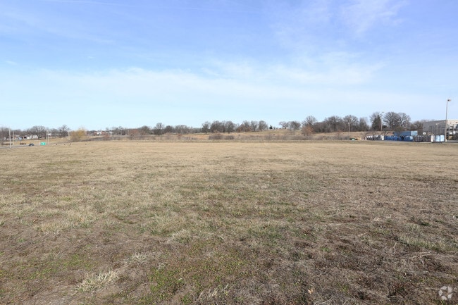
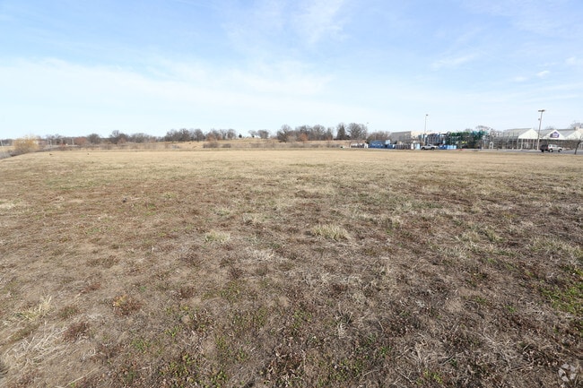
6920 State Ave
Kansas City, MO-KS
Lowes Sub
280200
LOWES SUB, S3, T11, R24, ACRES 14.66, L1
Storebuilding
Wyandotte
X
Kansas
20209C0151E
1
2025
14.62 AC
2025
Kansas City KS
044104
Kansas City
135,363 SF
DEMOGRAPHICS near 6920 State Ave
1 Mile
3 Mile
5 Mile
2024 Total Population
7,862
42,800
80,627
2029 Population
7,769
41,584
78,500
Pop Growth 2024-2029
(1.18%)
(2.84%)
(2.64%)
Average Age
37
38
37
2024 Total Households
3,140
16,189
28,954
HH Growth 2024-2029
(1.05%)
(2.87%)
(2.70%)
Median Household Inc
$39,343
$56,996
$57,104
Avg Household Size
2.40
2.50
2.70
2024 Avg HH Vehicles
1.00
2.00
2.00
Median Home Value
$150,074
$144,598
$138,749
Median Year Built
1973
1966
1961
Nearby Places
Map Layers
Map Styles
 Street
 Aerial
- Restaurants
- Banks
- Shops
- Fitness
- Groceries
PUBLIC TRANSPORTATION
AIRPORT
Kansas City International
DRIVE
WALK
Distance
Kansas City International
30 min
22.3 mi
Freight Ports
Tulsa Port Of Catoosa
DRIVE
WALK
Distance
Tulsa Port Of Catoosa
268 min
239.8 mi
SALE & LEASE HISTORY
LISTING DATE
SALE/LEASE

Feb 15, 2017
For Sale
Nearby Properties
Address
Land Use
TOTAL SIZE
Lot Size
Zoning
Address
Land Use
TOTAL SIZE
Lot Size
Zoning
872,064 SF
119.39 AC
Address
Land Use
TOTAL SIZE
Lot Size
Zoning
542,696 SF
28.12 AC
Address
Land Use
TOTAL SIZE
Lot Size
Zoning
264,254 SF
56.62 AC
KR1
Address
Land Use
TOTAL SIZE
Lot Size
Zoning
309,440 SF
120.73 AC
KR1
Address
Land Use
TOTAL SIZE
Lot Size
Zoning
346,224 SF
28.44 AC
Address
Land Use
TOTAL SIZE
Lot Size
Zoning
407,936 SF
37.46 AC
1
Address
Land Use
TOTAL SIZE
Lot Size
Zoning
108,385 SF
22.86 AC
KAG
Address
Land Use
TOTAL SIZE
Lot Size
Zoning
396,532 SF
31.98 AC
Address
Land Use
TOTAL SIZE
Lot Size
Zoning
241,816 SF
20.03 AC
Address
Land Use
TOTAL SIZE
Lot Size
Zoning
224,020 SF
24.72 AC
KR1
Address
Land Use
TOTAL SIZE
Lot Size
Zoning
88,396 SF
23.79 AC
Address
Land Use
TOTAL SIZE
Lot Size
Zoning
71,326 SF
6.31 AC
KR1
Address
Land Use
TOTAL SIZE
Lot Size
Zoning
48,278 SF
14.62 AC
Address
Land Use
TOTAL SIZE
Lot Size
Zoning
383,232 SF
15.93 AC
LU1
Address
Land Use
TOTAL SIZE
Lot Size
Zoning
54,578 SF
12.01 AC
KR1
Address
Land Use
TOTAL SIZE
Lot Size
Zoning
139,495 SF
35.01 AC
KR1
Address
Land Use
TOTAL SIZE
Lot Size
Zoning
158,011 SF
26.66 AC
Address
Land Use
TOTAL SIZE
Lot Size
Zoning
132,724 SF
20.84 AC
KC1
Address
Land Use
TOTAL SIZE
Lot Size
Zoning
62,068 SF
17.75 AC
KR1
Address
Land Use
TOTAL SIZE
Lot Size
Zoning
19,392 SF
2.77 AC
KCP1
Address
Land Use
TOTAL SIZE
Lot Size
Zoning
1,542 SF
48.61 AC
KR1
Address
Land Use
TOTAL SIZE
Lot Size
Zoning
239,205 SF
17.52 AC
Address
Land Use
TOTAL SIZE
Lot Size
Zoning
31,185 SF
4.72 AC
KC1
Address
Land Use
TOTAL SIZE
Lot Size
Zoning
39,588 SF
16.33 AC
KR1
Address
Land Use
TOTAL SIZE
Lot Size
Zoning
164,462 SF
23.15 AC
Address
Land Use
TOTAL SIZE
Lot Size
Zoning
43,922 SF
5.81 AC
Address
Land Use
TOTAL SIZE
Lot Size
Zoning
512,620 SF
23.85 AC
KM3
Address
Land Use
TOTAL SIZE
Lot Size
Zoning
9,700 SF
3.30 AC
KRP5
Address
Land Use
TOTAL SIZE
Lot Size
Zoning
97,100 SF
19.57 AC
KR1
Address
Land Use
TOTAL SIZE
Lot Size
Zoning
37,210 SF
7.50 AC
The World's #1 Commercial Real Estate Marketplace
Connect with us
© 2026 CoStar Group
The information above has been obtained from sources believed reliable. While we do not doubt its accuracy we have not verified it and make no guarantee, warranty or representation about it. It is your responsibility to independently confirm its accuracy and completeness. Any projections, opinions, assumptions, or estimates used are for example only and do not represent the current or future performance of the property. The value of this transaction to you depends on tax and other factors which should be evaluated by your tax, financial, and legal advisors. You and your advisors should conduct a careful, independent investigation of the property to determine to your satisfaction the suitability of the property for your needs.