Property Record
6920 Sw 92Nd Ave, Portland, OR 97223
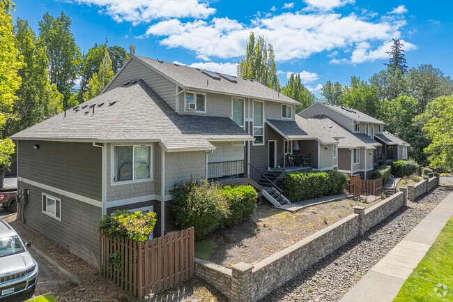

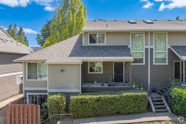
Property Detail
6920 Sw 92Nd Ave
R2161426
ACRES 2.62
Apartment
Washington
R-15
Oregon
AE The base floodplain where base flood elevations are provided. AE Zones are now used on new format FIRMs instead of A1-A30 Zones.
2.62 AC
2024
Raleigh Hills
2026
Portland
030501
Portland-Vancouver-Hillsboro, OR-WA
38,532 SF
NEARBY LISTINGS FOR SALE OR LEASE
DEMOGRAPHICS near 6920 Sw 92Nd Ave
1 mile
3 mile
5 mile
2025 Total Population
10,291
130,169
349,772
2030 Population
10,412
130,687
351,779
Pop Growth 2025-2030
+ 1.18%
+ 0.40%
+ 0.57%
Average Age
44
42
41
2025 Total Households
4,390
54,275
143,091
HH Growth 2025-2030
+ 1.14%
+ 0.46%
+ 0.60%
Median Household Inc
$92,382
$97,305
$106,353
Avg Household Size
2.20
2.30
2.40
2025 Avg HH Vehicles
2.00
2.00
2.00
Median Home Value
$706,659
$670,835
$692,298
Median Year Built
1972
1975
1981
Nearby Places
Map Layers
Map Styles
 Street
 Aerial
Layers
 Traffic
 Biking
Places
Listings with unknown addresses are not visible on the map
- Restaurants
- Banks
- Shops
- Fitness
- Groceries
PUBLIC TRANSPORTATION
COMMUTER RAIL
Hall/Nimbus (Westside Express Service - Tri-County Metropolitan Transportation District of Oregon Rail (TriMet Rail))
Drive
Walk
Distance
Hall/Nimbus (Westside Express Service - Tri-County Metropolitan Transportation District of Oregon Rail (TriMet Rail))
4 min
1.8 mi
Beaverton Transit Center (West Side Express) (Westside Express Service - Tri-County Metropolitan Transportation District of Oregon Rail (TriMet Rail))
Drive
Walk
Distance
Beaverton Transit Center (West Side Express) (Westside Express Service - Tri-County Metropolitan Transportation District of Oregon Rail (TriMet Rail))
7 min
2.5 mi
AIRPORT
Portland International
Drive
Walk
Distance
Portland International
35 min
20.1 mi
Nearby Properties
Address
Land Use
TOTAL SIZE
Lot Size
Zoning
Address
Land Use
TOTAL SIZE
Lot Size
Zoning
0.08 AC
IND
Address
Land Use
TOTAL SIZE
Lot Size
Zoning
828,566 SF
54.77 AC
CI2
Address
Land Use
TOTAL SIZE
Lot Size
Zoning
303,158 SF
18.18 AC
R10
Address
Land Use
TOTAL SIZE
Lot Size
Zoning
461,858 SF
36.37 AC
CS
Address
Land Use
TOTAL SIZE
Lot Size
Zoning
1,380,937 SF
36.42 AC
INST
Address
Land Use
TOTAL SIZE
Lot Size
Zoning
179,180 SF
36.77 AC
INST
Address
Land Use
TOTAL SIZE
Lot Size
Zoning
155,201 SF
4.04 AC
R7
Address
Land Use
TOTAL SIZE
Lot Size
Zoning
256,070 SF
32.39 AC
R7
Address
Land Use
TOTAL SIZE
Lot Size
Zoning
43,537 SF
3.59 AC
MUC
Address
Land Use
TOTAL SIZE
Lot Size
Zoning
234,391 SF
0.13 AC
CS
Address
Land Use
TOTAL SIZE
Lot Size
Zoning
37.55 AC
IND
Address
Land Use
TOTAL SIZE
Lot Size
Zoning
62,647 SF
9.65 AC
R7
Address
Land Use
TOTAL SIZE
Lot Size
Zoning
372,200 SF
34.75 AC
CS
Address
Land Use
TOTAL SIZE
Lot Size
Zoning
11,736 SF
2.85 AC
MUE-1
Address
Land Use
TOTAL SIZE
Lot Size
Zoning
285,650 SF
26.94 AC
INST
Address
Land Use
TOTAL SIZE
Lot Size
Zoning
423,095 SF
21.51 AC
R1
Address
Land Use
TOTAL SIZE
Lot Size
Zoning
270,237 SF
22.44 AC
R-15
Address
Land Use
TOTAL SIZE
Lot Size
Zoning
159,473 SF
12.58 AC
RC-BC
Address
Land Use
TOTAL SIZE
Lot Size
Zoning
128,176 SF
25.06 AC
R7
Address
Land Use
TOTAL SIZE
Lot Size
Zoning
4,046 SF
4.08 AC
MUE-1
Address
Land Use
TOTAL SIZE
Lot Size
Zoning
301,940 SF
15.04 AC
MU-CBD
Address
Land Use
TOTAL SIZE
Lot Size
Zoning
87,200 SF
8.81 AC
R7
Address
Land Use
TOTAL SIZE
Lot Size
Zoning
517,403 SF
3.21 AC
MUE-1
Address
Land Use
TOTAL SIZE
Lot Size
Zoning
18.78 AC
R-15
Address
Land Use
TOTAL SIZE
Lot Size
Zoning
140,938 SF
7.02 AC
C-WS
Address
Land Use
TOTAL SIZE
Lot Size
Zoning
262,880 SF
0.95 AC
CX
Address
Land Use
TOTAL SIZE
Lot Size
Zoning
3.88 AC
CS
Address
Land Use
TOTAL SIZE
Lot Size
Zoning
209,706 SF
4.89 AC
MUC
Address
Land Use
TOTAL SIZE
Lot Size
Zoning
157,885 SF
9.88 AC
R-25
Address
Land Use
TOTAL SIZE
Lot Size
Zoning
0.09 AC
OI-WS
The World's #1 Commercial Real Estate Marketplace
Connect with us
© 2026 CoStar Group
The information above has been obtained from sources believed reliable. While we do not doubt its accuracy we have not verified it and make no guarantee, warranty or representation about it. It is your responsibility to independently confirm its accuracy and completeness. Any projections, opinions, assumptions, or estimates used are for example only and do not represent the current or future performance of the property. The value of this transaction to you depends on tax and other factors which should be evaluated by your tax, financial, and legal advisors. You and your advisors should conduct a careful, independent investigation of the property to determine to your satisfaction the suitability of the property for your needs.