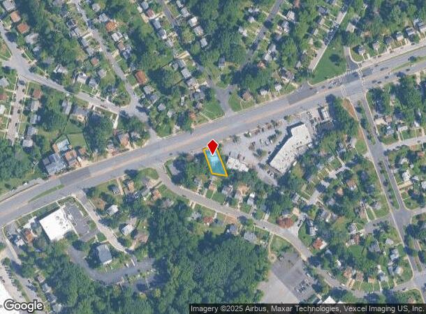
Property Record
6921 Annapolis Rd, Hyattsville, MD 20784


NEARBY LISTINGS FOR SALE OR LEASE
Property Detail
6921 Annapolis Rd
Washington-Arlington-Alexandria, DC-VA-MD-WV
Landover Hills Sec 5
02-0161281
LANDOVER HILLS
Commercialacreage
Prince George's
X
Maryland
24033C0134E
17
2024
0.17 AC
2025
Landover/Largo/Captl Hts
803700
Washington, DC
2,340 SF
DEMOGRAPHICS near 6921 Annapolis Rd
1 Mile
3 Mile
5 Mile
2024 Total Population
21,444
142,429
404,996
2029 Population
20,888
139,171
391,407
Pop Growth 2024-2029
(2.59%)
(2.29%)
(3.36%)
Average Age
37
37
38
2024 Total Households
6,518
45,319
138,896
HH Growth 2024-2029
(2.61%)
(2.38%)
(3.75%)
Median Household Inc
$77,052
$76,843
$74,243
Avg Household Size
3.20
3.10
2.70
2024 Avg HH Vehicles
2.00
2.00
2.00
Median Home Value
$314,842
$346,921
$373,178
Median Year Built
1962
1965
1967
Nearby Places
Map Layers
Map Styles
 Street
 Aerial
- Restaurants
- Banks
- Shops
- Fitness
- Groceries
PUBLIC TRANSPORTATION
COMMUTER RAIL
New Carrollton (PENN - WASHINGTON - Maryland Area Regional Commuter Trains (The MARC), Penn Line - Maryland Area Regional Commuter Trains (The MARC))
DRIVE
WALK
Distance
New Carrollton (PENN - WASHINGTON - Maryland Area Regional Commuter Trains (The MARC), Penn Line - Maryland Area Regional Commuter Trains (The MARC))
3 min
1.8 mi
New Carrollton Marc Nb (PENN - WASHINGTON - Maryland Transit Administration)
DRIVE
WALK
Distance
New Carrollton Marc Nb (PENN - WASHINGTON - Maryland Transit Administration)
3 min
1.8 mi
AIRPORT
Ronald Reagan Washington Ntl
DRIVE
WALK
Distance
Ronald Reagan Washington Ntl
23 min
13.6 mi
Baltimore/Washington International Thurgood Marshall
DRIVE
WALK
Distance
Baltimore/Washington International Thurgood Marshall
37 min
24.6 mi
Freight Ports
Port of Baltimore
DRIVE
WALK
Distance
Port of Baltimore
47 min
31.2 mi
Nearby Properties
Address
Land Use
TOTAL SIZE
Lot Size
Zoning
Address
Land Use
TOTAL SIZE
Lot Size
Zoning
1,631,415 SF
24.33 AC
RTOHC
Address
Land Use
TOTAL SIZE
Lot Size
Zoning
2,985,682 SF
4.33 AC
RSF65
Address
Land Use
TOTAL SIZE
Lot Size
Zoning
944,105 SF
23.09 AC
CGO
Address
Land Use
TOTAL SIZE
Lot Size
Zoning
413,915 SF
39.86 AC
IE
Address
Land Use
TOTAL SIZE
Lot Size
Zoning
393,700 SF
1.30 AC
RTOLC
Address
Land Use
TOTAL SIZE
Lot Size
Zoning
337,216 SF
1.18 AC
RTOHC
Address
Land Use
TOTAL SIZE
Lot Size
Zoning
821,240 SF
48.32 AC
IH
Address
Land Use
TOTAL SIZE
Lot Size
Zoning
337,500 SF
12.48 AC
RTOLE
Address
Land Use
TOTAL SIZE
Lot Size
Zoning
395,538 SF
9.89 AC
RTOLE
Address
Land Use
TOTAL SIZE
Lot Size
Zoning
1,082,460 SF
9.28 AC
RTOHC
Address
Land Use
TOTAL SIZE
Lot Size
Zoning
379,168 SF
18.94 AC
RMF20
Address
Land Use
TOTAL SIZE
Lot Size
Zoning
5.58 AC
RTOLC
Address
Land Use
TOTAL SIZE
Lot Size
Zoning
2.35 AC
RTOHC
Address
Land Use
TOTAL SIZE
Lot Size
Zoning
327,240 SF
1.72 AC
RTOHC
Address
Land Use
TOTAL SIZE
Lot Size
Zoning
10.63 AC
RMF20
Address
Land Use
TOTAL SIZE
Lot Size
Zoning
256,896 SF
34.96 AC
RSF65
Address
Land Use
TOTAL SIZE
Lot Size
Zoning
368,038 SF
12.87 AC
IE
Address
Land Use
TOTAL SIZE
Lot Size
Zoning
12,000 SF
1.47 AC
NAC
Address
Land Use
TOTAL SIZE
Lot Size
Zoning
216,000 SF
3.56 AC
LMUTC
Address
Land Use
TOTAL SIZE
Lot Size
Zoning
194,850 SF
8.90 AC
LTOE
Address
Land Use
TOTAL SIZE
Lot Size
Zoning
2.09 AC
RTOHC
Address
Land Use
TOTAL SIZE
Lot Size
Zoning
218,628 SF
1.45 AC
RTOHC
Address
Land Use
TOTAL SIZE
Lot Size
Zoning
300,000 SF
2.82 AC
RTOHC
Address
Land Use
TOTAL SIZE
Lot Size
Zoning
169,431 SF
43.81 AC
CGO
Address
Land Use
TOTAL SIZE
Lot Size
Zoning
108,864 SF
0.91 AC
RTOHC
Address
Land Use
TOTAL SIZE
Lot Size
Zoning
226,810 SF
21.40 AC
RSF65
Address
Land Use
TOTAL SIZE
Lot Size
Zoning
123,464 SF
8.03 AC
RTOLE
Address
Land Use
TOTAL SIZE
Lot Size
Zoning
2.35 AC
RTOHC
Address
Land Use
TOTAL SIZE
Lot Size
Zoning
10.81 AC
RMF48
Address
Land Use
TOTAL SIZE
Lot Size
Zoning
329,080 SF
15.31 AC
IE
The World's #1 Commercial Real Estate Marketplace
Connect with us
© 2025 CoStar Group
The information above has been obtained from sources believed reliable. While we do not doubt its accuracy we have not verified it and make no guarantee, warranty or representation about it. It is your responsibility to independently confirm its accuracy and completeness. Any projections, opinions, assumptions, or estimates used are for example only and do not represent the current or future performance of the property. The value of this transaction to you depends on tax and other factors which should be evaluated by your tax, financial, and legal advisors. You and your advisors should conduct a careful, independent investigation of the property to determine to your satisfaction the suitability of the property for your needs.